
ALSACE VOSGES - Col du Bonhomme - Col de Mandray
Year of visit: 2004, 2007, 2008, 2009, 2010, 2014
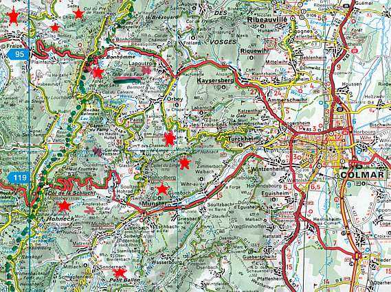
Alsace, France, the Vosges Mountains, on the right flank of General Joffre. At the summits and passes: battlefields of mountain warfare from the earliest days of the war in August 1914. We will visit in this photo impression about the central Vosges the Col du Bonhomme, the Col du Pré des Raves, la Roche du Coq de Bruyère, the Col de la Séboue, the Col des Journaux and the Col de Mandray.
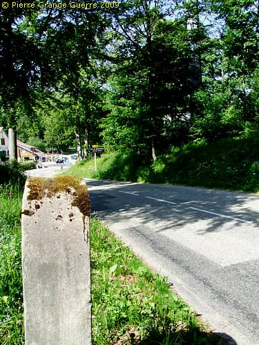
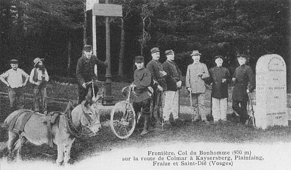
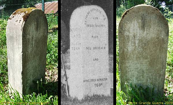
The Col du Bonhomme used to be a border checkpoint of the 1871-1918 Franco-German frontier. This old border stone has been moved from the Col itself to some 100 m. more southward along the D 148.
The text is not more readable. It used to be:
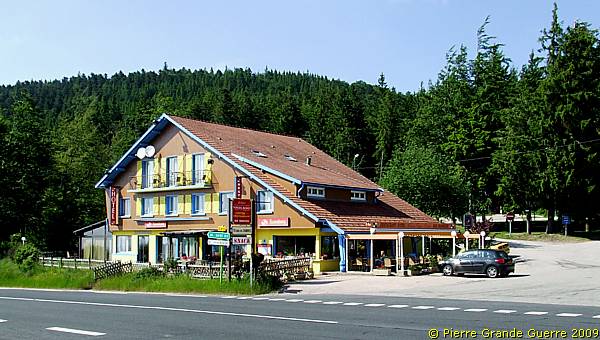
This hotel at the Col du Bonhomme forms always our base of operations to explore the battlefields. According to Martial, our host and cook, there used to be a French wartime cemetery on the premisses of his hotel.
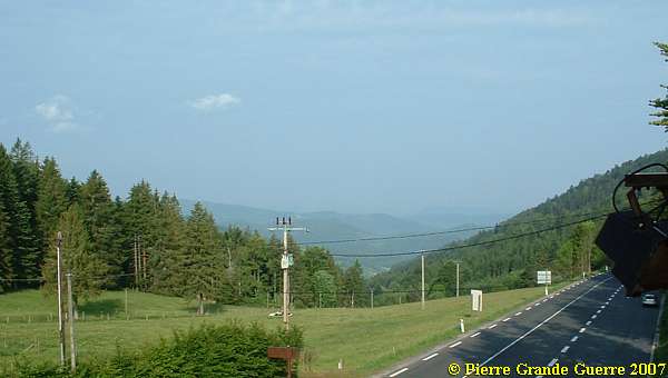
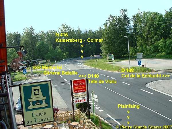
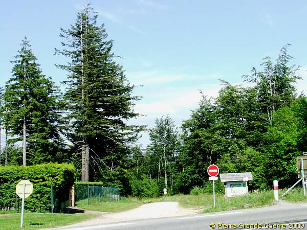
The Col's junction offers a good departure point for our explorations.
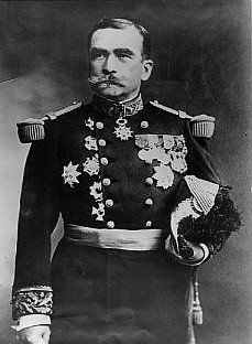
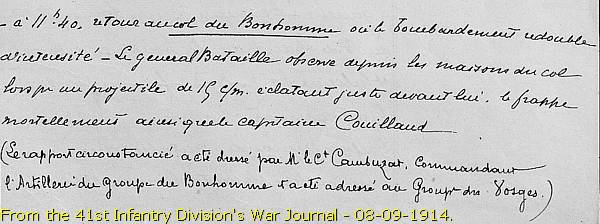
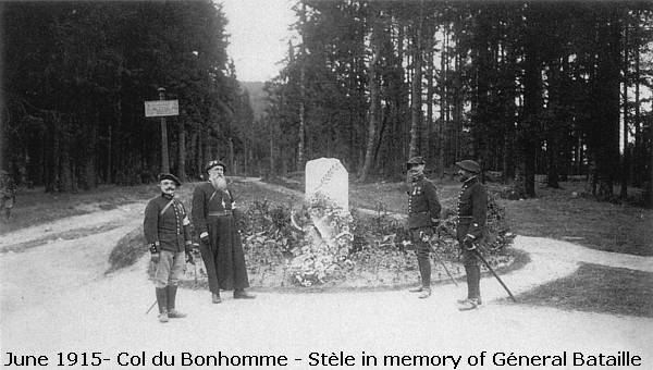
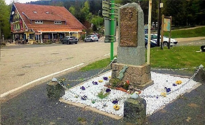
The Col also offers this Memorial for the French, 69-years old General Bataille, commander of the 41st Infantry Division since 3 September 1914, and 6 of his officers, who died on the Col du Bonhomme on 8 September 1914 by the impact of a German artillery grenade.
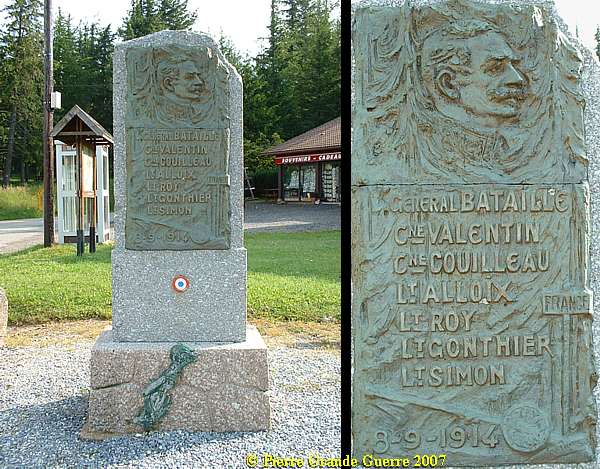
From the 41st Infantry Division's War Journal d.d. 08-09-1914:
"At 11.40 hrs. just returned to the Col du Bonhomme, where the artillery bombardment redoubles it's intensity, General Bataille makes his observations from the houses at the Col, when a 19 cm projectile explodes just in front of him, and it also hits mortally Captain Couillaud."
25 August 1914 - T
he
30e Battalion Chasseurs
Alpins occupies the Col du Bonhomme
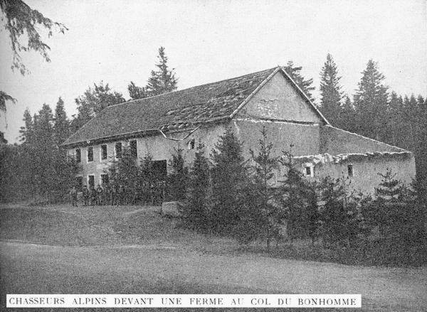
On 25 August 1914 the 30e Battalion Chasseurs Alpins occupied the Col and the area around it.
Since the summer of 2018 a small part of the ashes of my late wife, Chris van der Neut (08-05-2018), co-founder of this website, has been dispersed at the base of this monument. Martial and Carlos, hosts of the Relais Vosges-Alsace, take care of the memorial and the mortal remains of my wife. Passer-by, please, remember her.
The ancient road down to le Bonhomme.
In 2008 we went down for a walk down this road...
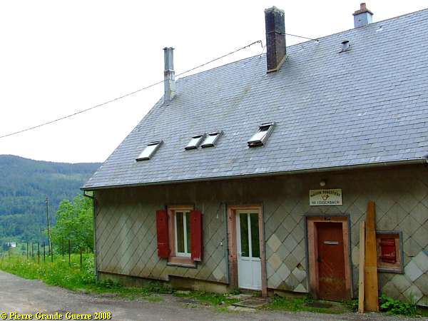
... to look for the former temporarily quarters of the General.
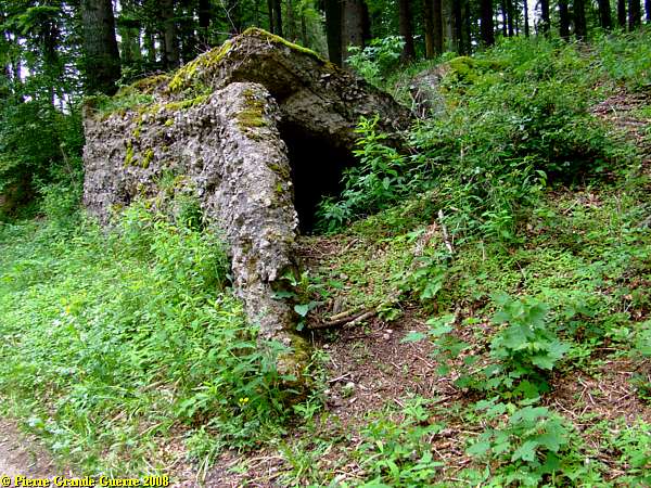
General Bataille's headquarters used to be in and around this foresters house.
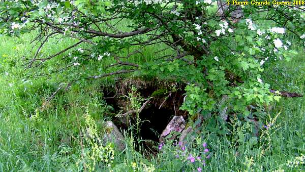
Around the house: some collapsed entrances to former French dug-outs.
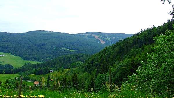
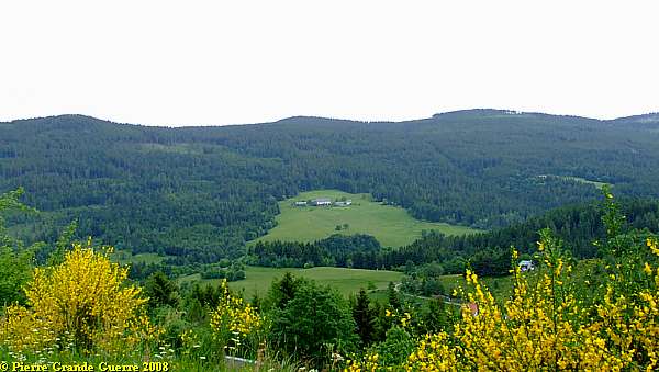
View from this spot over the valley of the Béhine-river.
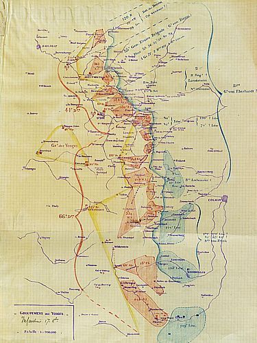
General Joffre' s Plan XVII
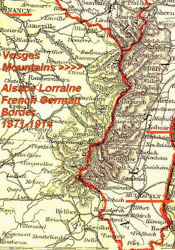
At the end of the French - Prussian War of 1870-1871 the French lost Alsace Lorraine, a vital and an important industrial area, to the Germans.
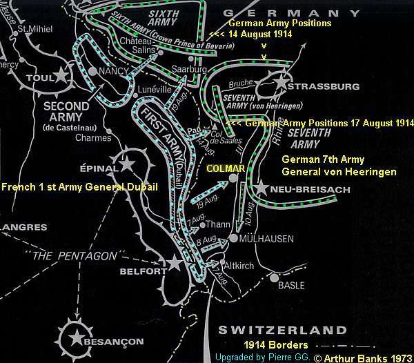
At the beginning of the Great War General Joffre launched Plan XVII, a kind of pre-emptive strike to recapture the lost Alsace Lorraine sector. Joffre ordered an "Offensive à l' Outrance!", an "
Offensive to the Utmost ".
From 6 August Joffre launched 3 Armies in Alsace Lorraine; General Ruffey and his 3rd Army near Metz, General Castelnau and this 2nd Army near Nancy, and General Dubail and his 1st Army near Epinal and the "Crêtes", the ridges and summits of the Vosges.
They were opposed by the Bavarian 6th Army of Crownprinz Rupprecht von Bayern, and the 7th Army of General von Heeringen.
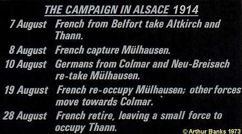
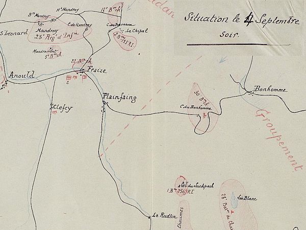
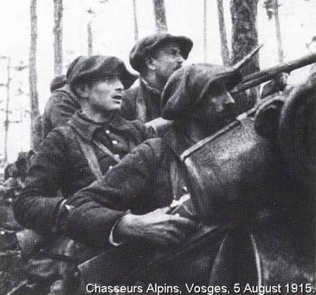
The several battles for the summits and the mountain passes of the Vosges would go on until January 1916, the attacks initiated alternately by both parties. The battles concentrated on the summits of the Tête de Violu, Col de Mandray, Col du Bonhomme, Tête de Faux, le Linge or Lingekopf, the Hohrodberg, the Grand Honack, Honeck, Rainkopf, Grand Ballon, le Sudelkopf, and the Hartmannswillerkopf of le Vieil Armand.
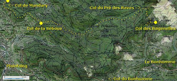
From the Col du Bonhomme we make a trip northward via the D 148 to the Col du Pré des Raves and the Col des Bagenelles. From the Col des Bagenelles we will later jump westward, via a numberless road, into the Forêt Domaniale de la Croix aux Mines. First: a short route from the Col du Bonhomme northward via the Col du Pré des Raves to the Col des Bagenelles.
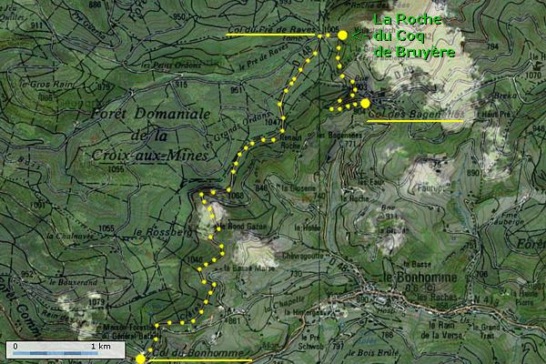
Col du Pré des Raves
East of the Col du Pré des Raves in the direction of ...
... the Col des Bagenelles lies along a hairpin curve...
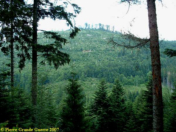
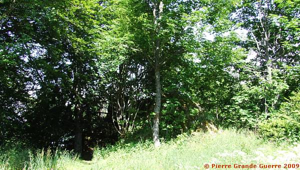
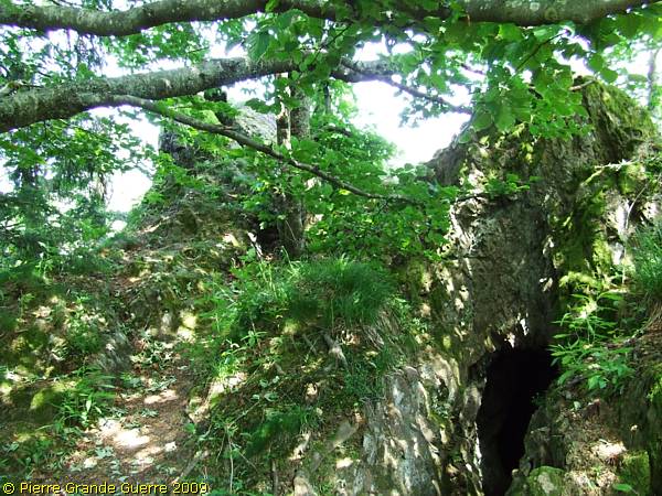
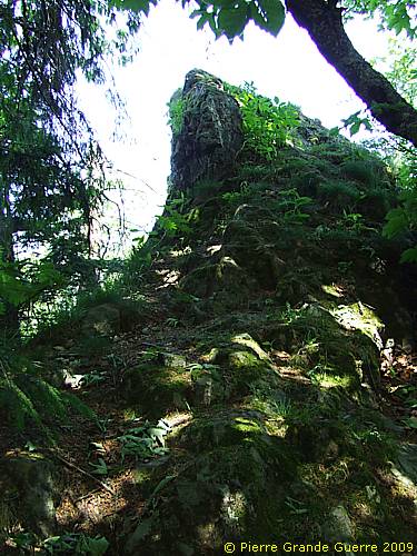
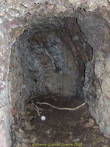
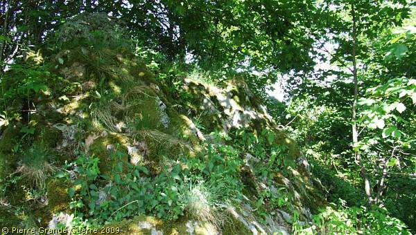
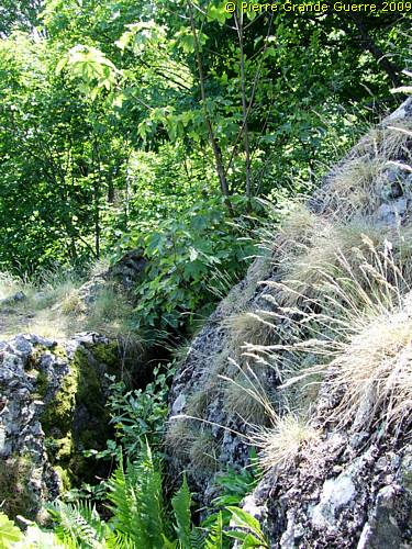
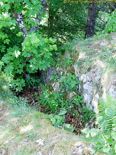
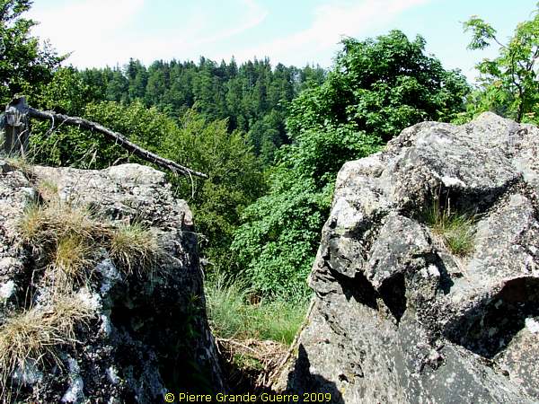
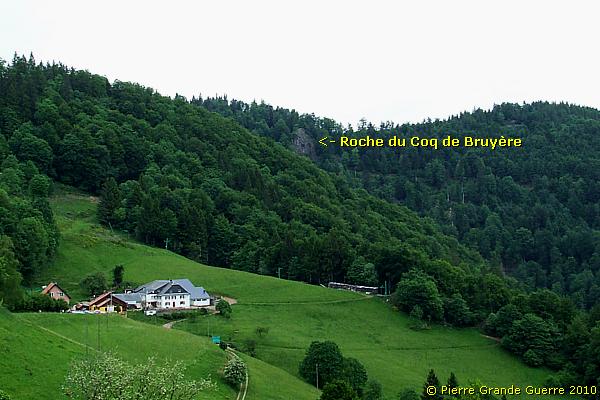
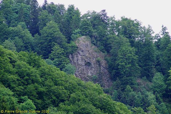
... the by dense vegetation hidden Roche du Coq de Bruyère ( Rock of the Rooster of Bruyère ).
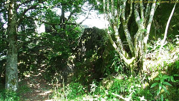
The rock served as an important observation post for the French with a trench on top of it , ...
... and a man-made tunnel beneath it.
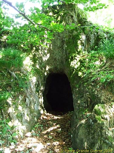
Of course I entered the tunnel, armed with my hat for protection and my flashlight.
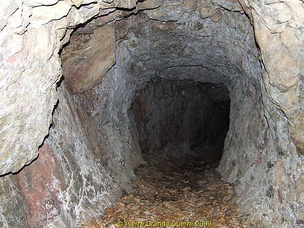
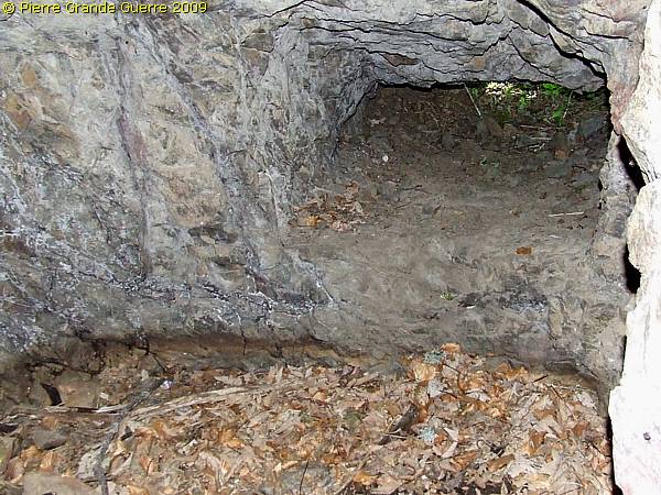
After 15 m. at the right is a small and low side room, with a rifle hole directed to the east.
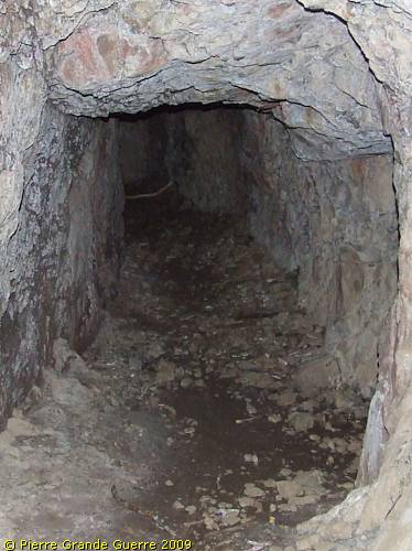
The main tunnel itself is not higher than 1.25 m.
Some 15 m. furtheron , again a lower room on the right side. It might have served an observation opening eastward, or a as "caponnière", a hole to throw hand grenades down the steep slope.
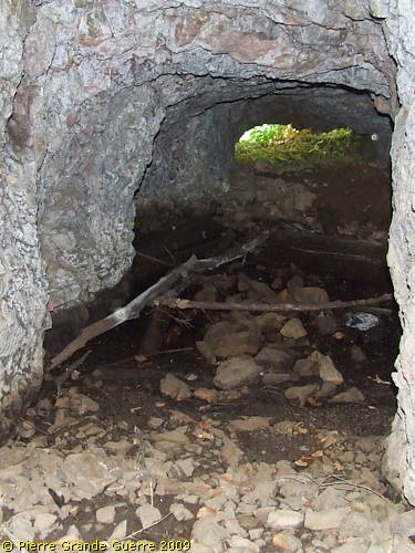
The tunnel ends some 15 m. further on; the entrance to the left corridor down is filled in.
Outside ; on the east side of the rock runs a now shallow trench.
A young tree grows out of the trench.
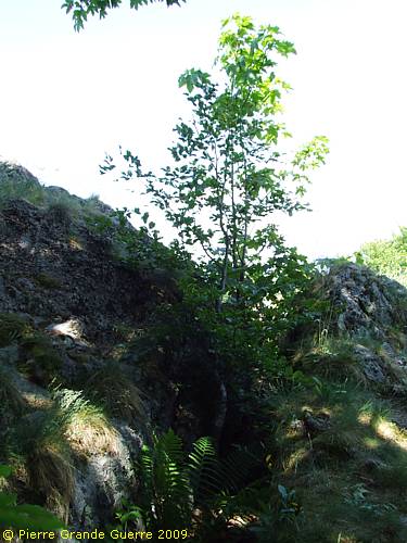
Beware. Climbing around this trench is dangerous...
... at the risk of tumbling down the steep slopes.
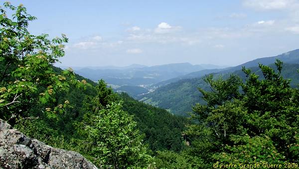
At the summit of the trench and the rock a view westward.
From the same spot a view northward over the former German lines in the Valley of the Lièpvre river, in the direction of Ste. Marie-aux-Mines (in German times "Markirch") .
For quite a different perspective of the Roche du Coq de Bruyère we continue, under other weather conditions , westward to the Col des Bagenelles .
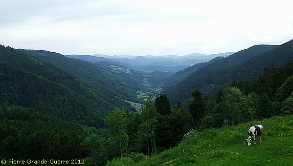
From the Col des Bagenelles a teleview up- and eastward to the Roche du Coq de Bruyère.
The Col des Bagenelles offers this panorama view northward over the valley of the Lièpvre river, in the direction of Ste. Marie-aux-Mines.
We return to the Col du Pré des Raves and from there we continue westward. We make some stops near the Col du Pré, at the Col de la Séboue, the Col des Journaux, and the Col de Mandray.
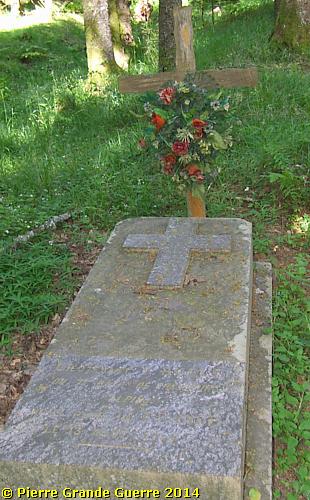
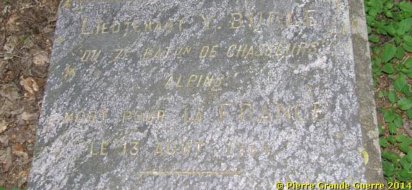
Hundred m. after passing the Col de Pré des Raves, we find on the verge of the right, or northern side of the narrow road, a battlefield grave.
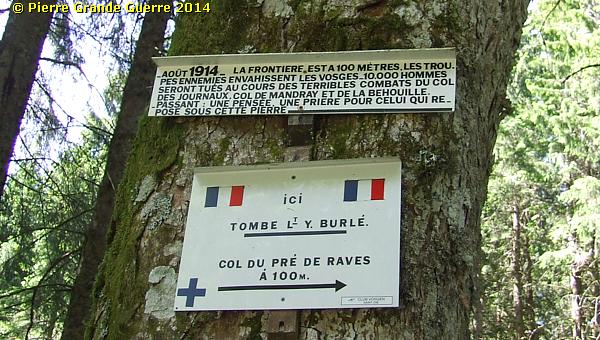
The battlefield grave of a Chasseur Alpin Lt. Y. Burlé of the 7e B.C.A., fallen on 13 August 1914 in the wood some 100 m. west of the Col du Pré des Raves. The grave is positioned just in between two 100 years old trees, which clarifies the strange angle of this photo.
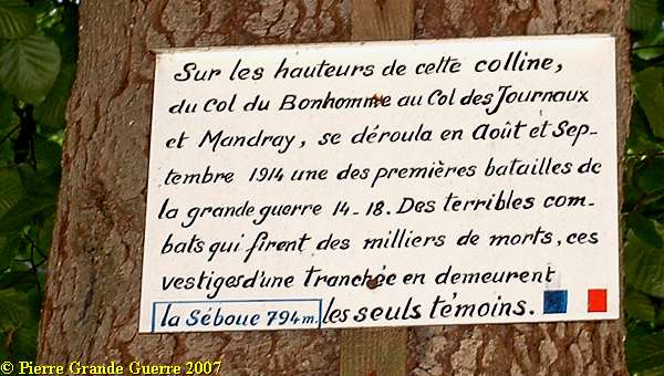
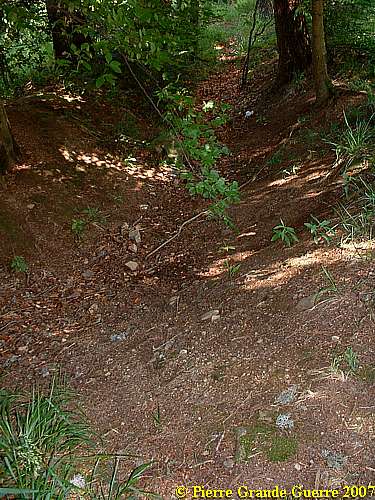
We continue westward to the Col de la Séboue (794 m.), a sign attached to a tree tells :
This ditch is one of the few relics of a French trench along this side road.
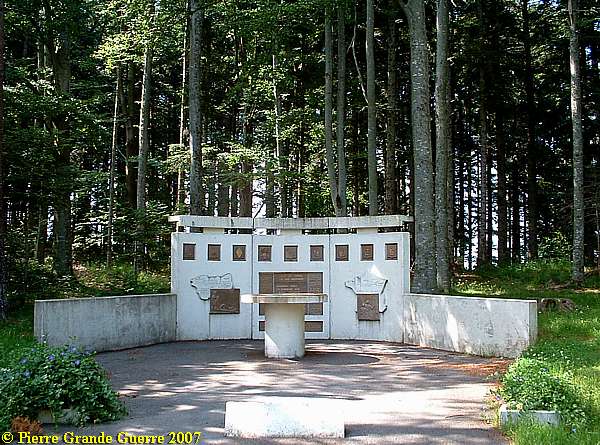
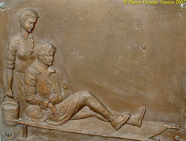
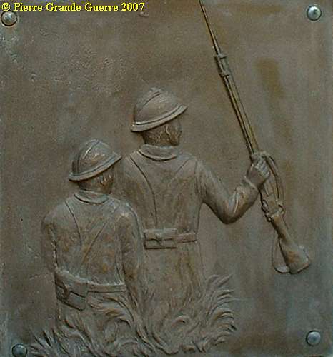
At the Col des Journaux near Fraize the Franco American Association raised this monument ...
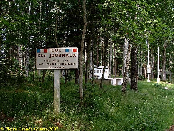
... to commemorate the battles of August and September 1914, ..
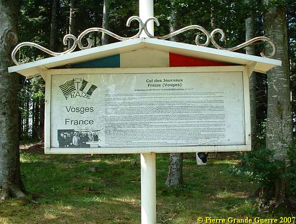
... and the 400,000 French and Allied soldiers , who died during the Great War in the Vosges.
Left column of this bronze plaque:
" Dedicated to 7 Indo Chinese Regiments - to 3 Divisions of Polish Volunteers , who fought under French Colours - to the 5th American Infantry Division -to the 868 Regiments or Battalions, who took part in the battles from 1914 to 1918 in the Vosges."
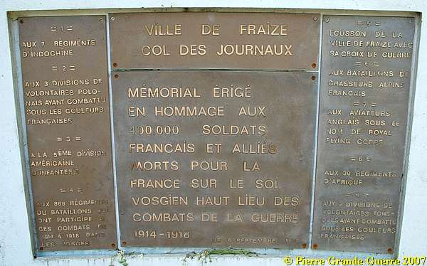
Centre column of the plaque:
"Memorial erected to honour 400.000 French and Allied soldiers, who died for France on the Vosgian soil, high region of combats of war 1914-1918."
Right column of this plaque:
"Heraldic shield of the city of Fraize with it's "Croix de Guerre" - dedicated to the Battalions of the French Chasseurs Alpins (mountain troops) - to the English pilots under the Royal Flying Corps - to the 30 African Regiments - to the 2 Divisions of Czechian Volunteers, who fought under the colours of France.
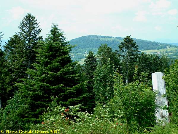
A few kilometers to the west, the Col de Mandray (694 m.).
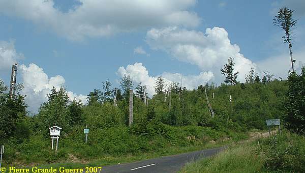
At the T junction with the D 23 ....
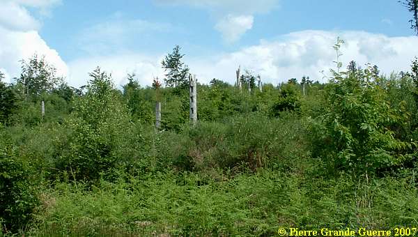
... we found this memorial with the inscription :
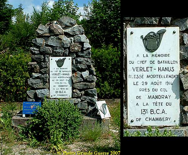
A view from the Verlet - Hanus Memorial westward.
Continue to the next Vosges front chapter : " Tête de Faux - Buchenkopf "


