
ALSACE VOSGES - Reichackerkopf - le Gaschney
Year of visit: 2009, 2010
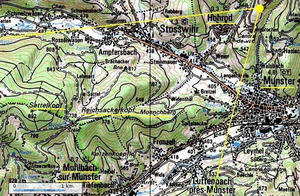
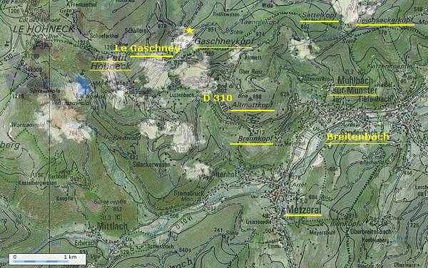
From the Hohrodberg we continue to Stosswihr, next passing Munster and Muhlbach-sur-Munster, for an approach from the southside of the former front line at the Col du Sattel. From the Col du Sattel we visit some French memorials and the German concrete relics at the Reichackerkopf. After the summer battles of 1915 the Reichackerkopf formed a natural German stronghold, defending the town of Munster. This page ends with a visit along the same D 310 to le Gaschney at the foot of the Petit Honeck and the Gaschneykopf for it's memorial for the Chasseurs Alpins.
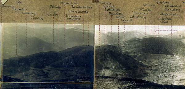
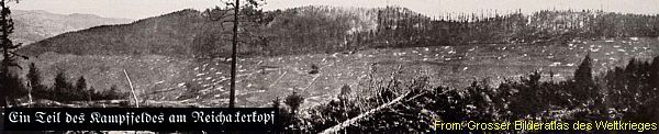
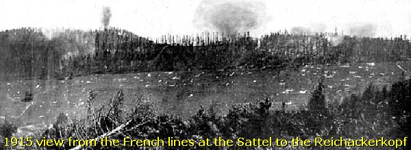
We start with this panorama view south-westward from the Hohrodberg to the Reichackerkopf and the Sattelkopf.
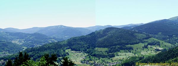
A detail of German army panorama view from the same direction.
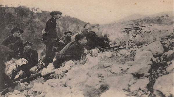
From August 1914 the French troops occupied the Sattel. The Germans positioned themselves at the Reichackerkopf.
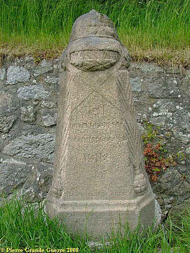
Along the D 417, near the village of Stosswihr, north of the Reichackerkopf, stands a demarcation stone, inscripted with "Stosswihr". The inscription is not readable anymore, only "1918". Based on other similar stones, I presume, that it formed the text:
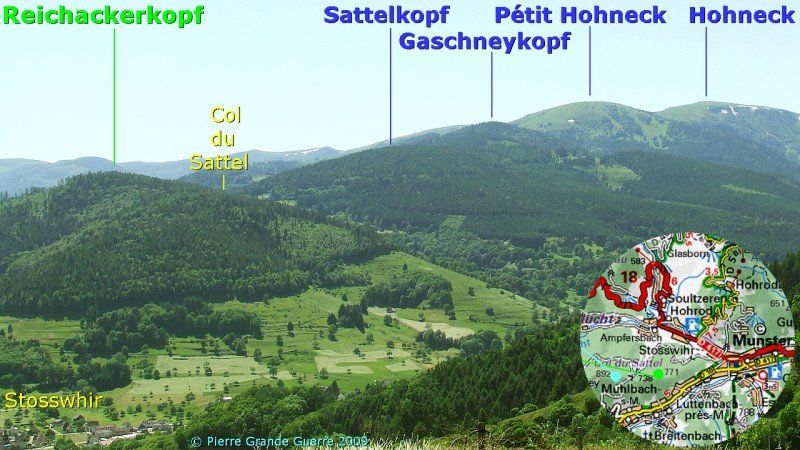
We will visit the Reichackerkopf, starting at the Col du Sattel , a pass between the Sattelkopf ( or Sattel ) and the Reichackerkopf. A view northward from the Col du Sattel.
We start at the Col du Sattel at the foot of the Reichackerkopf.
Some historic background information about the
Munster Sector.
The Battles for Munster
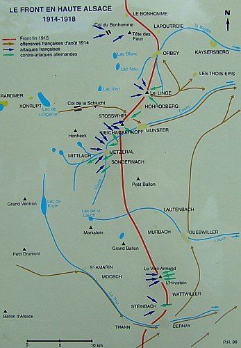
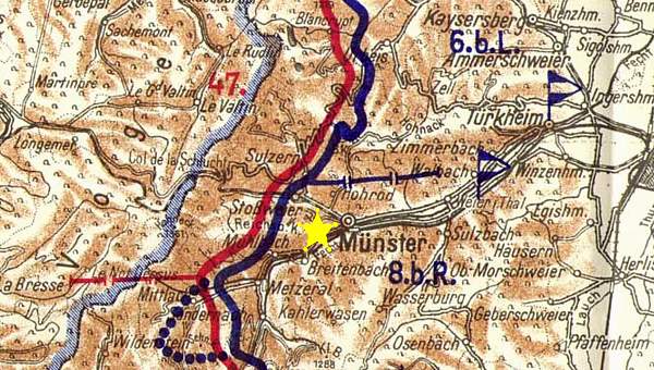
This map, you will often find on French cemeteries in the region, forms also a concise reminder, about how we are continuing our explorations southward along the frontline in this sector between the Col du Bonhomme and the Vieil Armand.
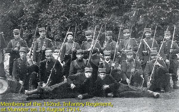
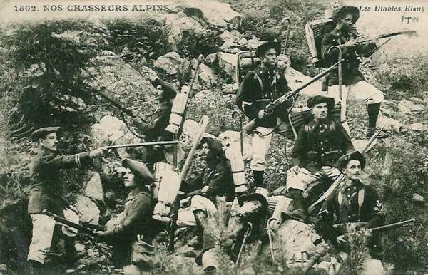
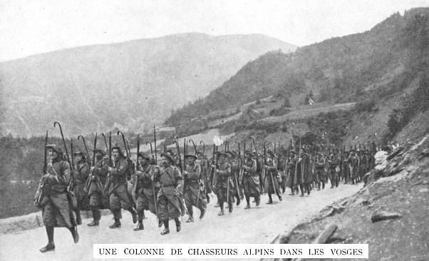
General Bataille's 81st Brigade, consisting of the 152e R.I and the 5e and 15e Bataillons Chasseurs à Pied attacked Munster on 15 August 1914, assisted by the 13e Bataillon Chasseurs Alpins in the south. They occupied the Gaschneykopf, the Sattelkopf, the Reichackerkopf and Munster and a part of the Valley of the Fecht on 18 August 1914.
Munster and the ridges west of it would attract of course several counterattacks of the Germans.
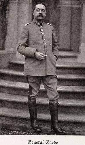
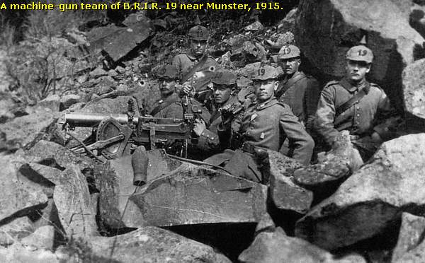
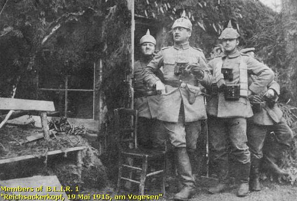
On 19 February 1915 General Von Gaede launched the Battle for Munster with Bavarian Landwehr Infanterie Regiment 1, B.L.I.R. 2, B.L.I.R., 3, B.L.I.R 12 , the B.F.A.R. 8 (Bavarian Field Artillery Regiment 8) and other units of the Bavarian 8. Reserve Division.
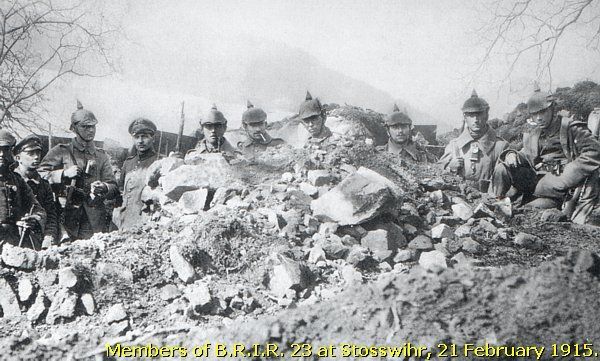
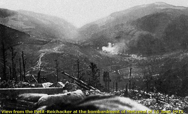
On the last day of the battle, at the 22nd, the Germans knew to recapture Munster, Metzeral, and the Reichackerkopf .
But still the battles would go on for the villages around Munster and for the mountaintops around the Valley of Munster from March until August 1915.
After this intermezzo we return back to the Col du Sattel.
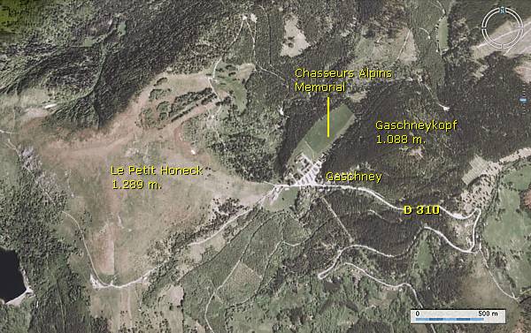
Circuit Historique 1914-18 - Gaschney - Reichackerkopf
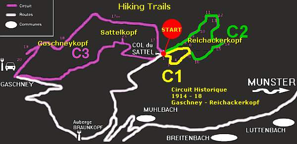
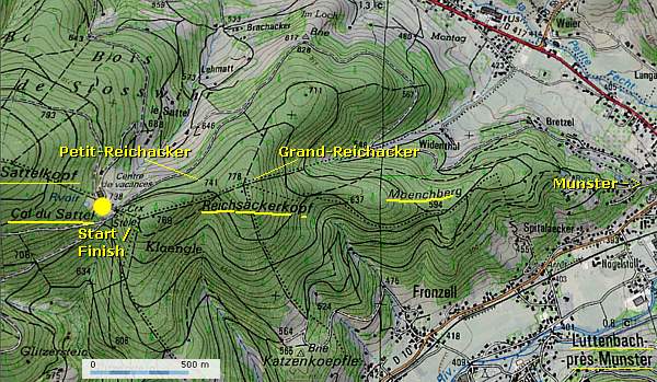
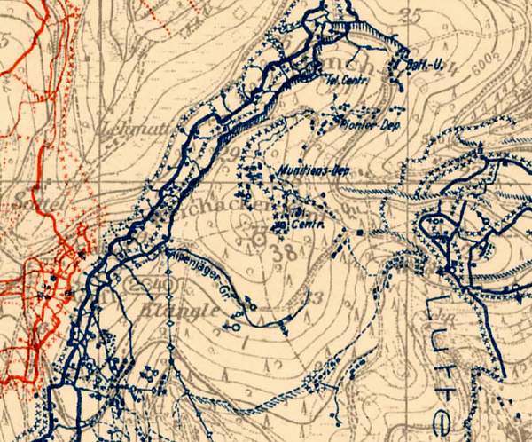
From the Col du Sattel we will follow two hiking trails, marked as C1 and C2 . We skipped the purple route C3 .
The C1 route criss-crosses over both the Reichacker summits, over the former French and German first lines. The C2 route concentrates on the German second line, the north, east, and south slopes of the Reichackerkopf.
C3 , which also starts at the wintersport village of Gaschney, concentrates on the French positions at the Gaschneykopf and the Sattel.
Though the information panel tells us that walking C1 and C2 in one visit would only take 2.5 hours, we needed more than 5 hours for walking these routes. Of course confusion about the sometimes unclear directions in the dense wood, our photographing, and some rests made us much slower.
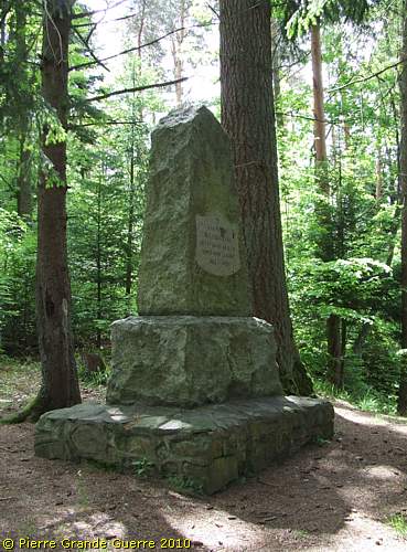
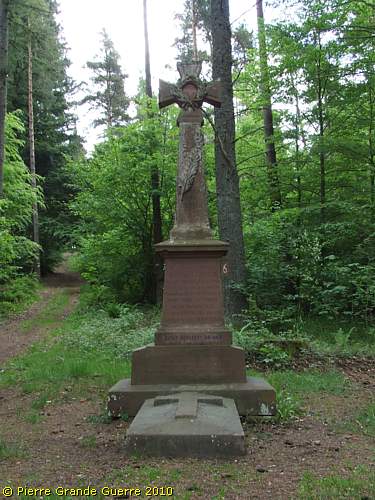
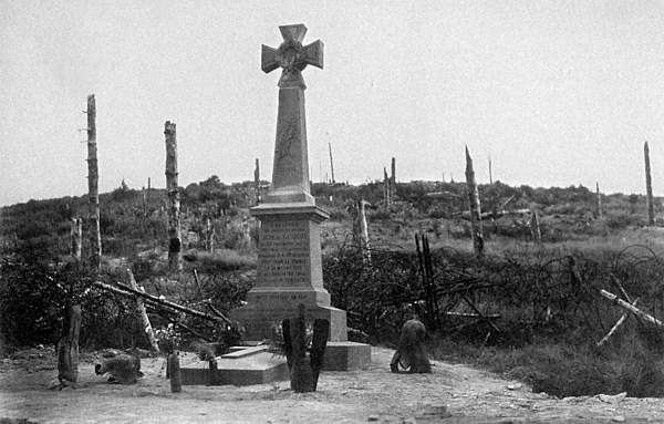
At the col below the Reichackerkopf, we start with this Memorial, commemorating soldiers of the 47e, 64e, 57e, and 68e Bataillons Chasseurs à Pied (meant here Chasseurs Alpins), who fell here and near this location of the Sattel and the Reichackerkopf.

A few meters to the left, in front of the track leading upward to the Petit-Reichacker ...
... stands the memorial for 2nd Lt. de Guardia of the 51e B.C.A.
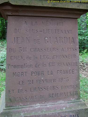
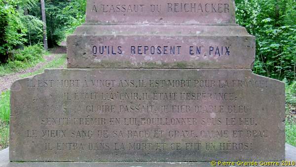
This memorial offers a good opportunity for some more concise background information.
The Battles for the Reichackerkopf
After the forced retreat of the French of 22 February 1915 on the Gaschneykopf and the Sattel, the Germans occupied the Reichackerkopf. The lines of both parties came here close together at the Col du Sattel, at the foot of the Reichackerkopf.
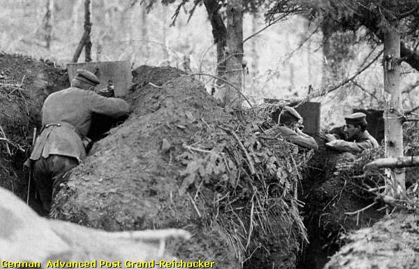
The Reichackerkopf, which is sometimes also spelled as Reichacker s kopf, Reichacker, or Reichaker, possesses besides the summit of the Grand-Reichacker (778 m.) also the sub-summits of the Petit-Reichacker (741 m.) and the Moenchberg (637 m.). Both belligerent parties started immediately to dig trenches and tunnel networks, running to mined caves.
During the months of March and April 1915 both parties deployed many attacks and counter-attacks over the Col du Sattel.
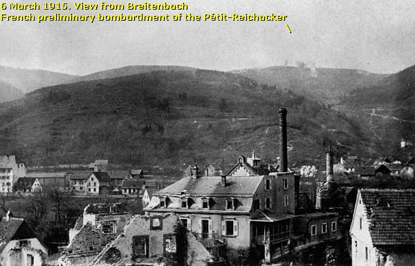
On 6 March 1915, after a preliminary bombardment, ...
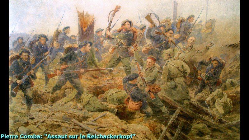
... the 6e and the 23e Bataillons Chasseurs Alpins (B.C.A.) of the 4e Brigade des Chasseurs launched an attack at the Petit-Reichacker and the Grand-Reichacker.
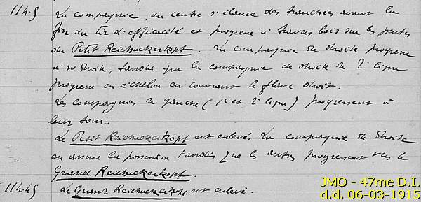
Due to German counter-attacks the fighting on the summit continued the following day of the 7th.
At the loss of many casualties the Chasseurs succeeded to occupy both summits, both Reichackers, for a short period of two weeks until 20 March 1915, when they were forced to draw back at the pass.
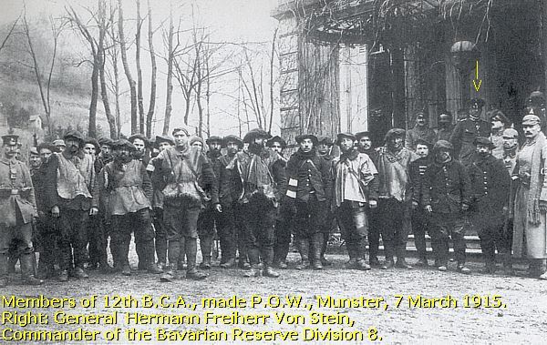
The Bavarian 8. Reserve Division - March 1915
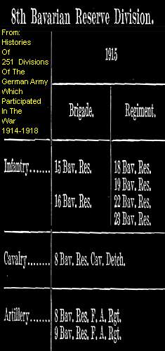
On 20 March, after a heavy bombardment at the Reichackerkopf, troops of the Bavarian 8. Reserve Division under command of General Hermann Freiherr von Stein ...

... captured again, but this time definitely, the Reichackerkopf but until the Petit-Reichacker.
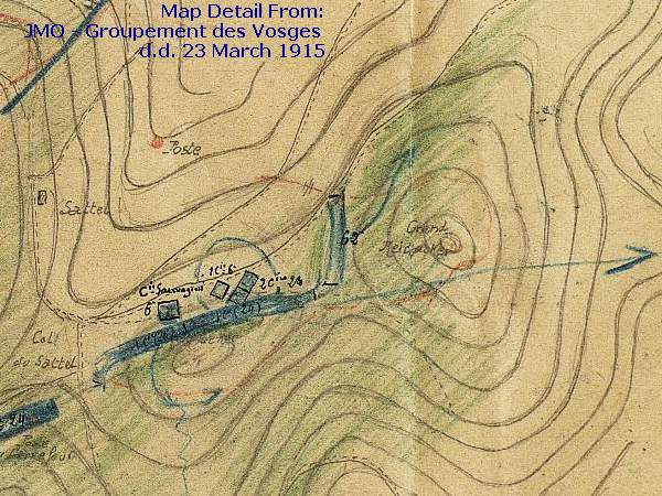
On 23 March another French attack followed the trail of the Chasseurs of 6 and 7 March without succes. The Germans occupied the Petit-Reichacker and drove the French troops back at the Col du Sattel.
May, June, July, 1915
During May, June, and July 1915 General de Pouydraguin's 47e Division d'Infanterie would stubbornly continue the attacks at the Reichackerkopf and Munster, mainly with the deployment of several units of Chasseurs Alpins and Chasseurs à Pied, but without any succes.
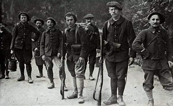
During these months at least 1.000 Chasseurs Alpins lost their lives.
From August 1915 the front at the Reichackerkopf stabilized in this situation until 1918. Though the large battles were now over, the "all day routine of daily warfare", the fighting along the Col du Sattel still continued, but on a less massive and frequent scale.
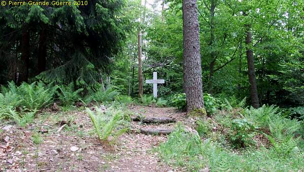
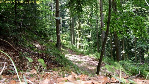
We follow the track of the Chasseurs Alpins of 6 and 7 March 1915 upward to the Petit-Reichacker.
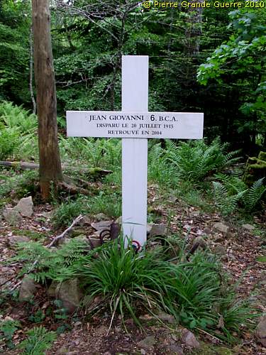
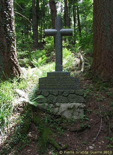
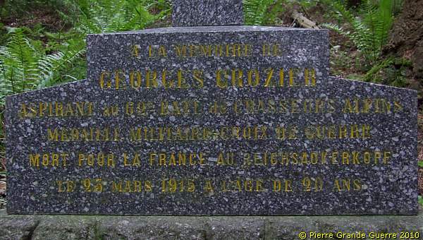
At the summit of the Petit-Reichacker lies the former grave of Jean Giovanni of the 6e B.C.A..
Chasseur Alpin Giovanni disappeared during the fights of 20 July. His human remains were rather recently discovered in 2004.
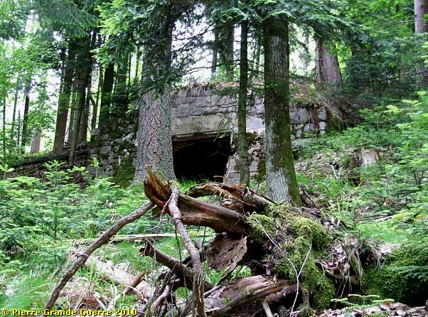
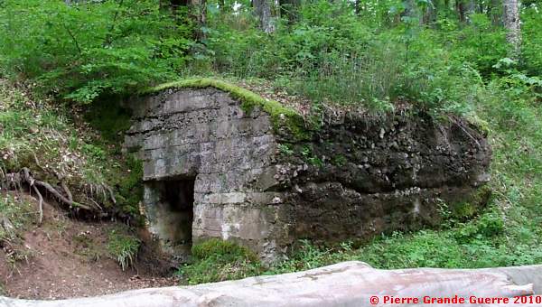
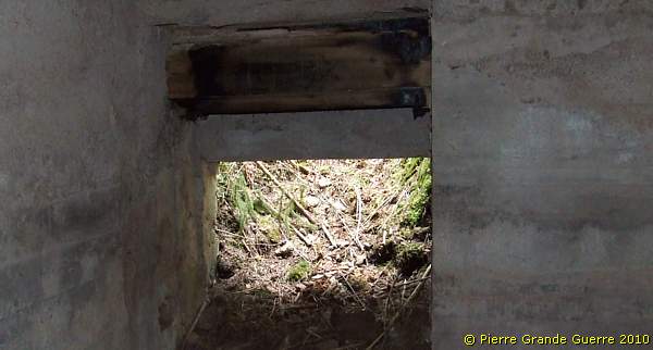
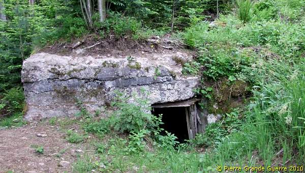
We walk some 75 m. southward from the Petit-Reichacker ...
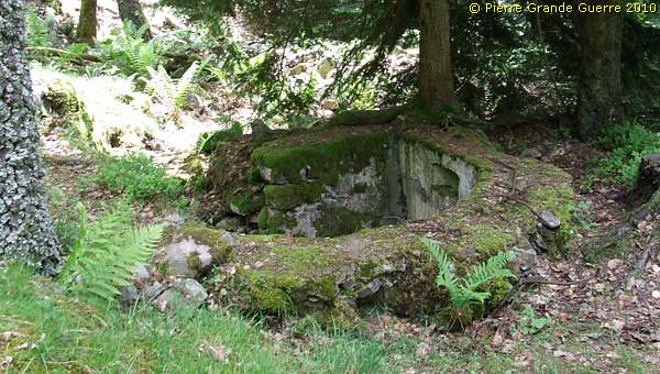
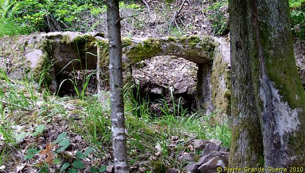
... to find this concrete German Observation Post.
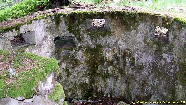
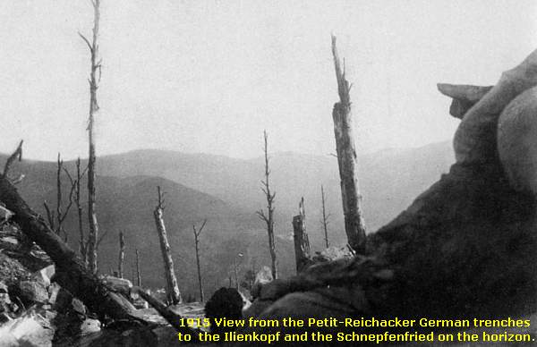
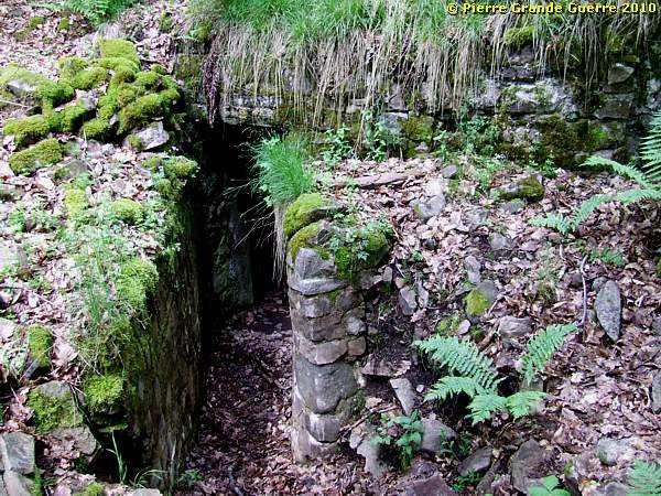
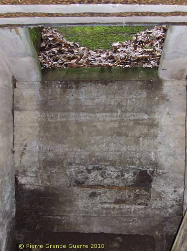
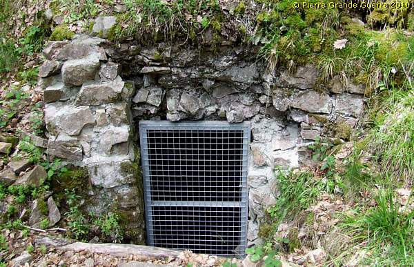
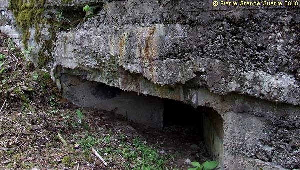
From the Observation Post we walk some 50 m. eastward, ...
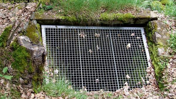
... where we find a German mortar pit, covered with a fence.
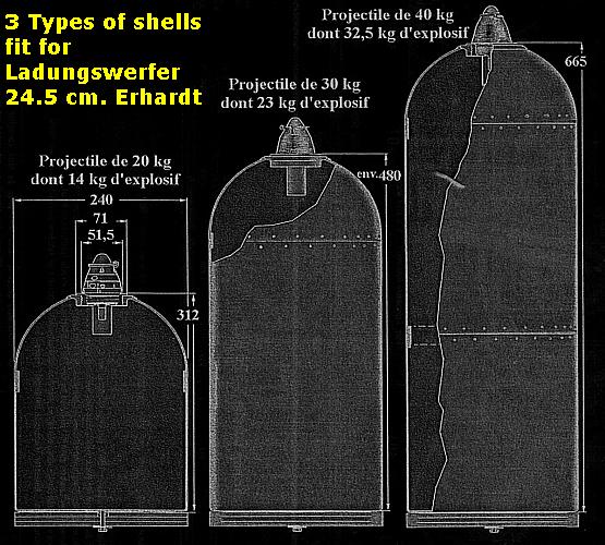
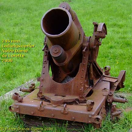
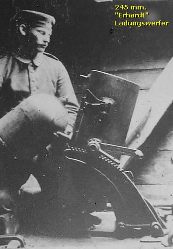
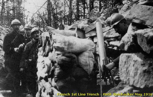
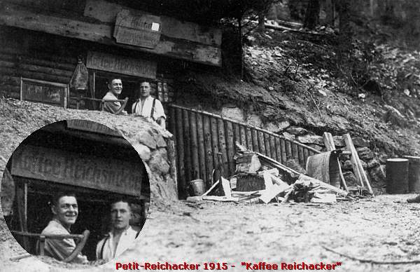
Erhardt Ladungswerfer
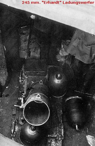
According to some Alsatian sources this 1915 period picture of the German lines of the Reichackerkopf shows probably the same 2,45 cm . "Erhardt Ladungswerfer" -pit as this specific mortar pit here.
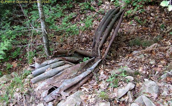
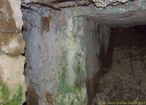
Some 10 m. further on we find the entrance at the rear to this "Ladungswerfer"-pit.
Inside the Ladungswerfer-bunker we find a silent witness of the constructors:
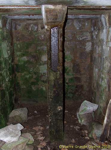
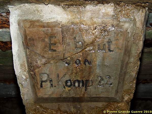
The small concrete room next to it, forms the genuine mortar pit.
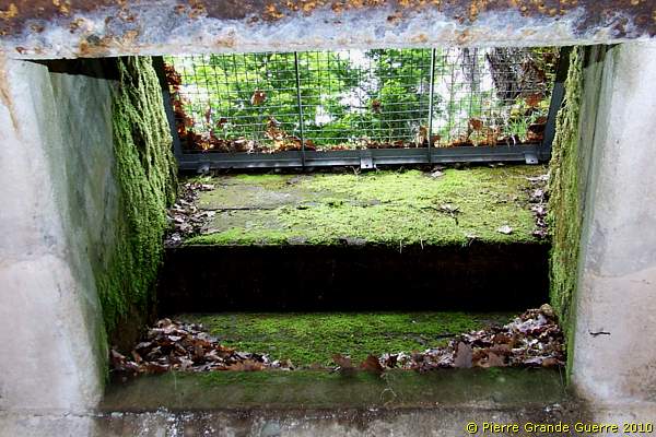
A view from the fenced pit upward.
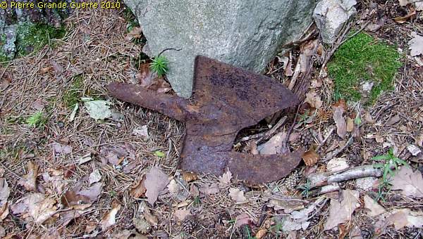
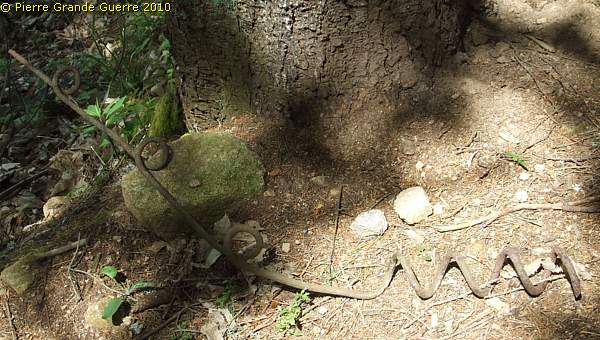
Sometimes you may still find on this slope entrances to tunnels and underground "Stollen"-networks.
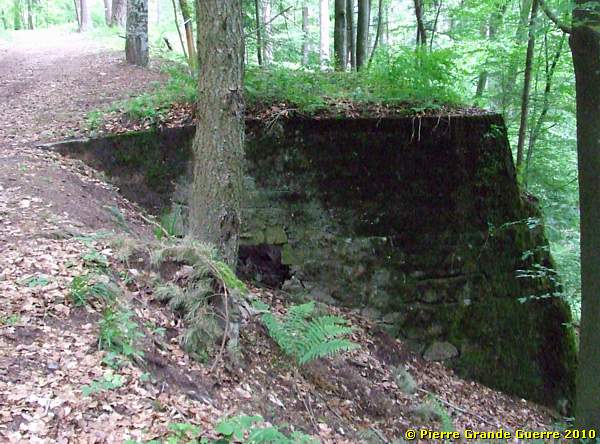
We follow the forest road around the summit south-eastward to find this sunken bunker; another exit of a tunnel.
Some meters further on the other side of the track; another entrance or exit of a tunnel.

We go around the northern side of the summit of the Grand-Reichacker, ...
... and we continue south-westward into the direction of the Col.
Here we find relics of masonry breastworks, ...
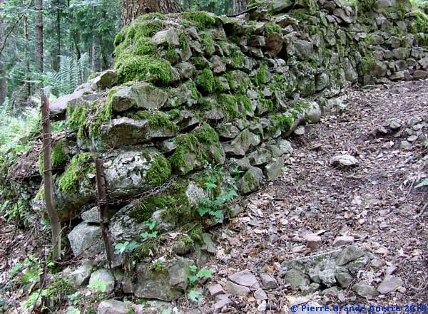
... constructed in March 1915 by French Chasseurs Alpins.
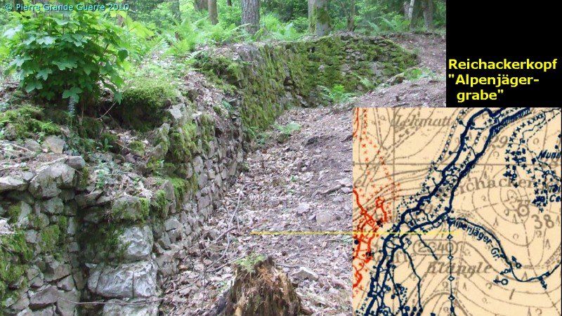
After the battle of the Reichackerkopf the Germans used this trench as a communication trench westward, which they named the "Alpenjägergrabe".
We return to the close by Col du Sattel, where we choose another track for route C2 , running more north-eastward.

At the verge of the track C2 stands this memorial.
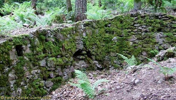
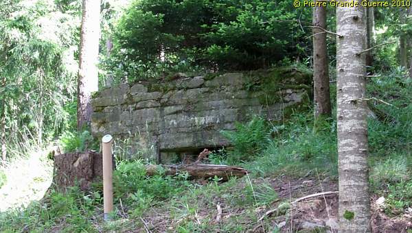
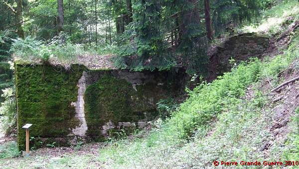
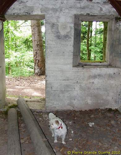
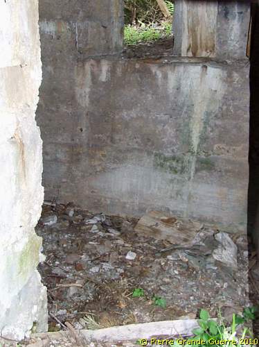
We follow a lower lying track around the Reichackerkopf, to arrive at the northern slope of the mountain for this bunker of the German second line.
The interior.
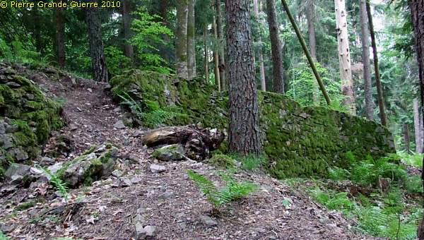
We follow the northern track eastward, ...
... following the German second line.
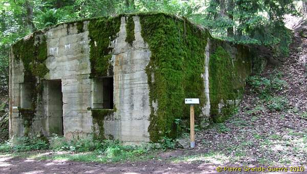
This 1916 machine-gun bunker has been constructed ...

... in case a French attack would rupture the German first line.
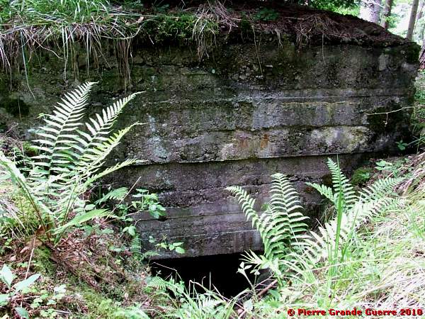
Interior.
German constructions on the Reichackerkopf
The Germans on the Reichackerkopf mainly
constructed their fortifications and dug-outs with rather natural
materials; stones, wooden beams, and steel H-bars. From the beginning
of 1916 the Germans started to construct concrete bunkers, but not as
many concrete bunkers as elsewhere in other Vosges sectors. In the
eighties of the last century the French authorities ordered the
destruction of many concrete relics on the Reichackerkopf. For these
reasons we are nowadays only able to see some of the bunkers, which
used to be here.
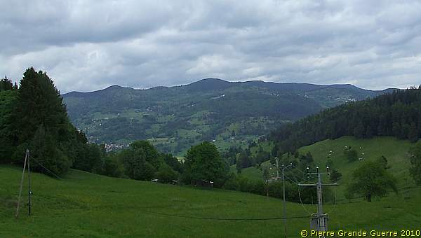
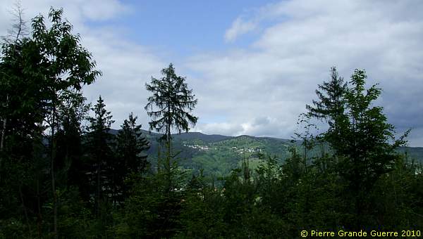
A panorama view northward, in the front: the village of Stosswihr. At the horizon right; the Schratzmännele and the Barrenkopf.

At the most northern point of our route there are still relics of a cableway station; “Umgebaut 1. Ldst. Inf. Batl. Freib XIV/7 Aug.1917”.
These "Drahtseilbahne" were important for the transport of supplies and ammunitions. They also transported wounded men downward to the rear of the front.
The track bends eastward.
We arrive at the 2-room bunker, which housed the specialists ...
... of the electricity and telephone networks.
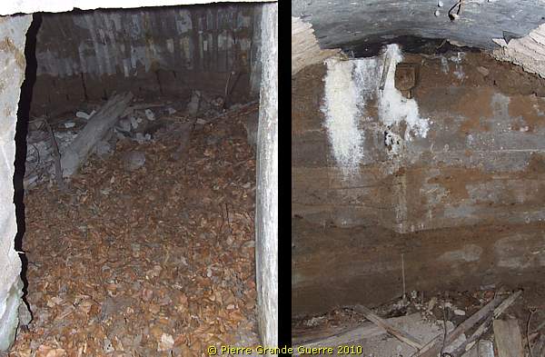
In the next room is a filled-in tunnel entrance, ....

... and a window facing northward.
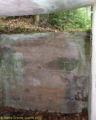
Via the first room we leave the bunker.
Some 50 m. more southward, above the communication specialists bunker, ...
... lies this shelter bunker.
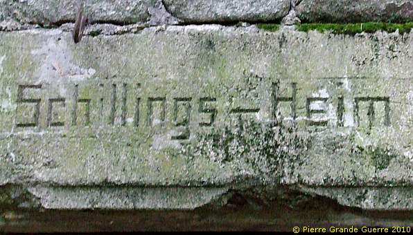
This "home" is probably called after an officer.

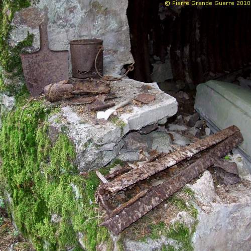
Souvenir hunters, please, leave these few relics untouched for the enjoyment of your other fellow travellers.

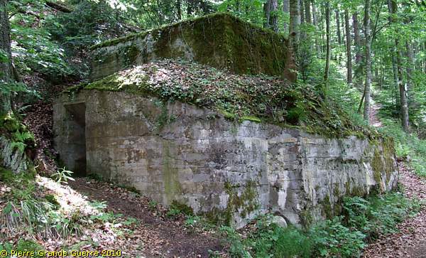
We continue some 750 m. southward to the eastern sub-summit, the Moenchberg (631 m.)

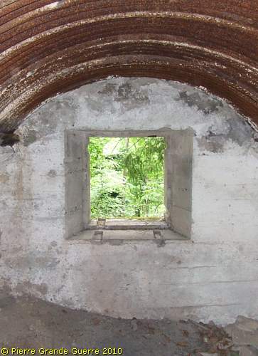
Here we find this interesting 2-floors observation post.
In case of a rupture of the 1st line this bunker could also serve as a machine-gun post.
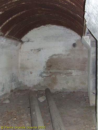
At the entrance indoors; a staircase downward and one upward.
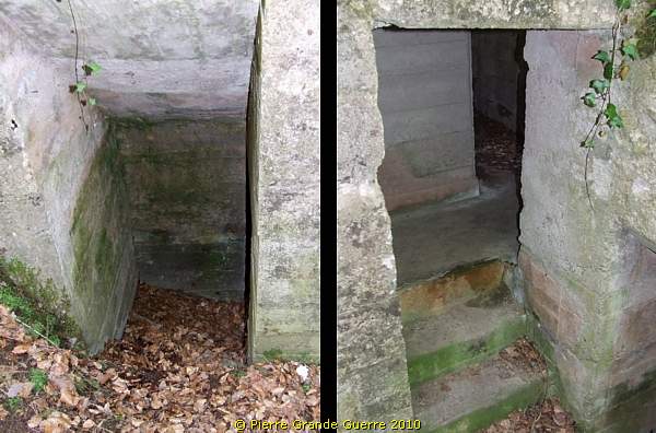
The lower floor. Notice the electricity box on the right photo.
The top floor with an opening wide enough to mount a machine-gun.
View from the observation window to the forest road.
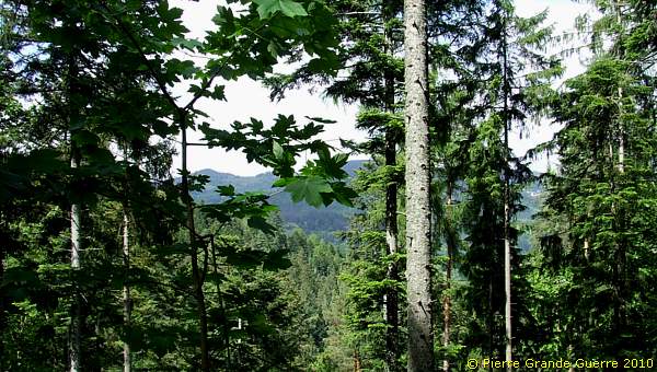
We continue westward and upward the Grand-Reichacker again. A panorama view north-eastward.
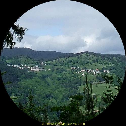
Teleview at Hohrod.
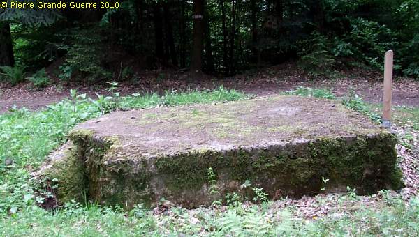
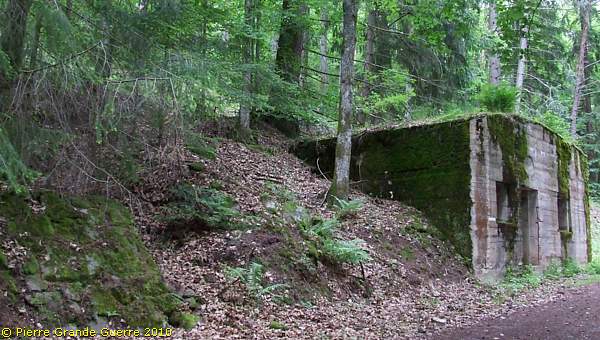
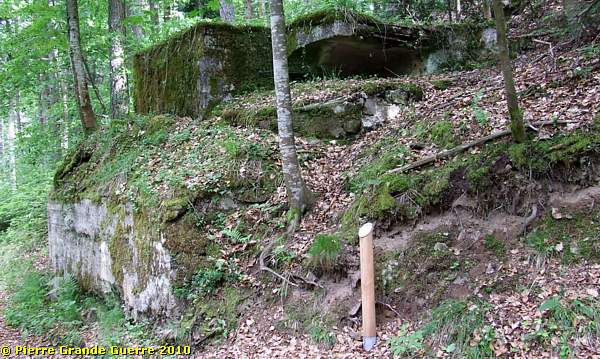
At this location we find only some debris; concrete relics of bunkers.
We continue south-westward, approaching the vicinity of the Col, and entering again the German first line.
This machine-gun post covered ...
.... the Petit-Reichacker and the Col du Sattel.
This bunker is also the last site we visit on the Reichackerkopf.

We end our day with this panorama northward from the Col du Sattel.
In 2009 we departed from Col du Sattel and we visited nearby le Gaschney. From the Col du Sattel we return to the D 310 and continue westward, passing along the Braunkopf and the Altmattkopf.
View westward from the Altmattkopf at the Hohneck and le Tanet.
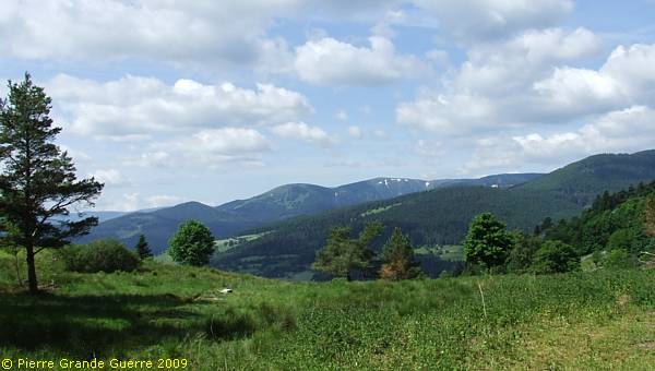
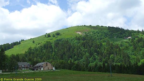
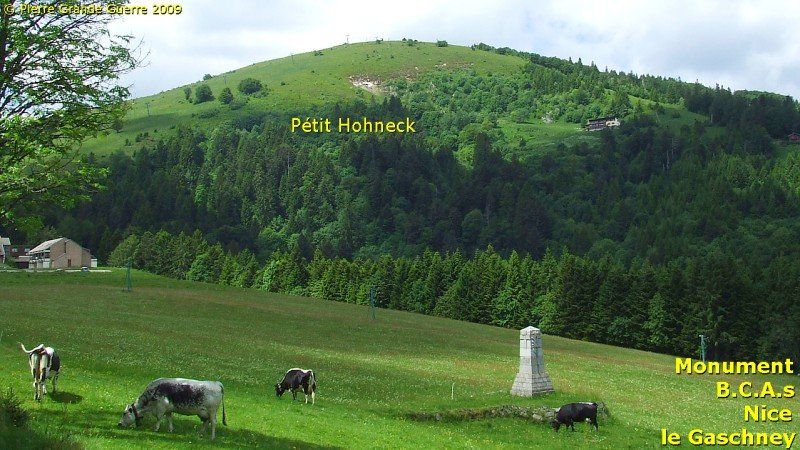
We follow the dead end D 310 upward to the wintersport centre of Gaschney at the foot of the Petit Hohneck.
At the wintersport centre of le Gaschney we have to park the car, and take a walk in the valley between the Gaschneykopf and the Petit Hohneck.
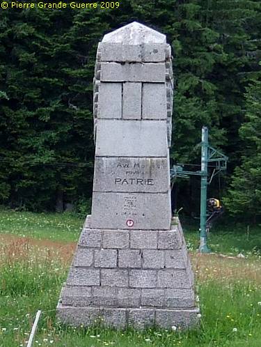
In the valley stands a memorial, reminding us of the encampments here of the Chasseurs Alpins, active in the fighting at the Col du Sattel and the Reichackerkopf.

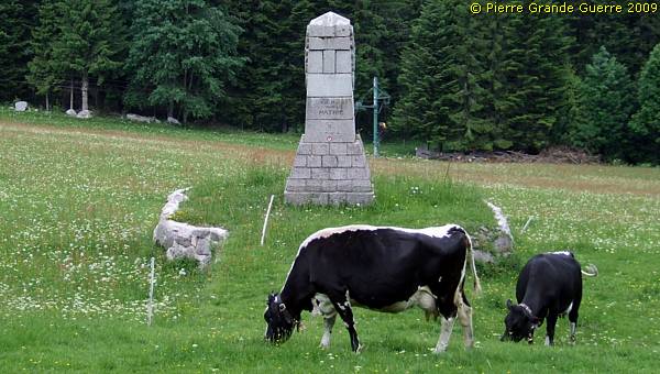
The Memorial is dedicated to the Chasseurs Alpins of the 6e B.C.A., 7e B.C.A., 46e B.C.A., and 47e B.C.A. from Nice, killed, amongst other places, during the combats at the Reichackerkopf.
With a last view at the Petit Honeck we return downward along the D 310, back to Hohrod.
Continue to the next chapter: " Munster Valley - le Petit Ballon " -
Dutch readers, meer weten over de Chasseurs Alpins? Lees meer details over hen in mijn geillustreerde lezing: " De Blauwe Duivels in de Vogezen - Chasseurs Alpins ".


