
ARTOIS - Illies - Wicres
Year of visit: 2010, 2014
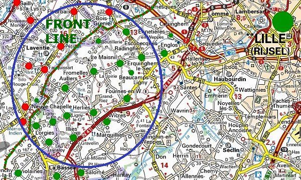
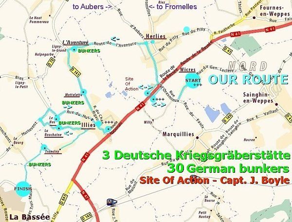
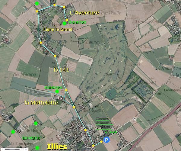
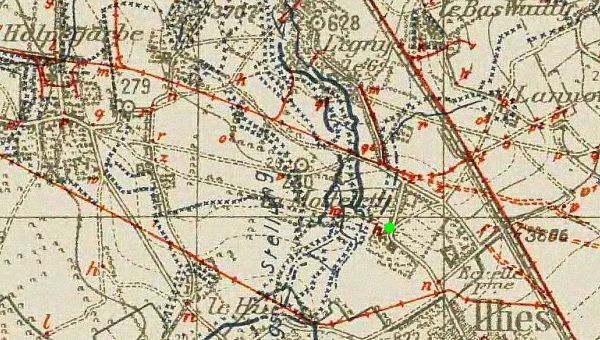
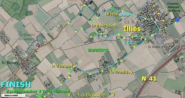
South-west of Lille, a visit to the Pays des Weppes. This time we tour along a German third line “Artillerie Sicherungs-Stellung” in the municipality of Illies, opposite the former British lines of Festubert and Neuve Chapelle. We will visit three German war cemeteries, Wicres - Village, Wicres - Route de La Bassée, and Illies. We will visit the Site of Action of Capt. J. Boyle and the Battle of le Pilly. Along our route we will pass the hamlets of L’Aventure, la Mottelette, la Bouchaine, le Transloy and les Trois Maisons, showing the relics of some 30 German bunkers of this defence line. Our point of departure forms the village of Herlies. Our first stop will be the “Deutscher Soldatenfriedhof Wicres-Village”. We will finish this trip with a visit to a large “Kaserne” bunker near the hamlet of les Trois Maisons.
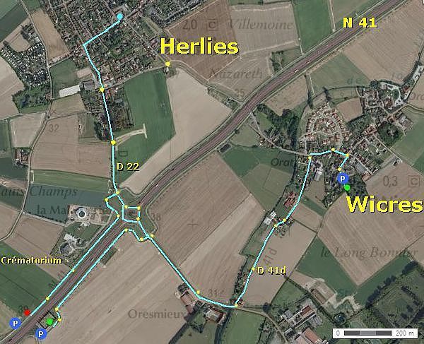
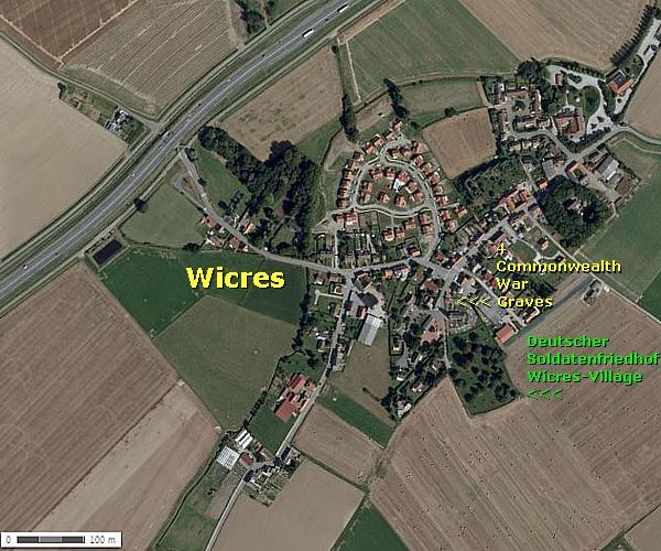
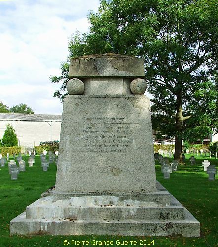
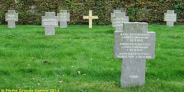
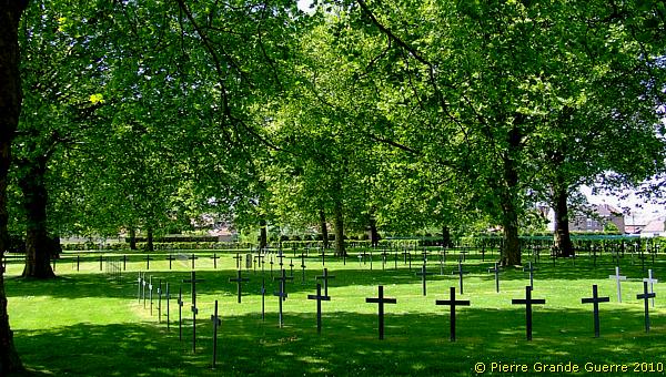
In the centre of the village of Wicres we park our car in front of the village church to visit first the Deutscher Soldatenfriedhof Wicres - Village .
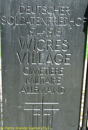
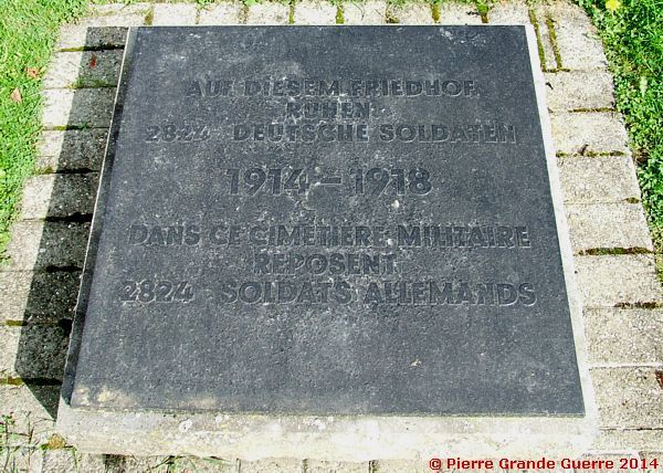
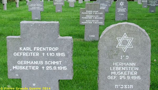
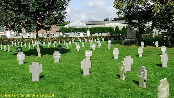
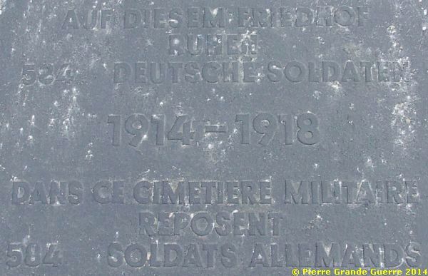
The German military cemetery of Wicres-Village
was established in September 1915 by the Prussian Infanterie Regiment Nr.13
(1.Westfälisches) from Münster for those fallen in battle in the area between
La Bassée and Neuve Chapelle. After the departure of I.R. 13 to other front
sectors, successive German troops also buried their dead here. More than 900
soldiers were buried here during the second half of 1915, and nearly 1,000
burials in 1918 during the major German offensive in May and the Allied
counter-offensive of September / October 1918. After the war the French
military authorities extended the cemetery, burying here the remains of
German soldiers from the fields of 12 surrounding communities. The soldiers,
buried here, were members of military units from their home garrisons in
Westphalia, West Prussia, Posen, Silesia, Thuringia, Hesse, Saxony,
Brandenburg, Baden, Bavaria, Lorraine and the Rhineland.
Source:
Volksbund
Deutsche Kriegsgräberfürsorge.
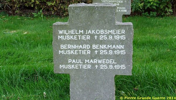
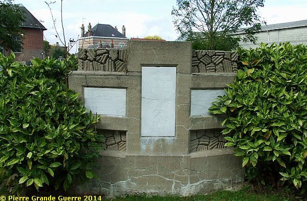
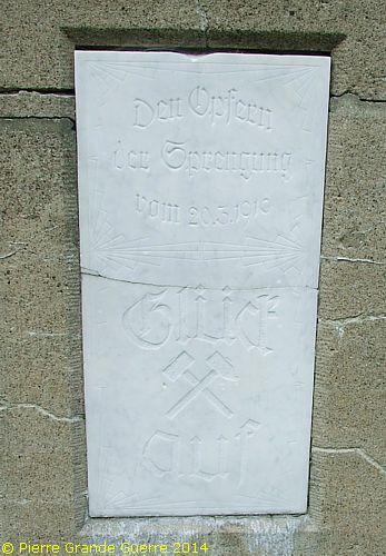
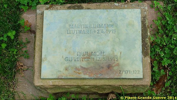
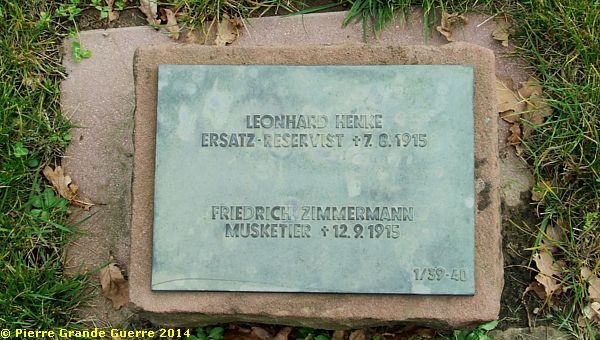
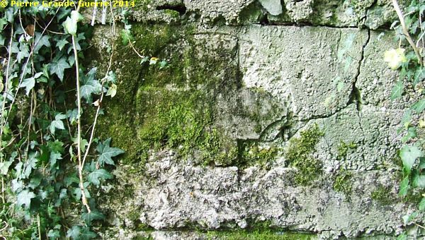
Two monuments in this cemetery remind us of the underground mine warfare on the front line. This is the first memorial, which commemorates the fateful day of 25 September 1915. On this day the Infanterie Regiment 13 lost 210 men by a mine explosion. They are buried together in separate plots.
On the rear side we find this inscription:
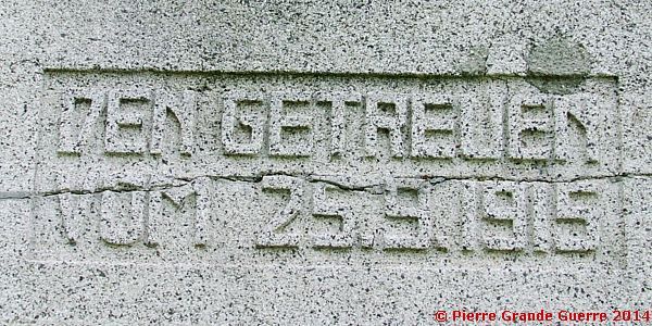
On the front side we find this worn-out inscription, which I could only decipher later with the help of some German friends.
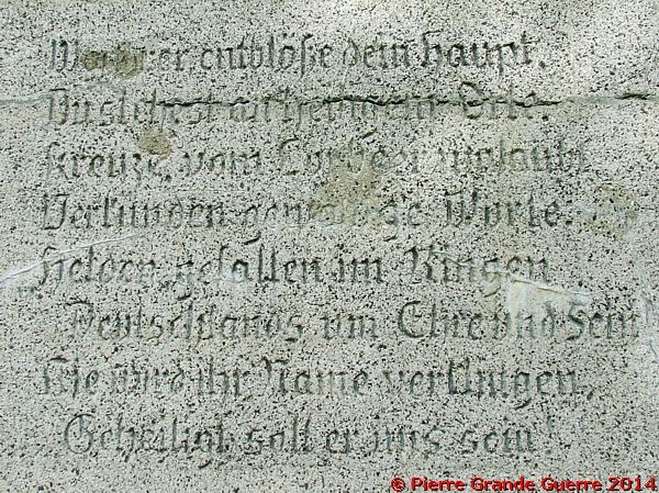
| “Wanderer entblöße dein Haupt. Du stehst an einem heiligem Orte. Kreuze vom Lorbeer umlaubt. Verkünden gewaltige Worte. Helden gefallen im Ringen Deutschlands um Ehre und Sein. Nie wird ihr Name verklingen. Geheiligt soll er uns sein. ” |
| English translation: “Hikers uncover your head. You stand in a holy place. Honoured by crosses of laurel. Announcing powerful words. Heroes fallen in the struggle of Germany for honour and existence. Never will their name fade away. May it be sanctified for us.” |
The Hebrew text on this Jewish grave means :
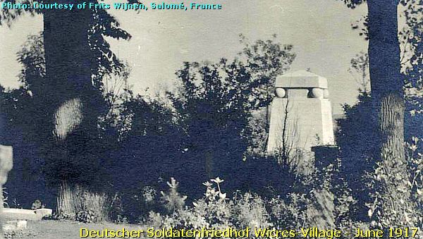
Two Period Photos
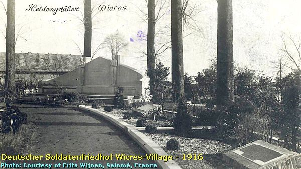
This 1916 period photo shows a large memorial in the Wicres-Village cemetery with two figures. This memorial has been removed after 1918, and it is not to be found anymore in the cemetery.
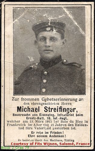
“Infanterist”, Michael Streifinger , of an Ersatz-Bataillon of the I.R. 16, fallen on 12 March 1915 near the Bois du Biez , Neuve-Chapelle, rests in Block 2, Grave 79.
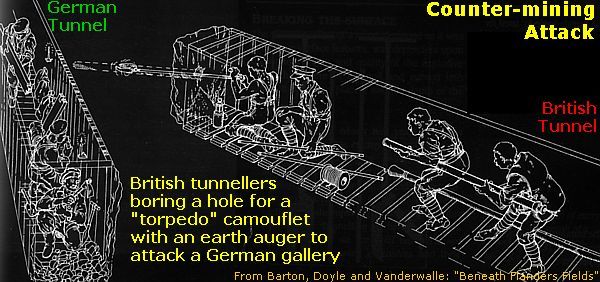
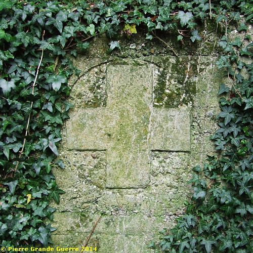
The second monument commemorates 10 miner soldiers (sappers), ...
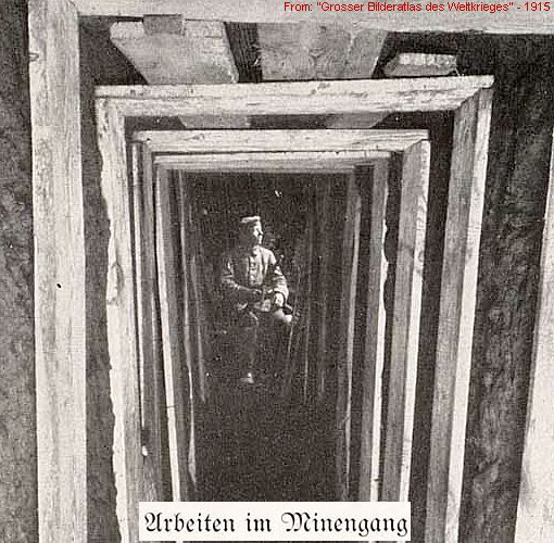
... killed by another mine explosion of 20 March 1916, ...
... possibly a counter-mining operation of the British.
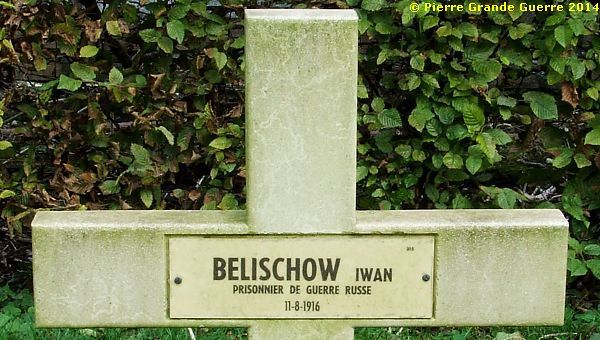
Among all these German graves we detect one grave with a French cross ...
... of a Russian Prisoner of War, who died on 11 August 1916.
We leave the cemetery to visit the civilian church yard.
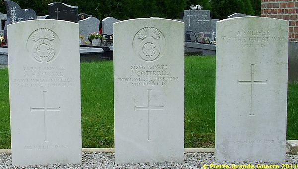
Here we find two plots of 4 Commonwealth War Graves, victims of 5 June 1916.
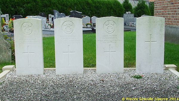
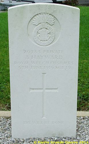
We leave the Wicres church yard.
Before we continue our trip, I shall briefly explain in the frame below the situation around Illies in October 1914.
|
Lille and the Pays des Weppes - October 1914 |
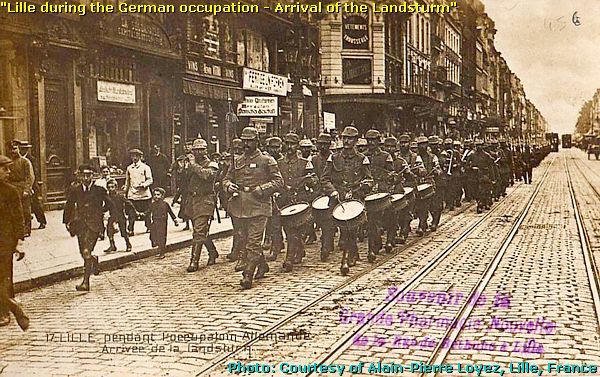
During the end of the period of the “ Race to the Sea ”, the German 6th Army, commanded by the Bavarian Crown Prince Rupprecht, captured and occupied on 11 October the city of Lille. From then on the Bavarians focused their attacks on the hills west of Lille.
The capture of Lille and these continuous attacks on the hills provoked desperate counter-attacks from the French XXI Army Corps and the Army Corps of the British Expeditionary Force. All these combats and battles would all together culminate in the “ First Battle of Ypres ” (18 October-11 November 1914).
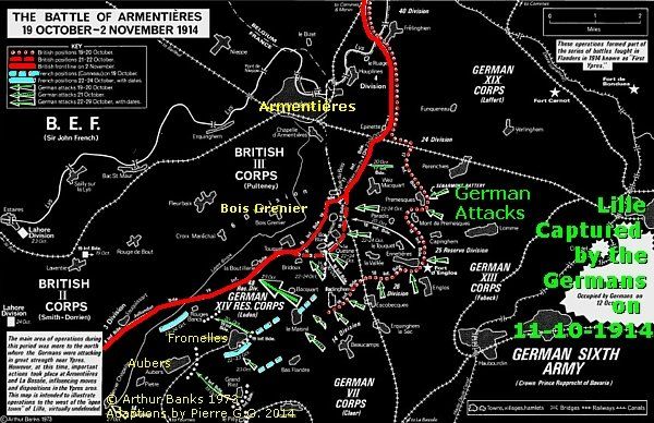
There were two other battles before this First Battle of Ypres. More to the north the British advanced from 16 October on Armentières, culminating in a battle, which lasted until 2 November 1914 and ended with the British capture of Armentières.
The Battle of La Bassée
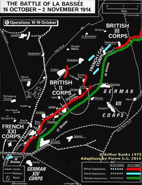
In the region of La Bassée and Illies the allied counter-attacks developed in the “ Battle of La Bassée ” (16 October – 2 November 1914), a desperate attempt by the Allies to chase the Germans from the hills and to re-capture Lille.
Occupation of the hills
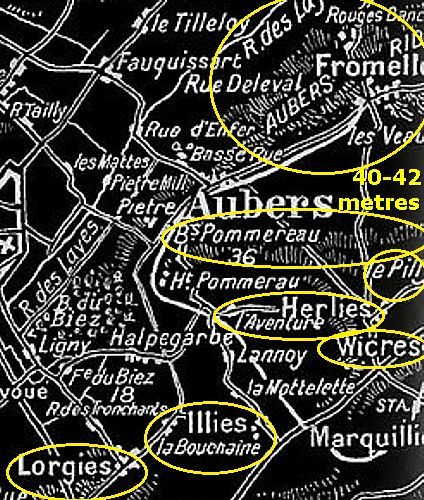
The inhabitants of the “Pays des Weppes” (Weppes-country) have built their villages on a stretch of 40-42 metres hills from before Roman times. During the autumn and winter the lower agricultural lands around these hills used to flood very often in a muddy landscape filled with pools.
As always during these first 3 months of the war, the Germans were eager to follow this traditional example of the inhabitants of these lower, often flooded areas; and they focused their attacks to occupy as much of the hills as possible. The military advantage from the possession of a hill is obvious: a better observation of the enemy, a better position for fortifications, and a better position for defence actions.
Warfare with superfluous water
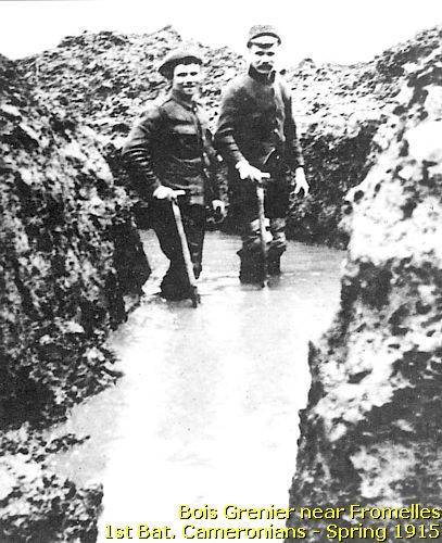
Another advantage is perhaps less known: warfare with superfluous water. In all lower ground front sectors, from the Ypres Salient in the north, via Neuve Chapelle, to Loos-en-Gohelle, more to the south from Illies, the Germans were flooding their superfluous water from their heights to their British enemies on the lower ground, forcing them to pump dry continuously their trenches and dug-outs.
Breastworks instead of trenches
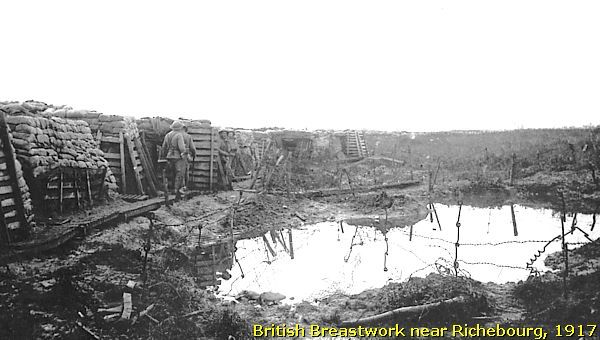
The lower, often flooded, parts of the countryside forced the troops on both sides to take a completely different approach to trench construction. In these lower parts the trenches were not dug into the ground.
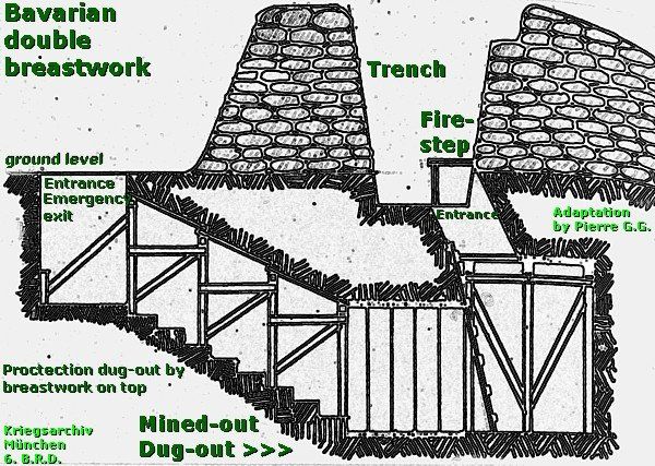
Here the soldiers constructed double breastworks on ground level, as shown in this sketch of the 6th Bavarian Reserve Division.
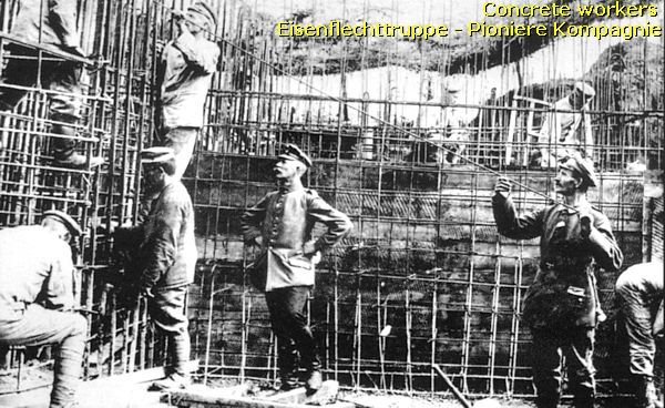
Concrete bunkers
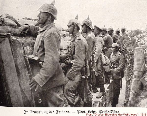
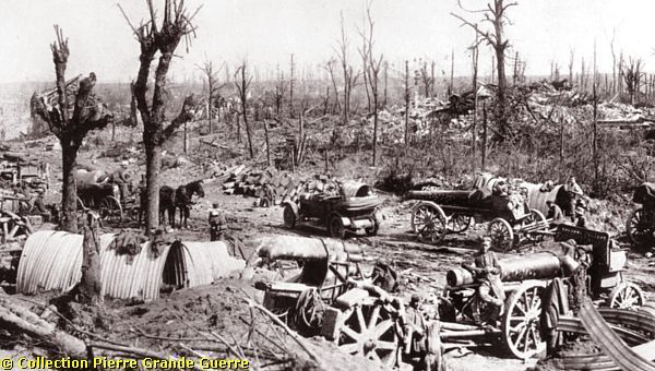
| After the Battle of Neuve Chapelle the Bavarians were constantly busy to improve their positions with mined-out dug-outs in the lower parts of the landscape and reinforcing the houses of the villages on the hills. After the Germans introduced reinforced concrete in early 1916, by pouring liquid concrete into wooden moulds with steel networks, they intensified their constructions of various types of concrete bunkers and would improve their defence lines to the maximum possible. |
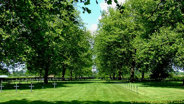
We continue our route to the Deutscher Soldatenfriedhof Wicres - Route de La Bassée , ...
... which is located along an eastern parallel road of the Route Nationale 41. On the horizon: La Bassée.
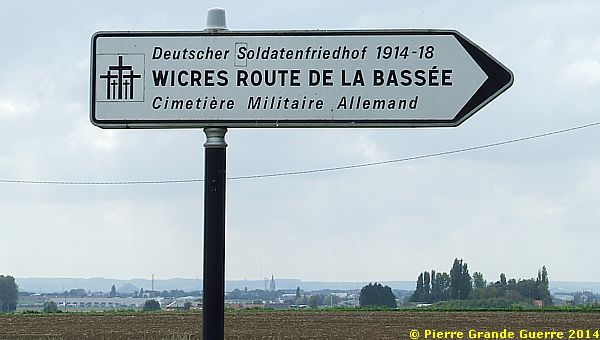
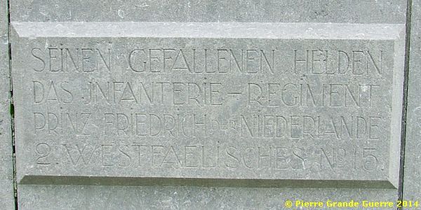
Deutscher Soldatenfriedhof Wicres - Route de La Bassée
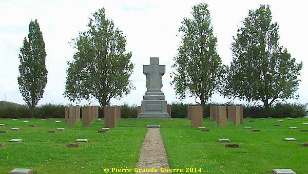
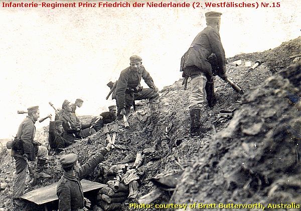
The German military cemetery of Wicres-Route de La Bassée was established in October 1914 by the Infanterie-Regiment Prinz Friedrich der Niederlande (2. Westfälisches) Nr.15 for their fallen in battles in the area between La Bassée and Neuve Chapelle. The soldiers, buried here, were members of military units from their home garrisons in Westphalia.
In good company
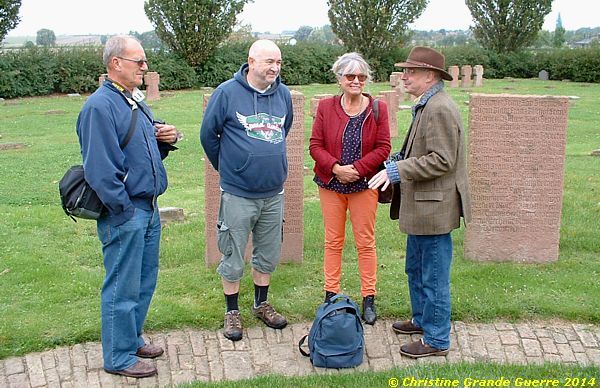
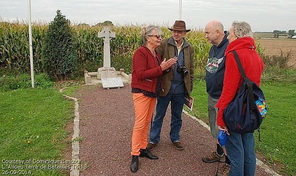
| During the first day of our 2014 visit to Illies we were welcomed by a delegation of well informed inhabitants of the Pays des Weppes: Mme. C. Dhennin, founder and president of the Société Historique d’Illies , and president of the Société “ Weppes en Flandre ”, Mr. D. Bascour, member of the association of L’Alloeu Terre de Batailles , and Mr. F. Wijnen of “Weppes en Flandre”. My wife and I had the honour to be guided around by this company of local historians with a store of knowledge about the Great War in the Pays de Weppes! Merci pour votre bon acceuil! |
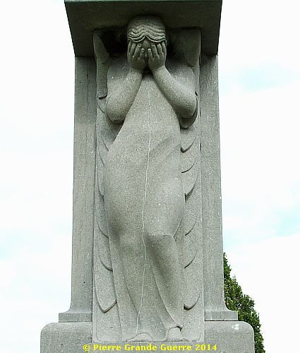
The brown granite crosses stand on communal graves.
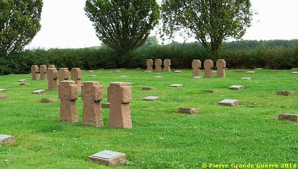
The names of the soldiers in the communal graves are mentioned on the steles, ...
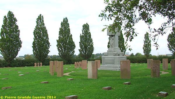
... which surround the central memorial.

Two mourning angels support the crucifix of the memorial.
We leave the cemetery to continue our route.
We return to the roundabout to cross the RN 41. From there we follow the western parallel road ...
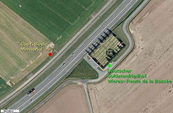
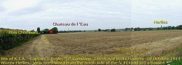
... to the Captain Boyle Memorial .
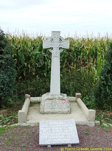
Before we will take a closer look at the exact site of action near this memorial, Madame Dhennin tells us the story of the fate of Captain Boyle.
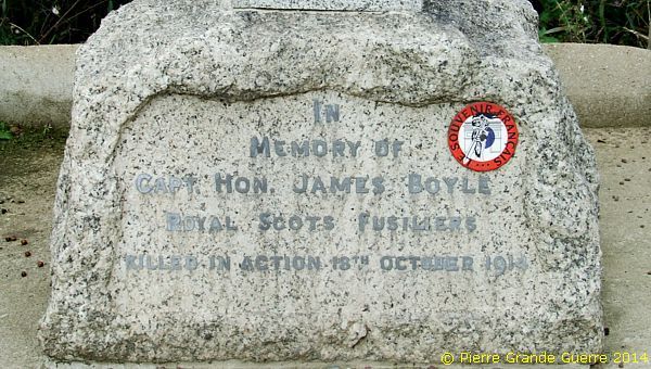
The fate of Captain Hon. James Boyle, 18 October 1914
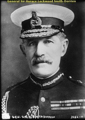
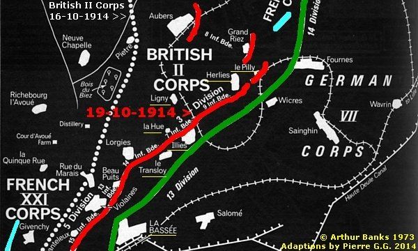
On 15 October the British learnt that the German cavalry corps were about to withdraw, but not that they were about to replaced by the infantry of the VII Army Corps. General Smith-Dorrien ordered a new offensive, this time to the south-east. Its aim was to outflank the German troops attacking the French lines to the south.
The attack began on 16 October, and made slow progress. Givenchy was recaptured, but the advance failed to reach La Bassée. The II Corps suffered another 1,000 casualties during this phase of the battle.
A key element in the failure of the offensive was the arrival of German reinforcements. The German Army XIII corps took over part of the line held by the VII Corps, making the German lines deeper.
Herlies, 18 October 1914
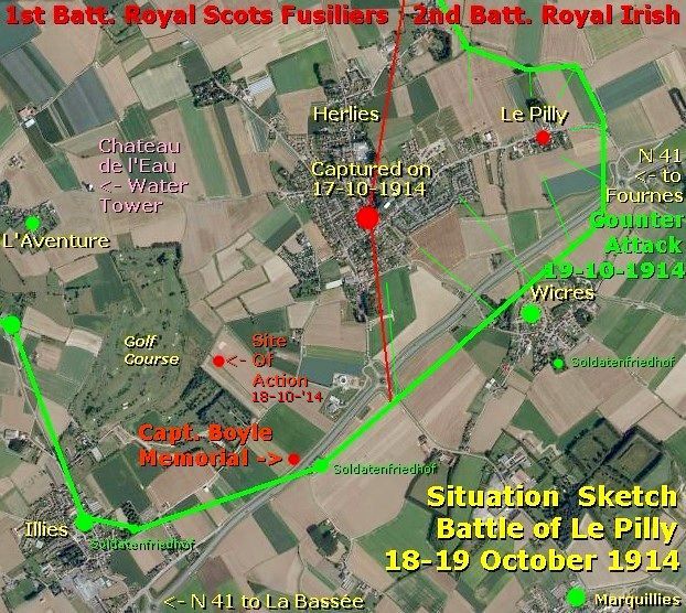
Attacking from the north, the 1st Battalion of the Royal Scots Fusiliers advanced southward from the village of Herlies, the objective being the chateau in the wood of the Bois Chombart. They had to cross a dip with a small farm at the bottom and advance through a maze of ditches.
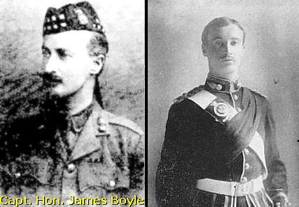
Ahead they could see the ground rising a bit to the La Bassée Road (now the RN 41). The wood was surrounded by entrenched German machine guns. Held up on the left the Scots were forced to dig in under heavy fire some 500 m. short of the objective. Just as it was getting dark, the Battalion was ordered to continue the attack. The 'D' Company under Capt. James Boyle was sent up in support. By 5.30 p.m. they were only 60 m. short of the wood but, they were ordered to retire.
Capt. Boyle, says the "History of the Royal Scots Fusiliers" (J. Buchan, 1925), fell as he reached the German trenches. But according to research by Geoff Bridger, Capt. Boyle and Capt. Lyon found themselves in a German trench occupied by dead Germans. "For some unaccountable reason Capt. Boyle prodded a dead German with his stick, a move, which awakened the in reality sleeping soldier, who promptly bayoneted and killed him." He was buried by the Germans, but his grave was subsequently lost.
A clip from the Glasgow Herald, d.d. 2 December 1914, honouring Capt. Boyle:
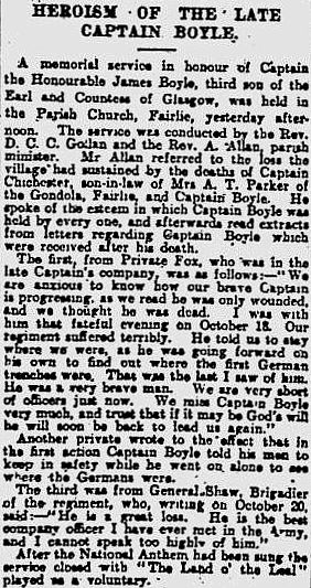
| Part of the text above is my resume and adaptation of this SOURCE of Mr. Barrie Thorpe on the website of the Western Front Association - U.K. Oral information on the site, Mme. C. Dhennin , fondatrice et présidente de la Société Historique d’Illies , et présidente de la société, " Weppes en Flandre ”. Additional images and the clip of the Glasgow Herald; courtesy of Mr. Pierre Seillier , la Bassée, France. Merci à TOUS! |
Right and directly next to the memorial we find the Site of Action of Capt. Boyle, ...
... as shown in my panorama photo below.
The same panorama in 3 separate overlapping photos from left to right:
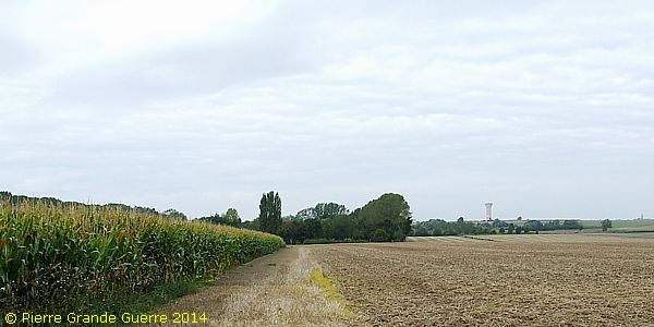
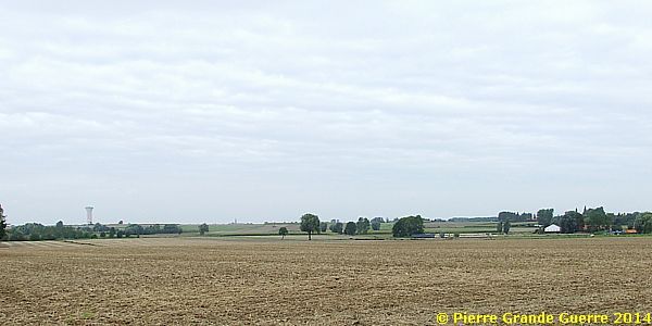
This particular part of the panorama offers a view at the church tower of Herlies, and east of it, le Pilly.
Time to tell you what happened on that next October day in these fields.
|
The Battle of le Pilly, 19 October 1914 |
Another Allied attack was planned for 19 October. The only success during this attack would lead to tragedy. The 2nd Battalion of the Royal Irish Regiment captured le Pilly, a village on the eastern outskirts of Herlies, but the rest of the advance failed. The Royal Irish were dangerously isolated, but before the order to retreat could reach them, they were surrounded by the Germans. Of 800 men only 300 survived to surrender to the Germans.
On 20 October the Germans went on to the attack. A major offensive was launched all along the German line from Arras to the sea. Fortunately, that day the II Corps had halted their offensive and been ordered to hold their line. German attacks on 20 and 21 October were repulsed, but Smith-Dorrien decided to retreat to a stronger defensive line that had been prepared behind the front line.
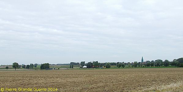
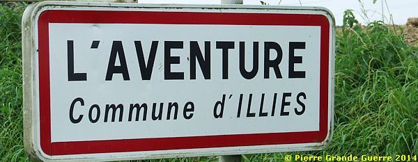
From the Boyle Memorial we continue northward to the hamlet of L'Aventure .
After passing the pink water tower we spot at the entrance of the hamlet, ...
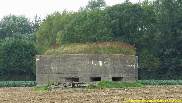
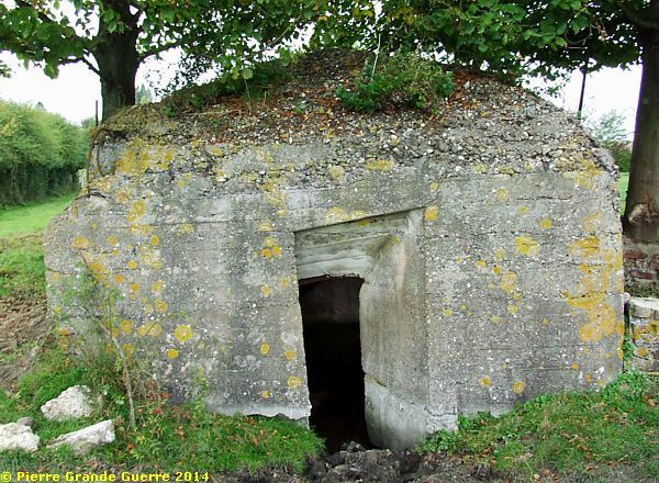
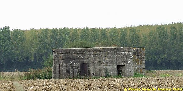
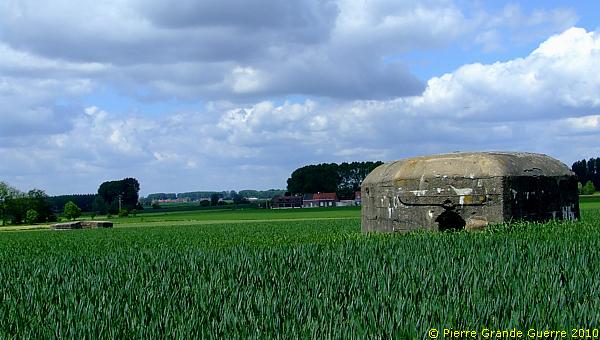
... our first German bunker of this trip, a reinforced concrete observation post.
From this bunker we approach and enter the hamlet from the north.
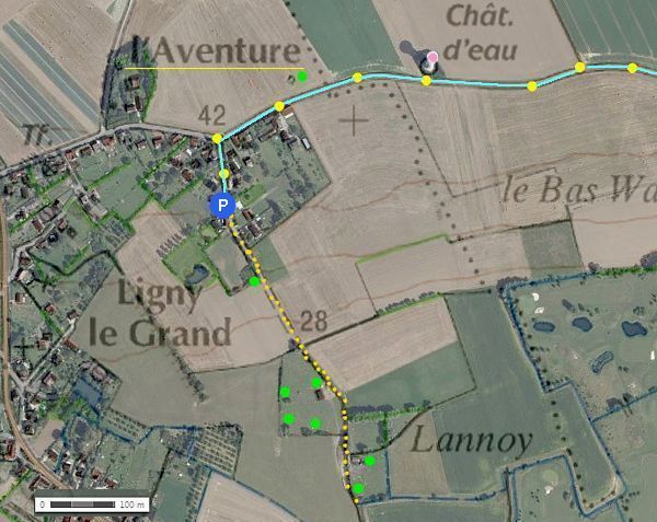
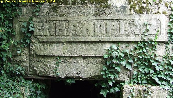
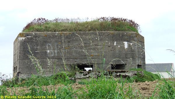
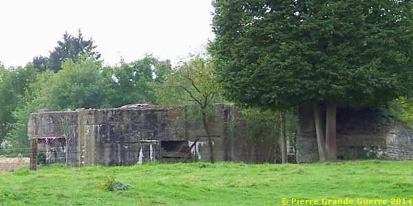
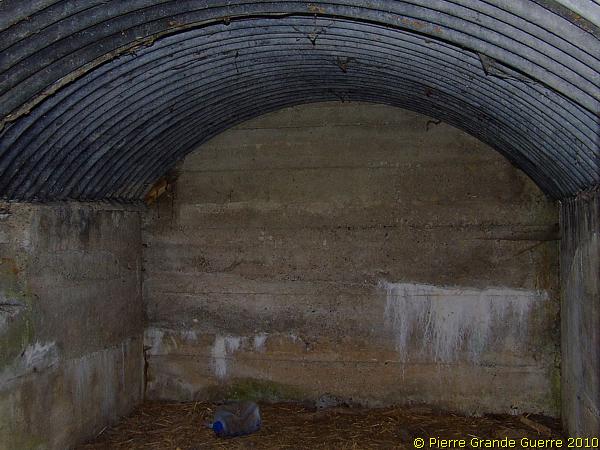
After parking our car we descend on foot a path southward to a location called Montécouvé. An information panel in the local dialect of French Flanders, of the Pays de Ch’ti , tells us ...
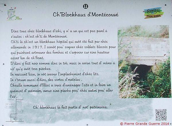
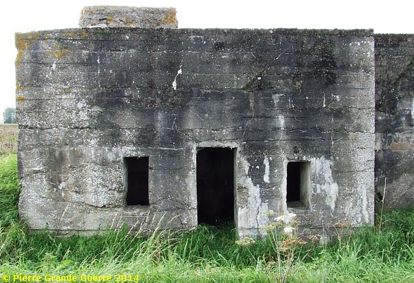
... the background of this German dressing station, a “Verbandplatz”.
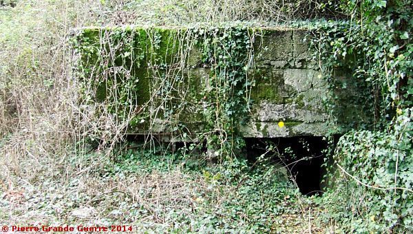
The Germans constructed this bunker in 1917.
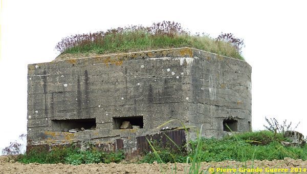
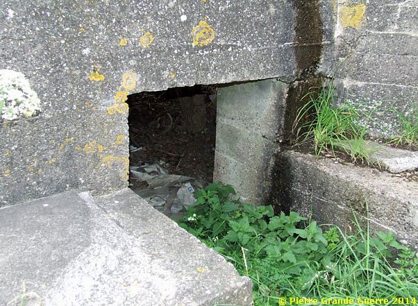
After re-opening the bunker, ...
... local researchers found two iron bed frames still intact.
The interior of the "Verbandplatz".
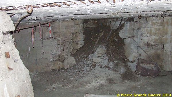
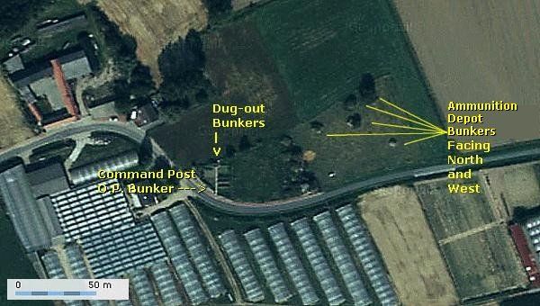
The dressing station used to be a component of a plot of bunkers, belonging to a heavy artillery gun base.
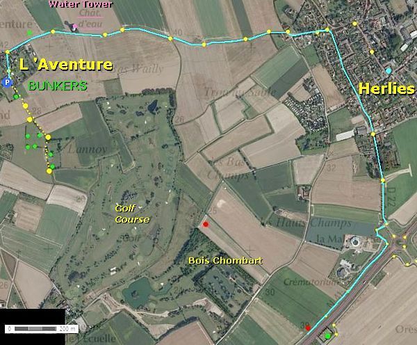
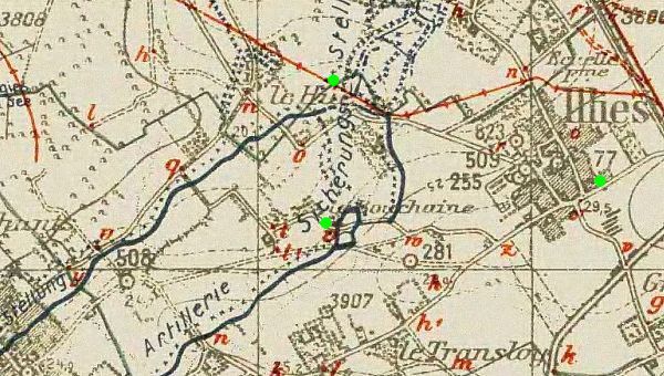
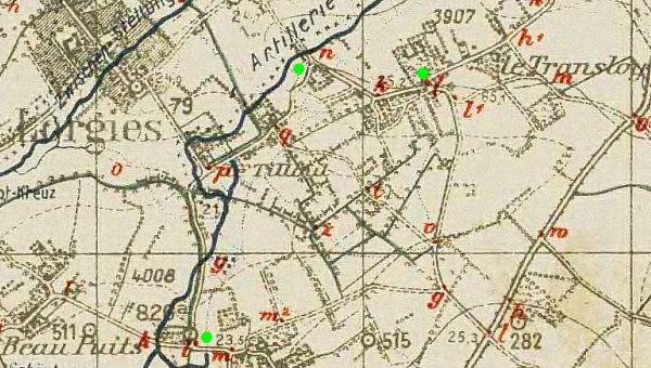
The “Artillerie Sicherungs-Stellung” of Illies
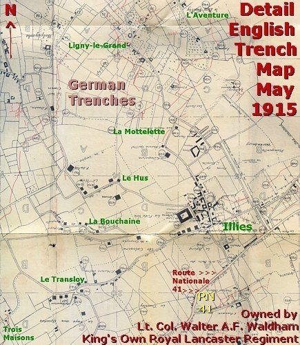
This map of Lt. Col. Waldham shows the German trenches and fortifications, which were known to the British, just before the Battle of Festubert (15-25 May 1915).
After the spring battles of 1915 of Neuve Chapelle and Festubert, the Germans speeded up their construction works. They constructed more and better breastworks in the lower grounds.
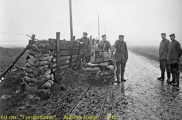
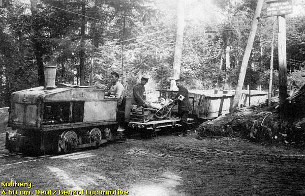
The Germans constructed a network of "Forderbahne", also called "Décauville" - 60 cm. railroads, to supply ammunition to the guns and the first line trenches.
They intensified their construction program with adding reinforced concrete bunkers along three defence lines, reaching their perfection in 1917.
Around Illies the Germans constructed a third defence line, empowered with a stretched chain of artillery batteries on the 40 metres hills, a so called “ Artillerie Sicherungs-Stellung ”.
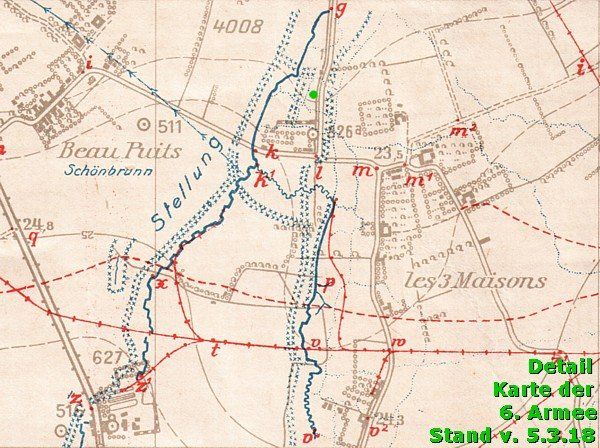
This German trench map of 17 March 1918 shows the same area around Illies, as the British trench map of May 1915 of above.
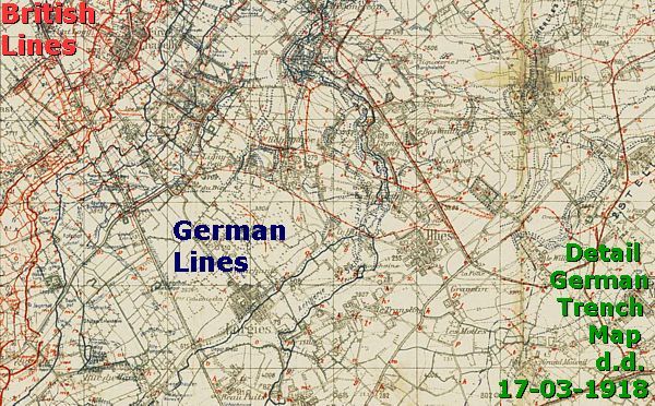
Let us take a closer look at this trench map. The map shows two remarkable features:
1. Of course you will notice the enormous extension after 3 years of construction of fortifications, trenches and barbed wire entanglements of a third line artillery position opposite the British area of Festubert and Neuve Chapelle!
2. Usually, trench maps of all the belligerent parties, meant for use on the battlefield, show only the lines of the enemy, like the 1915 map of Lt. Col. Waldham. Maps for use on the battlefield show only the “own” front line / jump-off line, and these maps hide all the other “own lines”, in case the owner of the map would be made Prisoner of War.
This German 1918 map however is of course a secret staff map. It was not meant for use by a common soldier or officer on the battlefield. This staff map, which was meant for use in a headquarters at a safe distance from the front line, shows also the lines of the Germans themselves .
During our route in the area of Illies we will explore some 30 bunkers of this “ Artillerie Sicherungs-Stellung ”. Later on this page I will show you sometimes a detail of this 1918 trench map to help you to imagine the situation of the site in wartime.
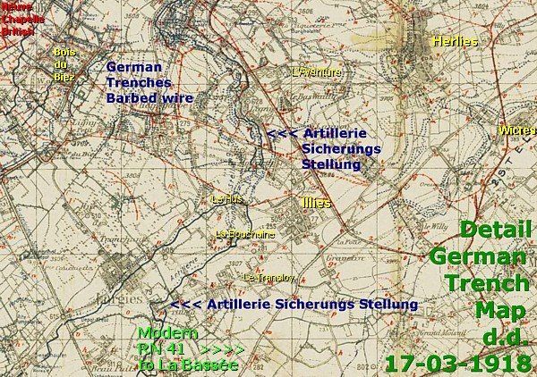
This map detail represents the situation around L'Aventure and Montécouvé.
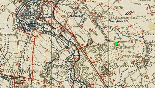
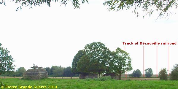
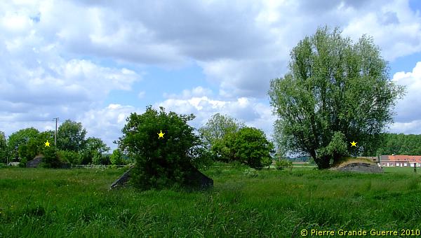
Before we return to the site of Montécouvé of 2014, I finish this frame with a satellite photo of the site of the heavy artillery gun.
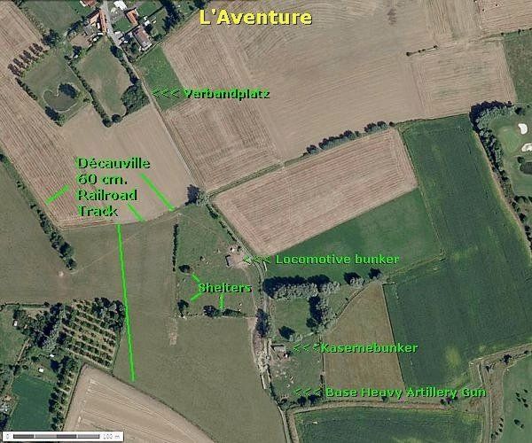
On this site Mme. Dhennin drew my attention to the traces of the Décauville railway, which supplied the battery with its ammunition.
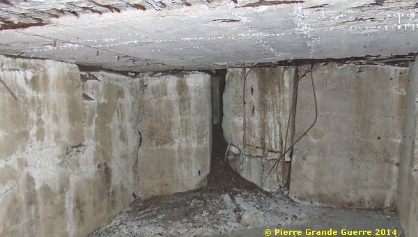
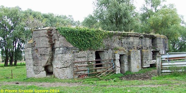
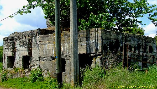
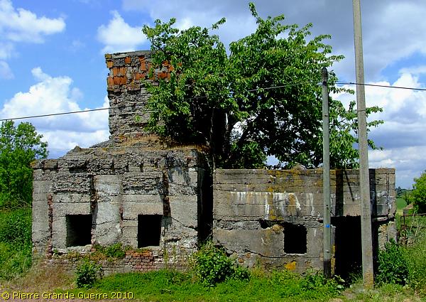
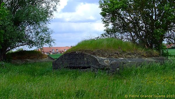
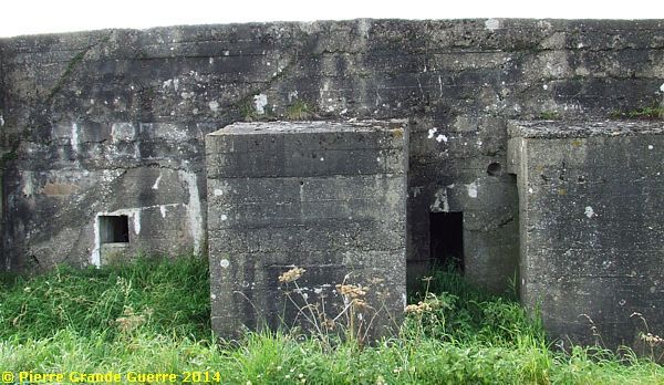
Perhaps the most interesting bunker of the site is this one.
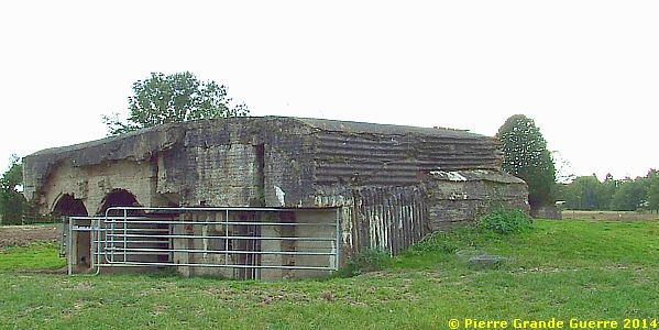
Probably the purpose of the bunker was to protect the two Deutz locomotives of the mini railway in the two arched rooms on the left.
The right room served to shelter the "Eisenbahn" personnel of the locomotives.
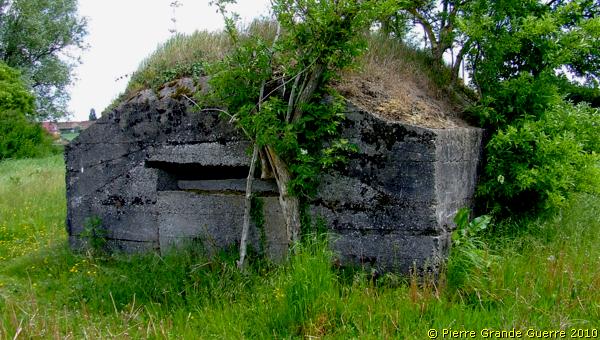
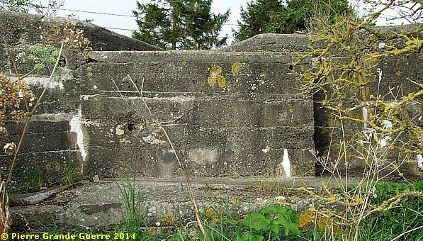
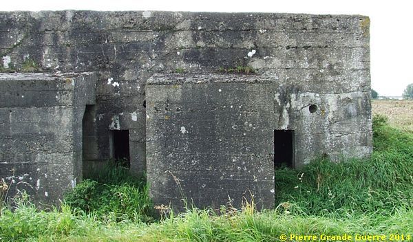
In the south-west corner of the site we find three bunkers. The largest one might have served as a workshop.
Some details of this bunker from left to right:
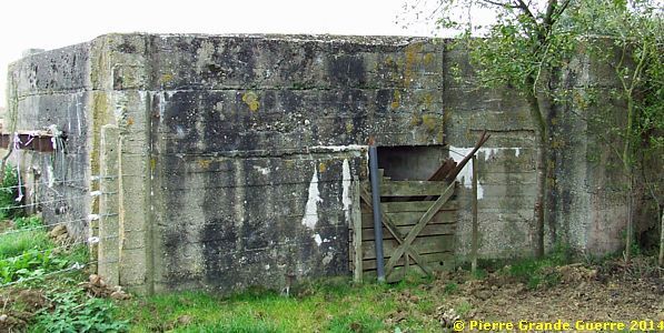
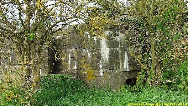
Next to it stands a small shelter bunker.
We continue southward to a "Kaserne" bunker, close to the concrete foundation of the gun. This "Kaserne" bunker housed the artillerymen.
The remains of the concrete foundation for the heavy gun. It is possible that the Germans destroyed the concrete base themselves in 1918.
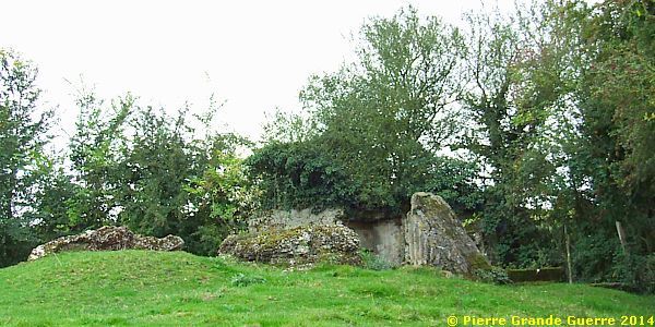
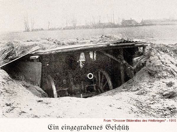
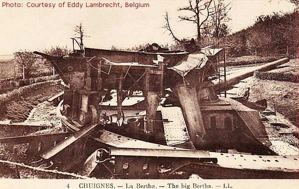
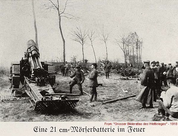
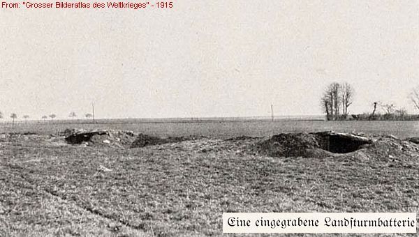
The “35.6 cm. S.K. L/52” Heavy Gun
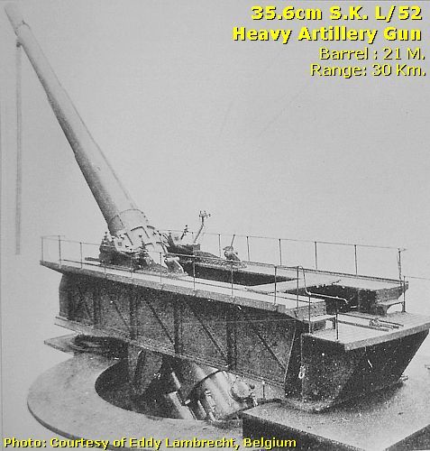
Probably this site has been the base of a German heavy gun, a “35.6 cm. S.K. L/52” gun with a range of 30 kilometres. This type of gun was normally used for coastal defence. During the war only two of these guns were installed along the Western Front on a concrete foundation. One gun was located in Arcy Wood, Somme. This last gun was known as the Chuignes Gun. (See photo below).
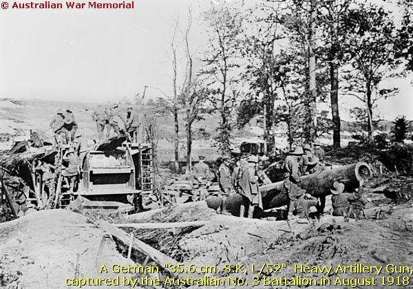
This concrete foundation on this Montécouvé site here is extraordinary in this front sector. The size of the foundation seems to match the size of the Chuignes Gun on the other period photo below. A heavy gun of this size was almost always surrounded by railways for transport of the gun to its base and for the supply of ammunition. (See for instance my photo impression about the German 380 mm. Artillery Base of Duzey ). Sources mention that the Westfälisches Fußartillerie-Regiment Nr. 7 Köln (VII. Armeekorps) installed such a gun in the winter of 1914 near Lille! Based on these facts, I consider it most likely that this location used to be the site of the “35.6 cm. S.K. L/52” gun near Lille.
With a last view at the concrete foundation we leave the site of the artillery base.
Via the D 141 we continue southward to the hamlet of la Mottelette.
At the junction near Ligny-le-Grand we pass this shelter bunker.
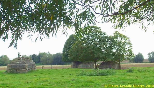
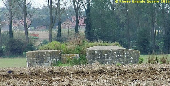
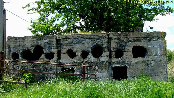
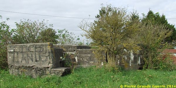
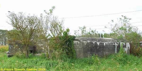
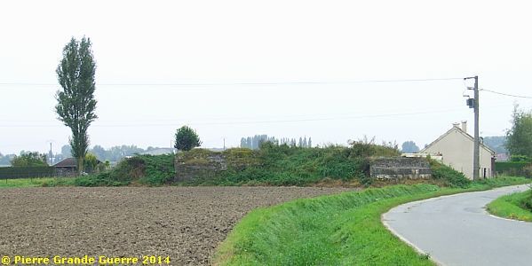
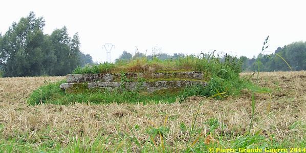
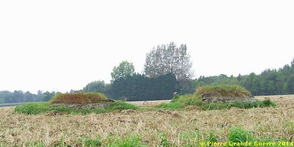
As we near the hamlet of la Mottelette , ...
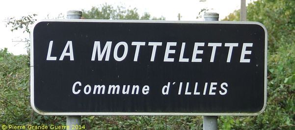
... we detect in the fields on the western side of the road three large bunkers.
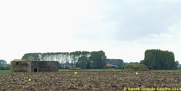
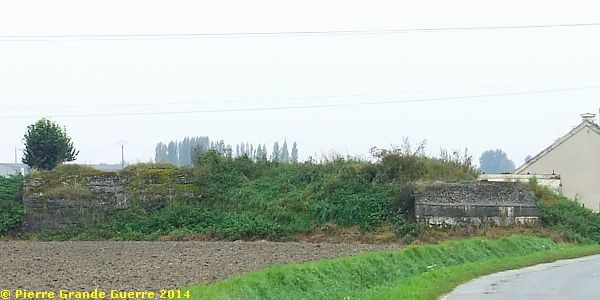
Three zoomed-in tele-views of these bunkers, from left to right:
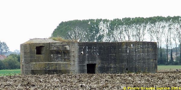
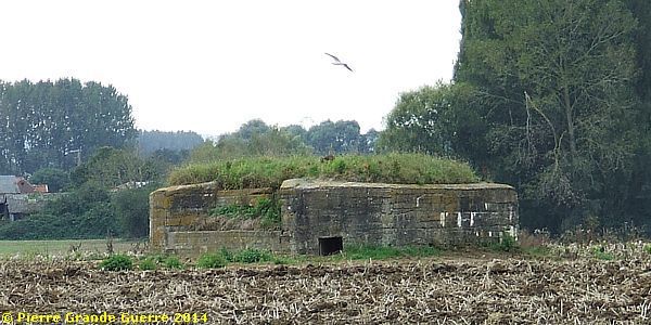
In a few moments we will visit this bunker "in the background" for a closer view.
The right, most northerly, bunker of the three.
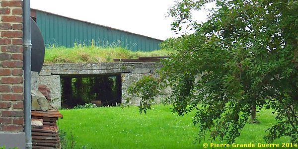
In the hamlet we detect in someone's private garden a large shelter bunker.
Passing the hamlet via an unpaved road we take another look at the bunker, formerly mentioned as “the bunker in the background”.
From la Mottelette we return to the D 141 to continue our trip southward to Illies.
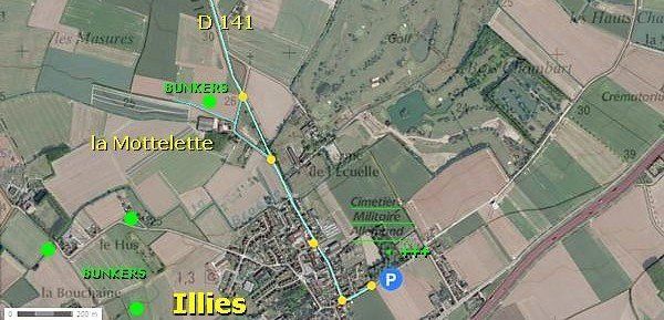
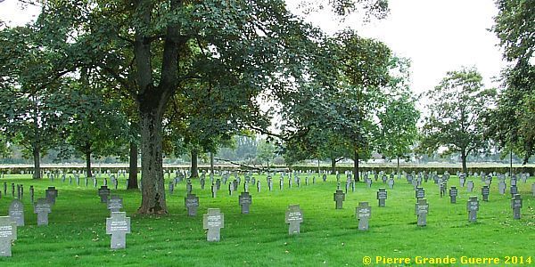
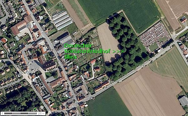
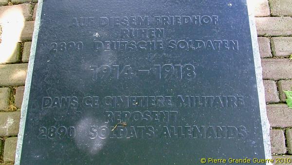
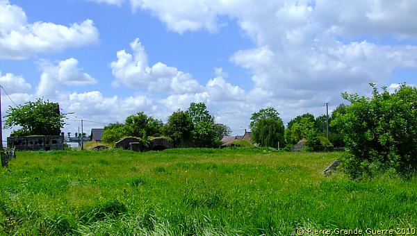
In 2010 and in 2014 we paid a visit to the Illies Deutscher Soldatenfriedhof , ...
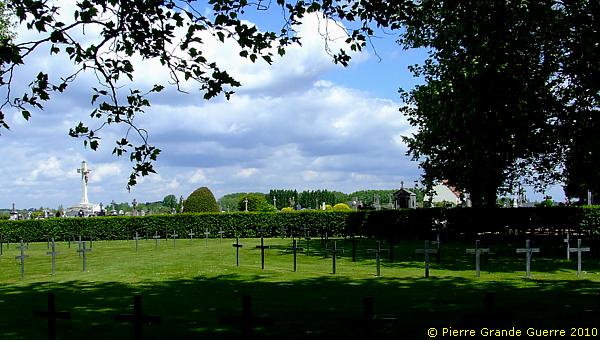
... which is located next to the civilian cemetery of Illies.
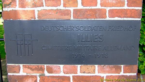
The Illies Deutscher Soldatenfriedhof was created in 1914 by German troops. After the war the French military authorities extended it to receive the remains of the German fallen from 17 neighbouring municipalities. Many victims died during the battles of the "Race to the Sea" period, in October-November 1914, and the spring offensives in Artois of 1915. In 5 communal graves there are buried 275 soldiers, of whom only 56 are identified.
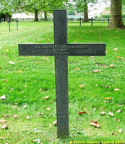
Out of the 2890 burials I show you here only two remarkable graves.
This the grave of Alexander Freiherr ( Baron ) von Siebold, a son of a Japanologist, famous for his knowledge in the 19th century in Germany and Austria, Alexander George Gustav Freiherr von Siebold.
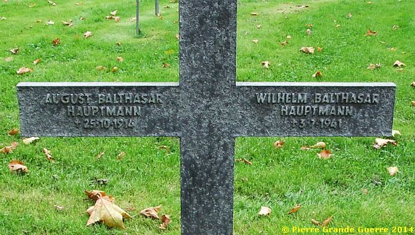
The second grave is perhaps even more extraordinary; father and son, both Captains in different World Wars, share the same grave.
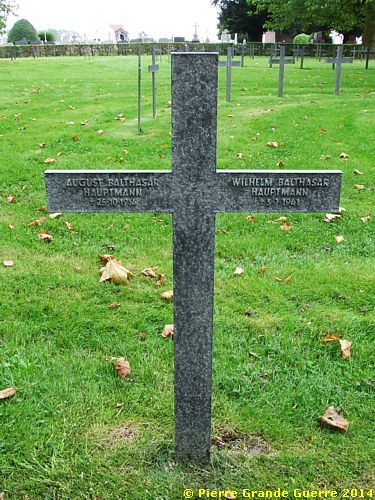
The father was killed in October 1914, the son was killed in July 1941.
From the cemetery we continue westward to the outskirts of ...
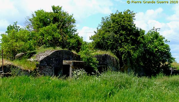
... Illies and the hamlet of la Bouchaine , ...
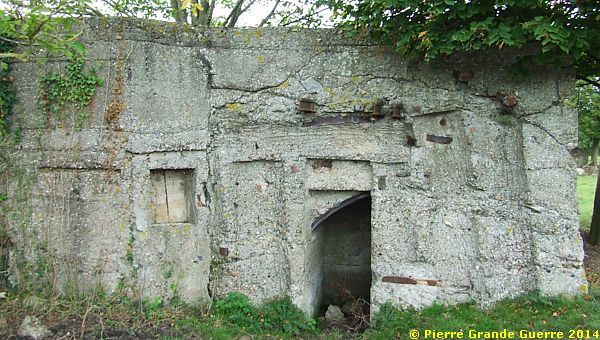
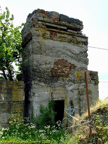
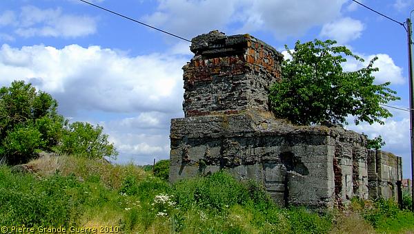
... to the concrete relics of a German stronghold.
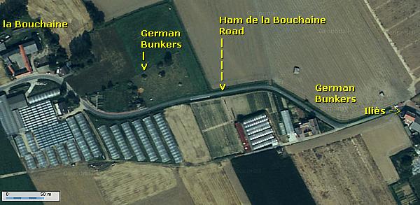
Almost 4 km. south of Aubers this concrete observation post bunker is also part of a third line stronghold, ...
... which belonged to the Aubers Ridge front sector of the 1917 Hindenburg Line.
Though we see here some 1916-1918 bunkers, ...
... the Germans established this stronghold already at the start of 1915.
At the other, northern side of the Hamm de la Bouchaine road ...
... stands this machine-gun bunker.
About 100 m. to the west is another machine-gun bunker, ...
... with a construction on the top, fit for mounting an anti-aircraft machine-gun.
We continue some 150 m. westward, along the Hamm de la Bouchaine road.
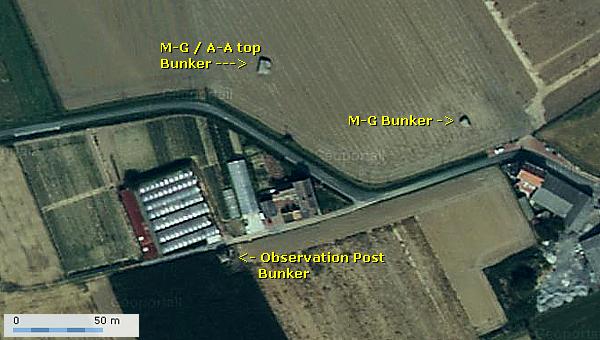
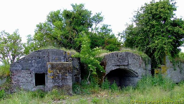
On this side of the road we detect this field with a concentration of several bunkers.
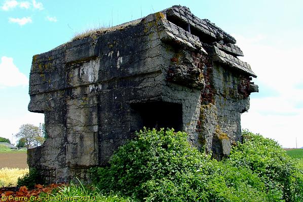
This large bunker could possibly have served as a Command Post. It used to be a farmhouse, which the Germans fortified with concrete.
An observation post towers on its superstructure.
On the left: the blinded side of two dug-out bunkers.
We enter the field along the damaged walls of the Command Post.
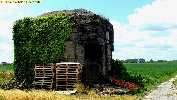
Next to the Command Post lie these shelter bunkers, ...
... with the entrances and windows facing south-east.
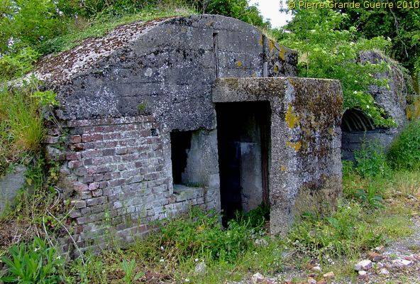
The interior of the right bunker. Quite remarkable; after so many years there is hardly a trace of rust.
In this field there are also 6 identical ammunition depot bunkers, ...
... of which the blast walls are facing north, north-west, and west.
Notice the blast wall below the opening, to release the pressure of an unwelcome explosion.
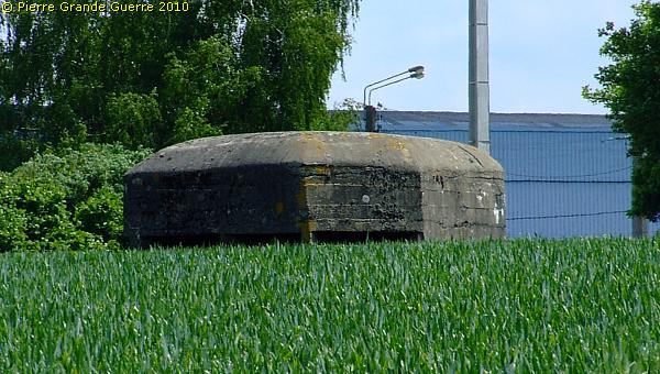
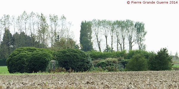
From la Bouchaine we continue westward, to circle northward and eastward to the hamlet of le Hus .
Just before we enter the hamlet we pass the bridge over the brook of la Broëlle, where we detect on the south side of the road a large, densely vegetated bunker along the brook.
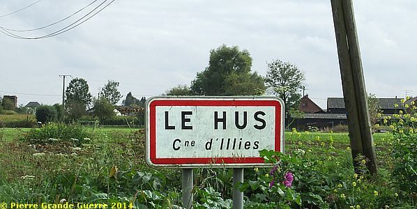
At the only junction in the hamlet of le Hus we detect this bunker.
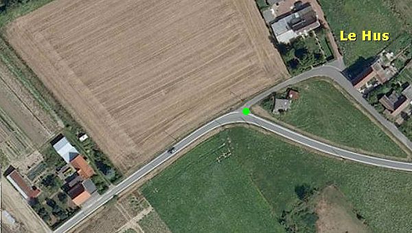
The top structure of this bunker was also fit for mounting quickly an anti-aircraft machine-gun.
I show you here some interesting details.
From le Hus we return to Illies, to continue from there south-westward via the Rue du Calvaire and the Rue du Touquet to le Transloy .
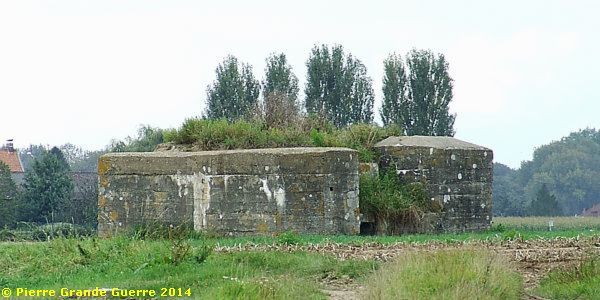
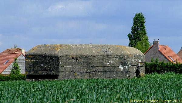
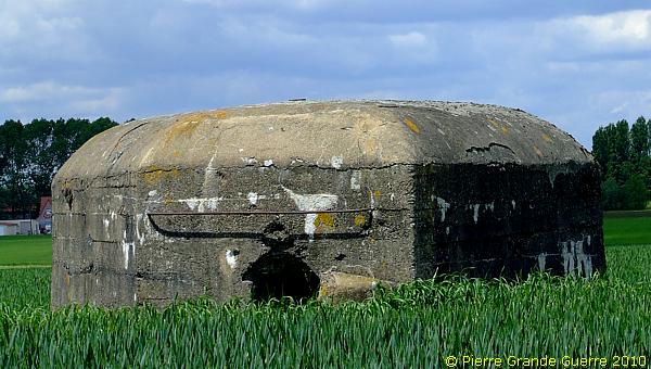
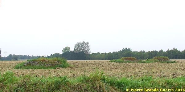
Just before we enter the village of le Transloy we see in the fields at the southern side of the road two large bunkers.
At the eastern entrance of the village we find another large bunker.
A close-up of the same bunker.
Halfway to La Bassée and the hamlet of les Trois Maisons, we detect three small shelter bunkers along the Rue du Touquet.
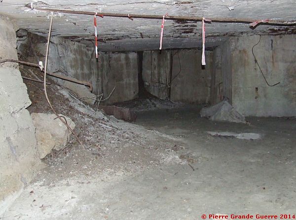
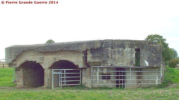
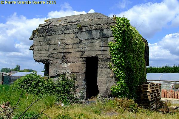
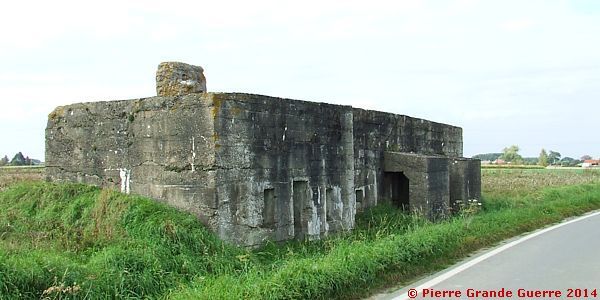
We continue in the direction of La Bassée. Just before entering the community of La Bassée, near the hamlet of les Trois Maisons , we visit our last bunker of this trip.
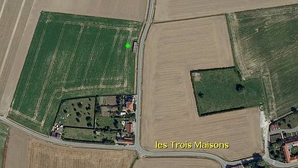
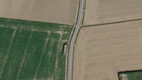
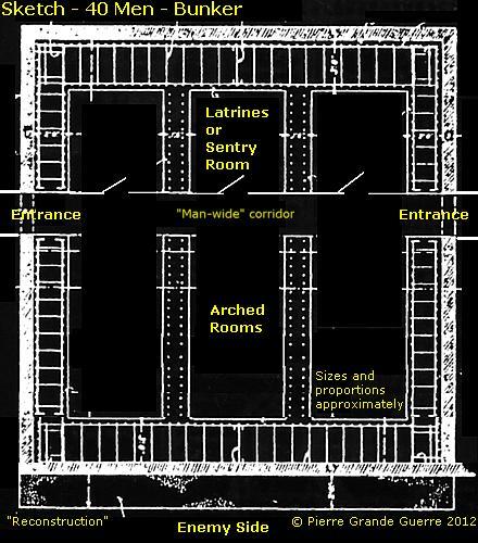
On the west side of the road stands this large bunker, obviously a large “Kaserne” bunker.
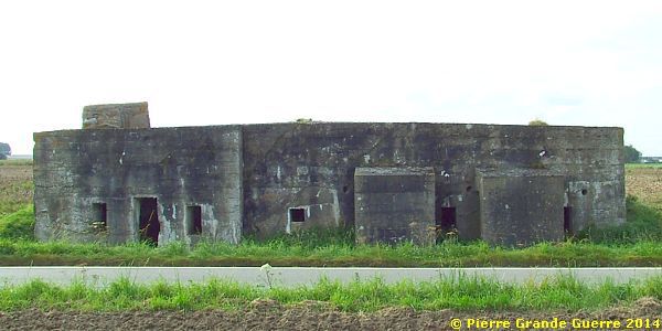
Such a bunker would shelter at least 40 soldiers.
Next I show you three details of the "Kaserne" bunker, from left to right.
This last view of the “Kaserne” bunker of les Trois Maisons forms the finish of our trip to Illies and the end of this photo impression.
Acknowledgements
This Photo Impression has been enriched
by the spontaneous
contributions
of 10 persons from 4 different
countries. I would like to express my deep gratitude here to the following
persons. From France: Mme. C. Dhennin, Mr. D. Bascour, Mr. F.
Wijnen, Mr. P. Seillier, Mr. A.P. Loyez, Dr. M. Brett-Crowther. From Germany: Herr. M. Rupp and Herr M.R. Galle. From Belgium: Mr. E. Lambrecht. From
Australia: Mr. B. Butterworth of Drake
Goodman's Online WW1 German Photos. Thank you very much!
Continue
to the next Artois chapter: " Neuve Chapelle - Richebourg
"


