
SOMME BRITISH Sector - Newfoundland Memorial Park - Y Ravine - Beaumont-Hamel
Years of visit: 2005, 2007, 2011
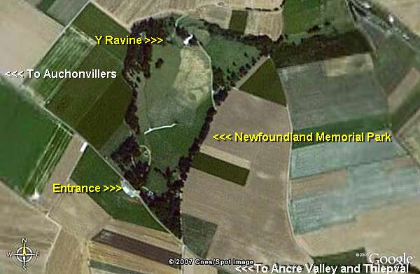
| South of nearby Hawthorn Ridge , along the D 73 from Auchonvillers to Hamel, and south of Beaumont Hamel v illage : the shell holed battlefield of the nowadays called Newfoundland Memorial Park. |
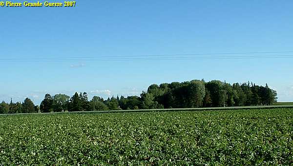
From almost anywhere around Beaumont Hamel one can detect the typical trees around the Newfoundland Memorial Park , ...
... like from this British Observation Post bunker at "Fort Moulin", along the D 174.

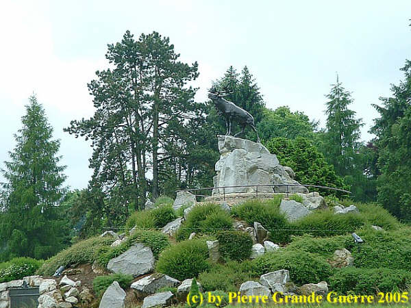
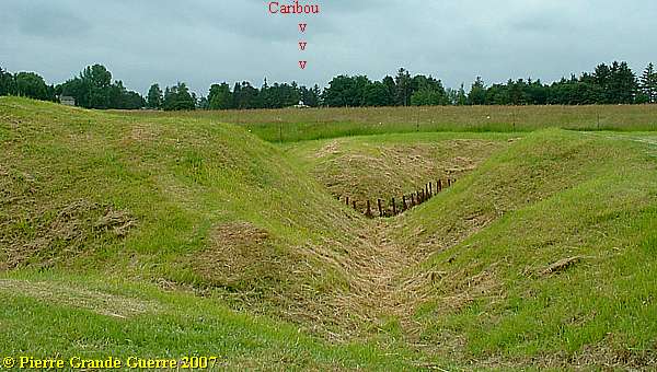
This grieving Caribou is the symbol of the Royal Newfoundlanders Regiment.

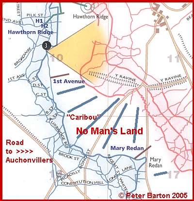
It looks over the battlefield of Beaumont Hamel from the former British trenches to the German trenches at Y Ravine, some 1.350 m. to the north-west.
The 1st Battallion of the Canadian Newfoundland Royal Regiment
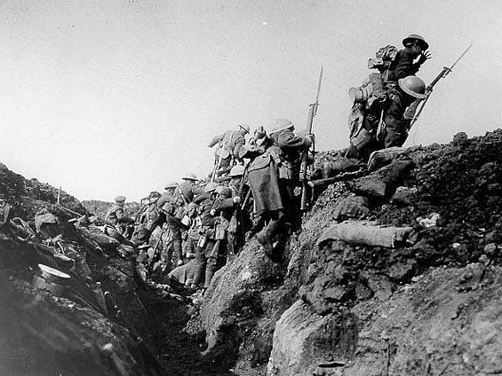
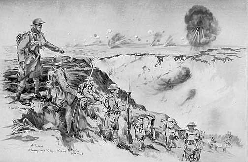
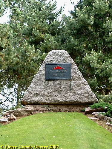
The 29th Division under General Hunter-Weston attacked at 8.30 hrs., 10 mins. too late (!) after the explosion of the Hawthorn Ridge Mine. First Hunter-Weston attacked with the 87th Brigade, and some time later with the 88th Brigade.
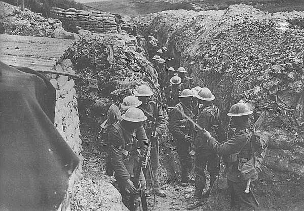
The 1st Battallion of the Canadian Newfoundland Royal Regiment, part of the 88th Brigade, was assigned this section of the frontline at Beaumont-Hamel on 1 July.
This was the Newfoundlanders' first battle in France after Gallipoli in Turkey.
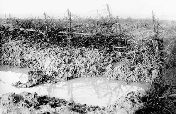
Soon after the attack began from these trenches along the D 73, it was clear, that the German machine guns were not silenced, and the barbed wire had not been destroyed by the artillery bombardment.
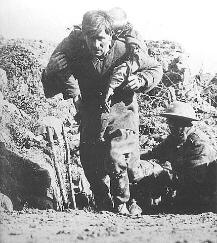
The bravery of the Newfoundlanders was undeniable. Although their chances for success were practically non-existent.
Of the 801 Newfoundlanders, who left their trenches on 1 July 1916, only 69 returned to answer the roll-call. The dead numbered 255. 386 Men were wounded and 91 were recorded missing.
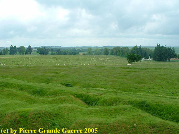
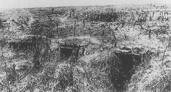
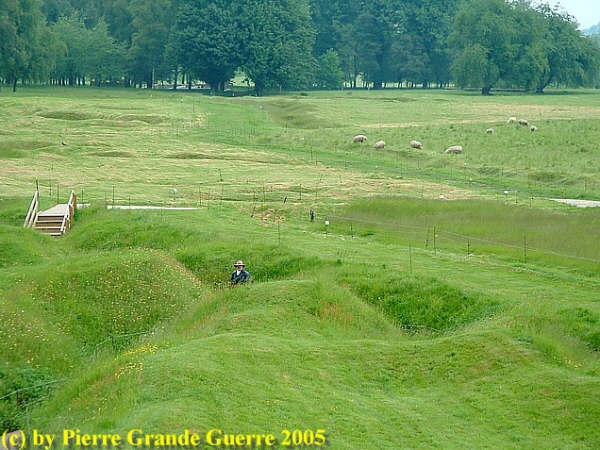
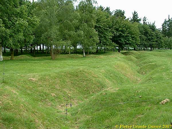
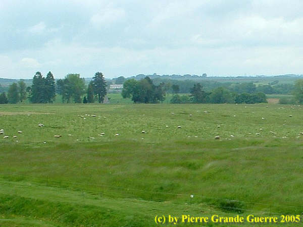
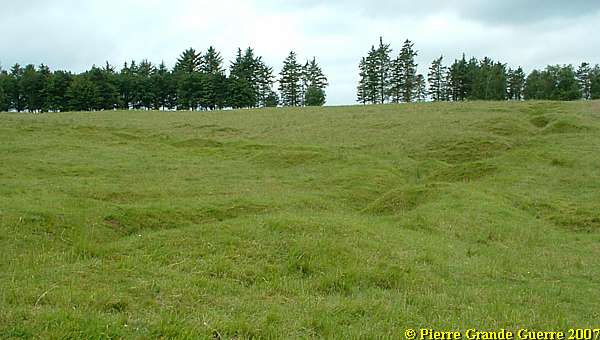
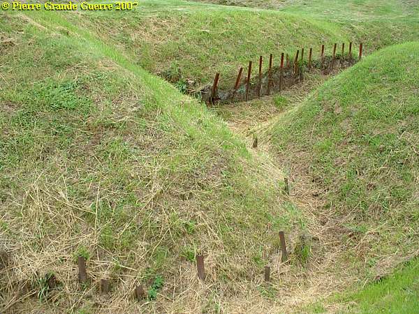
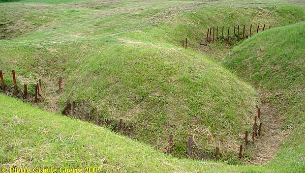
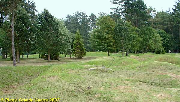
Nowadays the Newfoundland Memorial Park shows shell holes, and zig-zagging traces of the trenches of the battlefield.
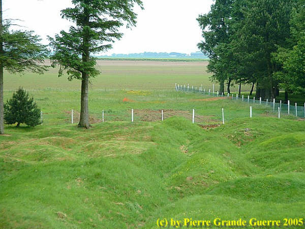
The guardians of the Park prefer not to restore the trenches, but to preserve the traces of the trenches in a natural way.

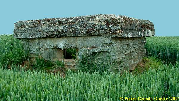
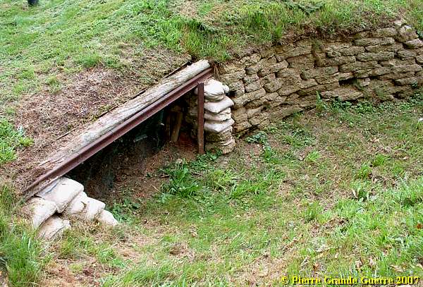
Entrance of a dug-out.


From the Caribou statue we walk down the ridge, ...
...crossing No Man's Land, to Y Ravine, and the former German trenches. View in the direction of the "Highlander" monument near Hunter's Cemetery.
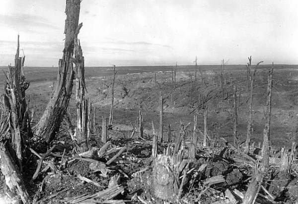
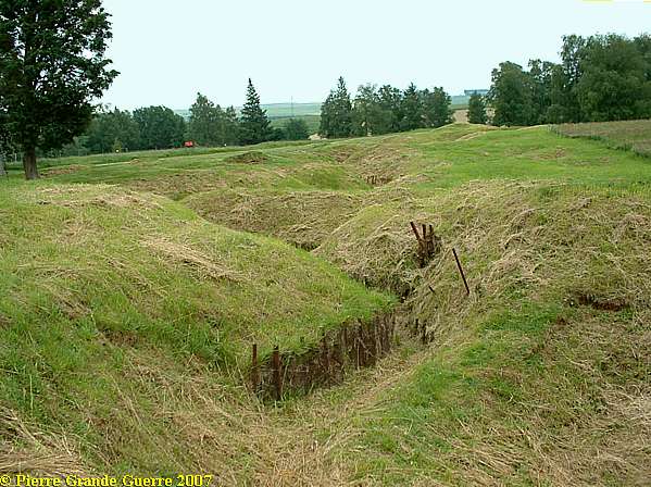
Y Ravine

I made these photo's from the Y Ravine, the former German trenches, upward in the direction of the trees, which mark the location of the trenches, from where the Newfoundlanders made their attack.
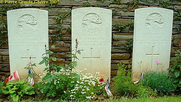
At Y Ravine we pass Y Ravine Cemetery , containing 366 burials, mainly Newfoundlanders, killed near this spot on the 1st of July.
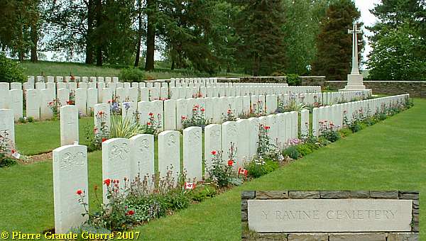
"Y" Ravine runs East and West about 800 metres South of the village, from "Station Road" to the front line of July 1916. It was a deep ravine with steep sides, lined with dug-outs, with extending two short arms at the West end. The village of Beaumont-Hamel was attacked and reached on 1 July, 1916, by units of the 29th Division (which included the Royal Newfoundland Regiment), but it could not be held. It was attacked again and captured, with the Ravine, by the 51st (Highland) Division on 13 November 1916. The Newfoundland Memorial Park, and the 29th and 51st Divisional Memorials within it, commemorate these engagements, and "Y" Ravine Cemetery is within the Park. The village was later "adopted", with three others in the Somme, by the City of Winchester. The cemetery was made by the V Corps in the spring of 1917, when these battlefields were cleared. It was called originally "Y" Ravine Cemetery No.1. No.2 cemetery was concentrated after the Armistice into Ancre British Cemetery, Beaumont-Hamel. There are now over 400, 1914-18 war casualties commemorated in this site. Of these, over a third are unidentified and special memorials are erected to 53 soldiers (or sailors or Marines) from the United Kingdom and eight from Newfoundland, known or believed to be buried among them. The cemetery covers an area of 1,166 square metres and is enclosed by a rubble wall.
Source:
Commonwealth War Graves Commission
The Caribou, emblem of the Newfoundland Regiment, "crowns" the tombstones.
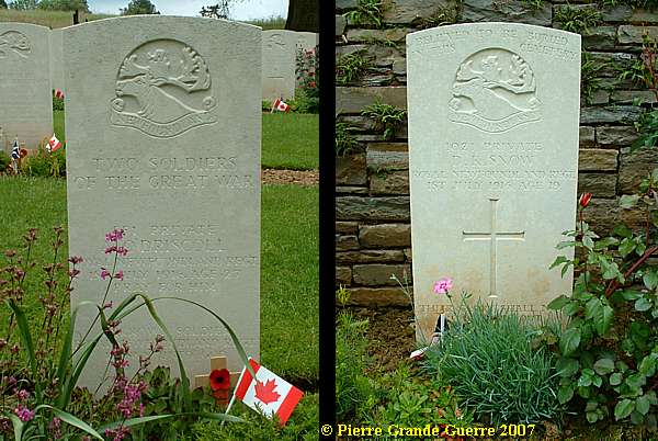
Like on Maple Copse Cemetery , Flanders, again: "BELIEVED TO BE BURIED IN THIS CEMETERY"
A view from Y Ravine over the battlefield in the direction of the Caribou statue.
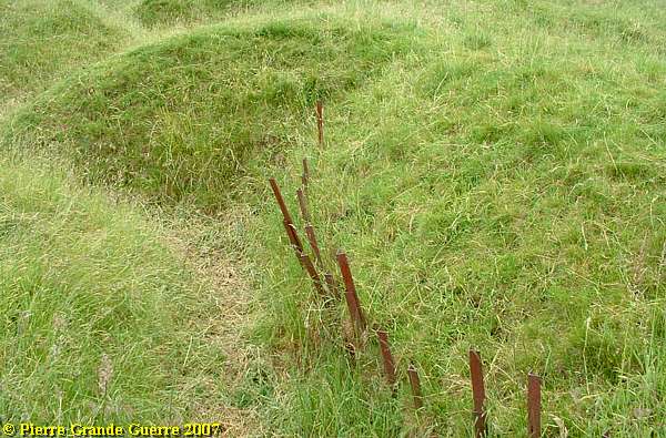
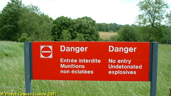
Some locations in Y Ravine are closed off by electric wire for obvious reasons.
Some 150 meters from Y Ravine Cemetery stands the proud Highlander of the 51st Highland Division, ...
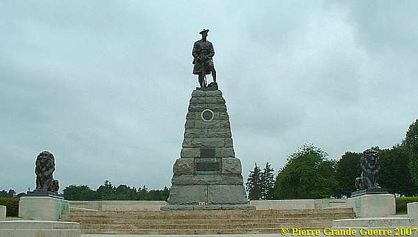
... commemorating the heroic actions of the Division, who captured Beaumont Hamel and Y Ravine on 13 November 1916, together with the 63rd Royal Naval Division, four and a half months later!

Passing the trenches we arrive at the close by ...
... Hunter's Cemetery.
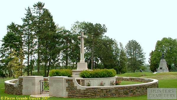
Beaumont-Hamel was attacked in vain on the 1st July, 1916, and captured by the 51st (Highland) and 63rd (Royal Naval) Divisions on the following 13th November. Hunter's Cemetery (the origin of the name may refer to a Chaplain attached to the Black Watch, the Rev. Hunter) is, in fact, a great shell-hole, in which soldiers of the 51st Division, who fell in the capture of Beaumont-Hamel, were buried after the battle. There are now over 40, 1914-18 war casualties commemorated in this site.
Source:
Commonwealth War Graves Commission
Even more nearby Hunter's Cemetery, ...
... is the Hawthorn Ridge Cemetery No. 2.
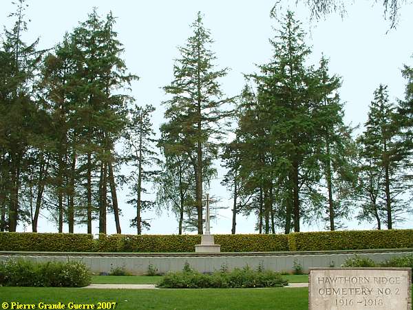
Hawthorn Ridge Cemetery No.2 is 460 metres South of No.1. (
Near the Hawthorn Crater P.G.G. ) It was made by the V Corps (as V Corps Cemetery No.12) in the spring of 1917, and seven isolated graves were brought in after the Armistice. There are now over 200, 1914-18 war casualties commemorated in this site. Of these, over 50 are unidentified. The great majority fell on the 1st July, 1916. The cemetery covers an area of 1,019 square metres and it is enclosed by a low stone rubble wall.
Source
: Commonwealth War Graves Commission
From the German trenches at Y Ravine ...
... I lead you back uphill ...

... through some British trenches, ...
... to the Monument for General Hunter-Weston's 29th Division near the entrance.
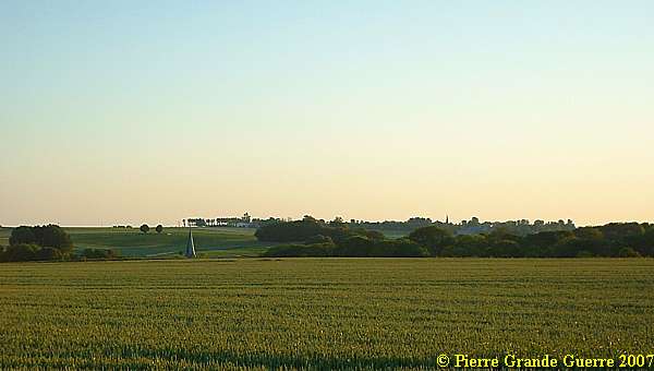
With this last view from Redan Ridge to Hawthorn Ridge and the Newfoundland Memorial Park, we went on further to the north, to the battlefield around the village of Serre.
Continue to the next page: " Serre - Hébuterne "


