
St. MIHIEL SALIENT - Les Eparges Ridge
Years of visit: 2005, 2006

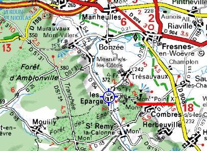
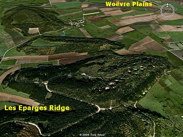
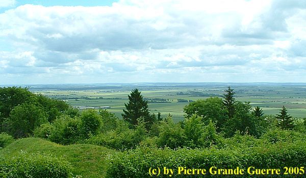
A photo report of two visits to the Crête des Eparges. Les Eparges Ridge is the most north-western point of the St. Mihiel Salient. The ridge overlooks the plain of Woëvre, towards Verdun in the north-east. We approach the ridge from a side road of the D 15. We will visit the infamous Point X, the memorial for the French 106th and 132nd Infantry Regiments, 1915 mine craters and a German dressing station bunker.
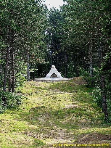
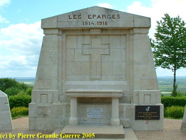
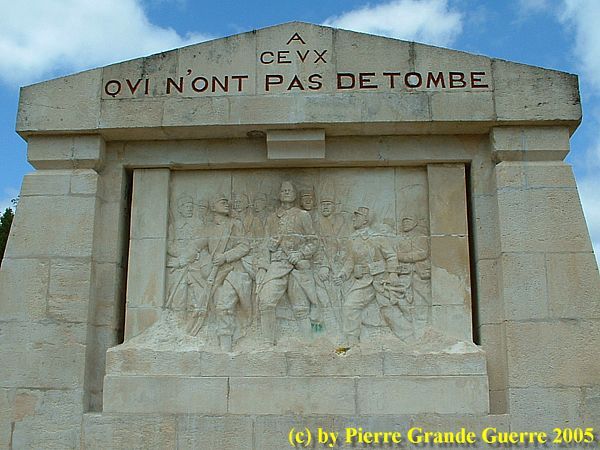
Ascending the ridge we pass the Memorial for the French 106th and 132nd Infantry Regiments.
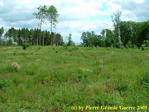
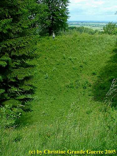
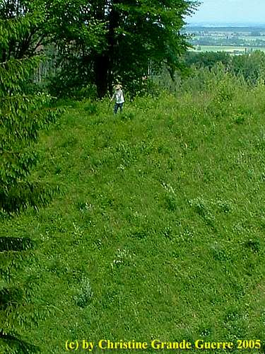
The battlefield on top of Les Eparges Ridge shows many shell holes.
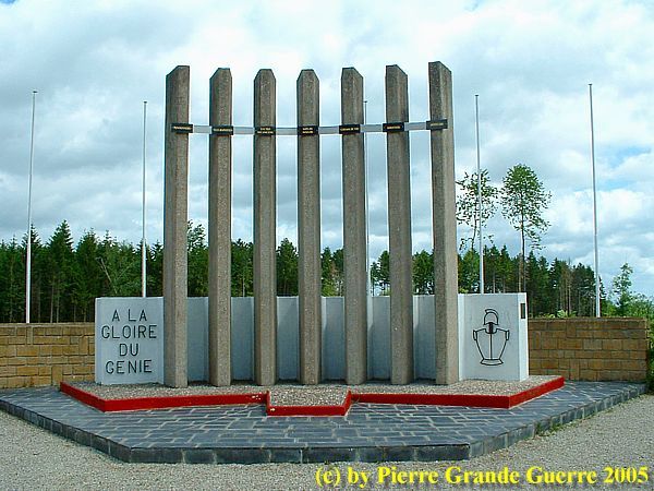
Memorial for the French Engineers (" Génie" ) on Les Eparges, whose units were involved in the mine warfare here.
Before we continue some historical background information about the
Saint
Mihiel Salient
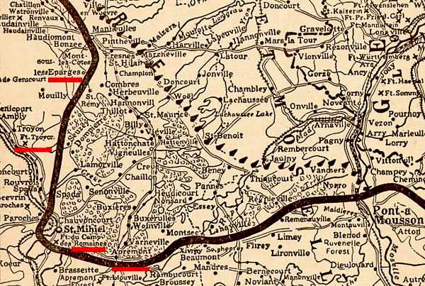
In September 1914 the Germans tried to capture Verdun from the south side. On 22 September 1914, the Germans occupied all ridges dominating the Plain of Woëvre . The city of St. Mihiel would fall only 3 days later, on the 25th. And so the Germans created the Saint Mihiel Salient .
The frontline went from Les Eparges , St. Mihiel , Apremont , to the Bois le Prêtre on the west bank of the Moselle and north of Pont-a- Mousson on the east bank.
The Salient would never be recaptured until 13 September 1918. As you can read in my Photo Impression of the Butte de Montsec , American troops made a big difference during this last Franco-American offensive .
Before the definite capture of the salient in 1918, the French Army tried to retake the salient many times !
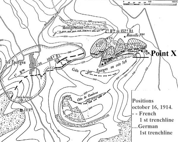
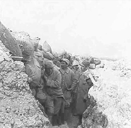
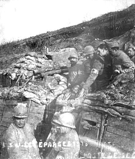
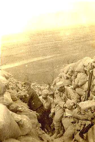
On the summit of the ridge we visit Point X .
From 5 until 9 April 1915 the French 12e Division d'Infanterie, more specifically units of the 106e Régiment d'Infanterie and the 132e R.I., tried to recapture Point X, the highest point of Hill 346. It was the final combat after many other attempts since February 1915 to capture Point X.
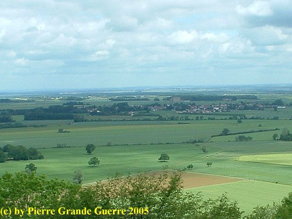
Point X overseeing the Plain of Wöevre in the direction of Verdun Tavannes .

The Battles of Les Eparges Ridge and Point X
Since September 1914
the Germans occupied the larger halve of Les Eparges Ridge, only 1,4 km in length, including Point X. Point X was an ideal observation point for artillery, overseeing the plain of Wöevre in the direction of Verdun Tavanne
s
.
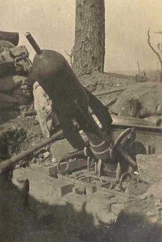
Mine Warfare
The French Génie were digging saps and tunneling underground for months to position huge amounts of explosives under the German positions.
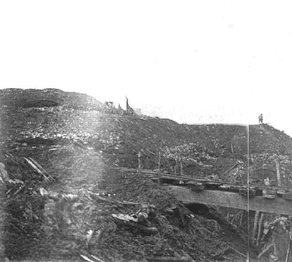
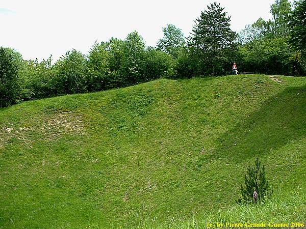
On 17 February 1915, the French detonated 4 mines on Hill 346 causing craters of more than 30 meters deep. The explosions of these mines formed the start of an offensive of 3 days trying to recapture les Eparges Ridge.
This attack is immediately followed by heavy German counter-attacks, resulting in 1,600 French casualties.
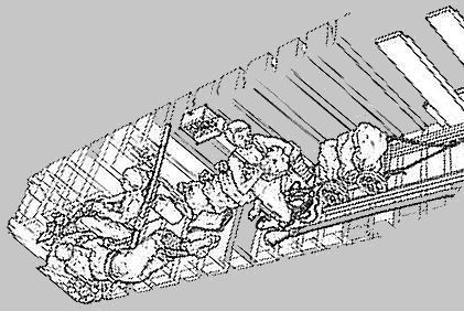
The French author, Maurice Genevoix , served as a Sous-Lieutenant in the 106e R.I. He wrote an eye witness story of his presence at these battles of February 1915 in his book "Ceux de 14", Those Men of 14.
March 1915 - General Herr deploys new attacks
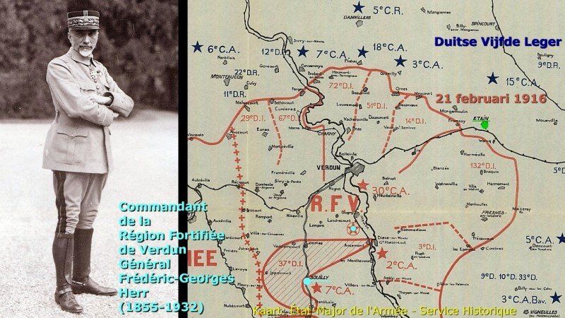
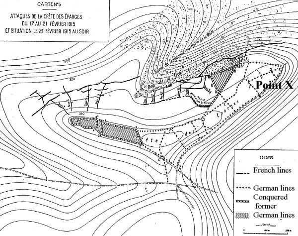
On 17 March 1915 General Herr, commander of the 6e Corps d’ Armée, ordered his 12e D.I. to attack again. More than 100 guns are involved in 45-minute artillery preparation. The assault troops are the 1st and 2nd battalions of 132e R.I., the 3rd battalion is in support of the 1st. The reserves are formed by 6 companies of the 54th R.I. At 16 hours, the French troops launch their attack and approach the defensive sector called point C, the main objective of the assault, but the are not able to occupy the zone. This assault allows just the capture of 350 meters of trenches, but Point X is still being located 100 meters from the new French lines.
Om 27 March General Herr orders the execution of a new attack by the 12th D.I., this time re-inforced by a Battalion of Chasseurs again with no result.
From 5 to 9 April 1915, a new series of attacks was launched on the ridge of Les Eparges during the French offensive in the Woëvre Plain. The 12e D.I. was again engaged to take the summit. The 106e R.I. had to capture Point C in the middle of the ridge while the 132e R.I. had to attack the eastern part of the ridge and take Point X.
At 4 pm, after a 30-minute artillery preparation, the infantry attack started. The 106e R.I. succeeded in capturing its objectives, the 132e R.I. is blocked by the violence of the German fire. Some French sections are forced to break off the fight; the mud rendered their weapons out of service.
On 6 April, the 67e Infantry Regiment attacked with a battalion of the 132e R.I., but the attack was stopped by German machine guns. During the day the Germans counter-attacked and took back all the ground lost on April 5 during hand-to-hand combats. From 3 pm, the French artillery launched a barrage. A general attack of the French troops made it possible to take again Point C, but it is blocked at the extreme east of the butte of Les Eparges at Point X.
On 7 April, four German battalions attack the 106e R.I. and 132e R.I. These two regiments are not supported by the French artillery and must abandon the ground captured the day before. In the afternoon, the German advance is contained, but French counterattacks fail.
On 8 April, the 8e R.I. is sent in support of the 12e D.I. This regiment participates in several night attacks which are immediately stopped by the Germans who repel all these assaults.
On 9 April 9, the ridge line was bombarded by the French artillery, and the 106e R.I. and the 25e Battaillon Chasseurs Alpins supported by the 132e R.I. captured definitively Point C and the line of crest. The 8e R.I. attacked Point X, but after very violent fighting the Germans remained in possession of Point X and the southern slope of the hill. To all these deadly fights the 166th R.I. was also involved.
After three months of extreme fighting for the infantry of both parties, in the mud, under the incessant shelling of artillery on both sides, the French possessed, under precarious conditions, most of the Ridge of the Eparges except Point X. It was impossible for them to establish posts for the artillery, the original purpose of the battle.
Casualties
For both sides each these fights cost about 12,000 casualties (killed, wounded and disappeared), for almost zero results. Fighting in this region turned into a mine warfare until April 1917, creating more mine craters on the ridge as we will later see. During this period, 46 German mines and 32 French mines exploded on a front length of 800 meters without changing the front line.
From Point X we walk to some of the mine craters.
On 17 February, 1915, the French detonated 4 mines on Hill 346 causing craters of more than 30 metres deep. My late wife, Chris ( + 08-05-2018), made this photo: me on the lip of one of the 4 huge mine craters, just to show you the size of it.
As we walk towards the former lines we cross this huge mine crater, lying behind …
... the “ Monument du Cocq ”, the Memorial of the French Cockerel.
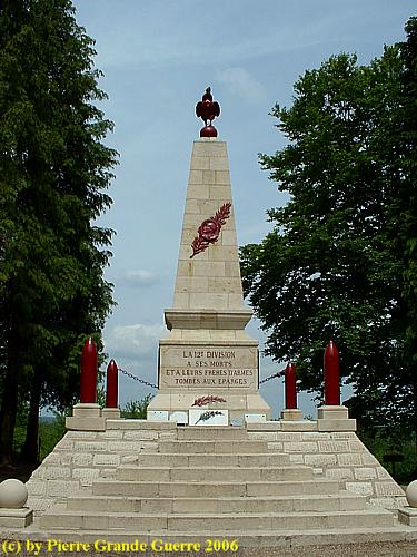
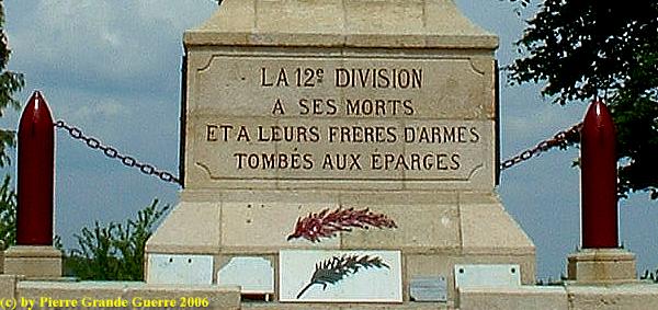
The monument commemorates the 12e Division d' Infanterie.
Amidst traces of shell holes and trenches we descend from the memorial downward …
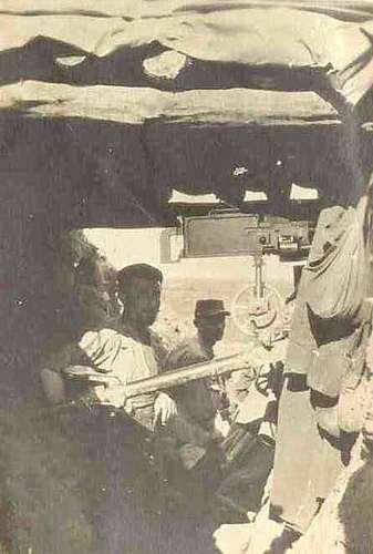
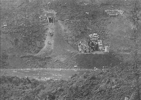
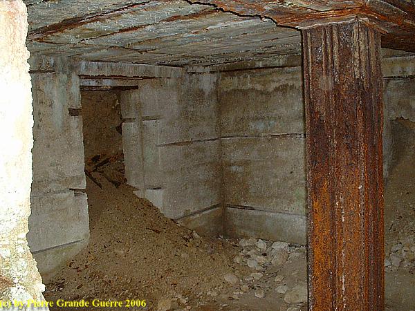
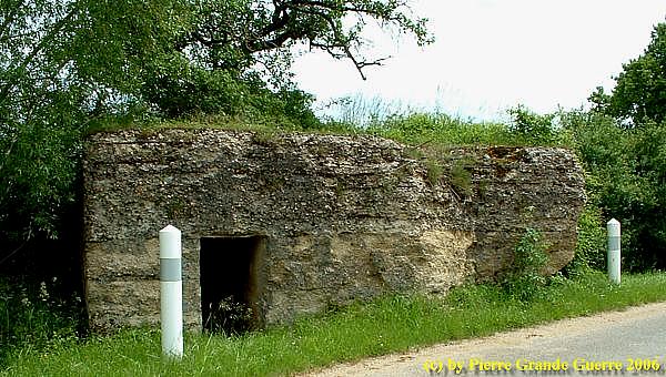
… to this German dressing station bunker, constructed during the winter of 1914-1915.
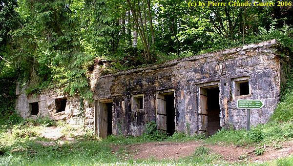
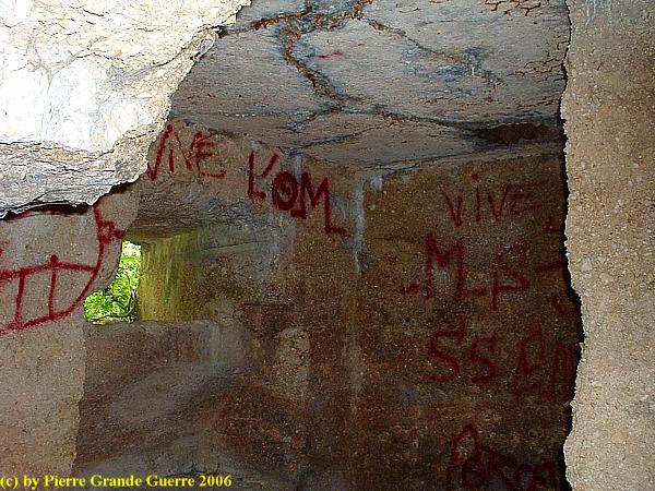
The interior of the bunker, which used to have 3 floors.
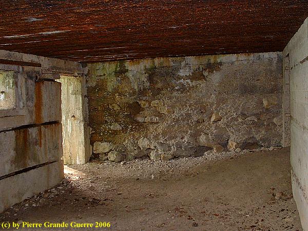
The tunnelled corridors into the underground of the ridge are now filled in.
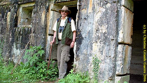
A sign near the bunker calls this bunker wrongly : "L 'Abri du Kronprinz" , the shelter of the Crown Prince.
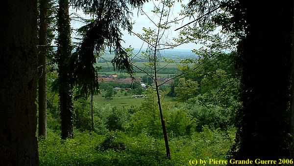
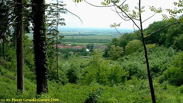
With my back to the bunker I look to this marvellous view of the Woëvre plain and the village of Combres-sous-les-Côtes.
In the valley, south of les Eparges, along the D 113, we discover this German machine gun bunker.
The interior of the bunker.
We continue
our trip through the St. Mihiel Salient to the Fort de Troyon.
Continue
to: " Fort de Troyon
"


