
ARTOIS - Aubers 1915
Year of visit: 2005, 2006, 2010, 2014
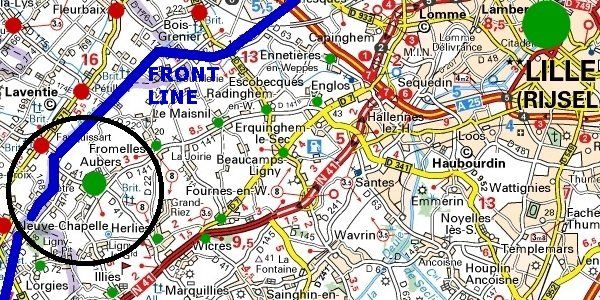
Our route focuses on 11 German bunkers out of many others in the German “ Wick ” Salient in and around the village of Aubers. In an illustrated frame I will briefly explain the Battle of Aubers Ridge of 9 May 1915. Since the fate of the villages of Aubers and Fromelles were inseparable during the Great War, I also recommend you for a complete picture of Aubers Ridge to visit later the follow-up Photo Impression of Fromelles , focusing on the Battle of Fromelles of 1916.
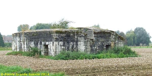
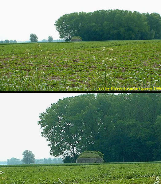
We start on the outskirts of the village of Aubers on the junction of the D 41 and the Rue de Plouich. On the east side of the road we find this observation post in the shape of a farmhouse.
These are relics of bunkers of the 3rd German defence line.
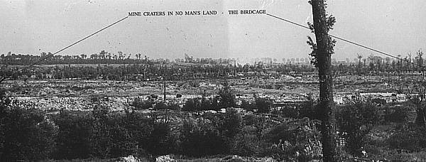
There used to be some 700 German bunkers around Aubers Ridge : many machine-gun pillboxes , shelters, observations posts , communication bunkers, dressing stations and command posts.
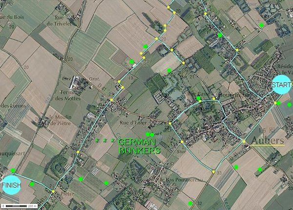
We continue southward
and go right to enter the village centre
via the Rue Houdringue to 37, Rue Basse. Keep the maximum speed
limit of 30 km. or rather less,
or you will pass this bunker, before you know it.
On the
right
side of the
street
, you
will
find
the
relics
of this
observation
post, set back from
the
street
in someone’s
backyard.
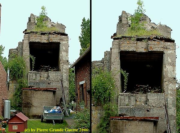
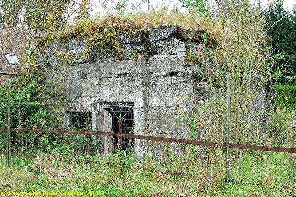
The Kaiser Bunker
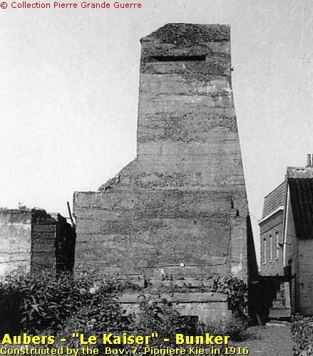
| The engineers of the Bavarian 7th Pioniere Kompanie constructed this concrete observation tower in 1916. The inhabitants of Aubers nicknamed this bunker “Le Kaiser”. Legend has it that the Kaiser himself or Kronprinz Wilhelm (“Little Willie”) visited this bunker. Hence this nickname , “Le Kaiser”. |
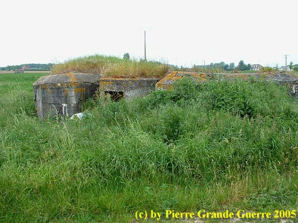
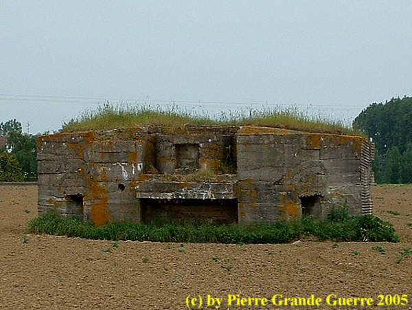
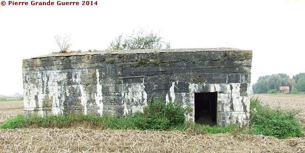
From the village we continue southward to return to the D 41. We turn left and continue northward until the Rue de Leval. On the east side of the road stands, among others , this multi-purpose bunker.
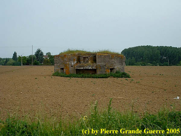
The Bavarian Reserve- Pioniere Kompanie 81 constructed the bunker in 1916. The two rooms on ground level served to shelter soldiers. There are holes in the top construction for observation. The 2nd level construction was meant to mount a machine-gun, a " Maschinengewehrstand ".
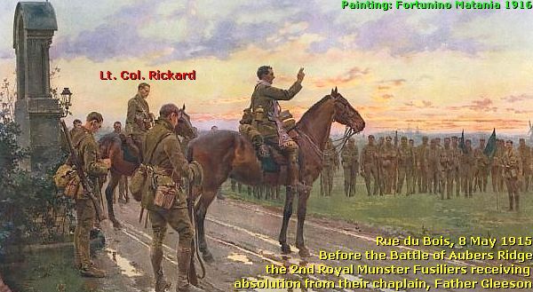
Before we continue our route, I shall briefly explain in the frame below the Battle of Aubers Ridge of 9 May 1915.
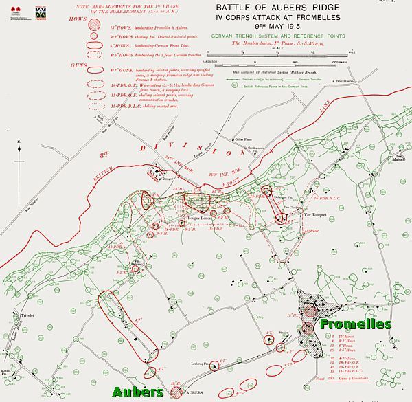
The Battle of Aubers Ridge - 9 May - 1915
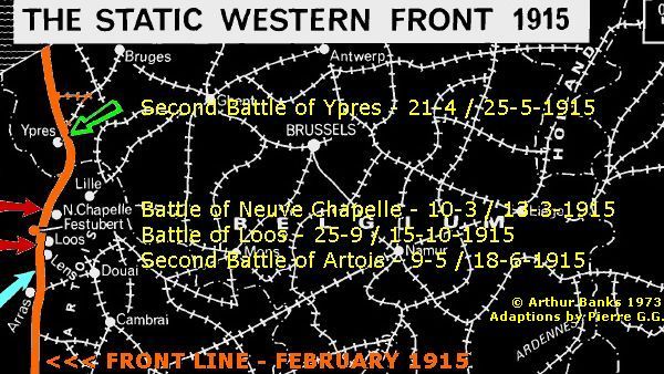
The Battle of Aubers Ridge was a one day British offensive on the Western Front on 9 May 1915. The battle was part of the British contribution to the Second Battle of Artois, from 9 May to 18 June 1915. During the Great War there were three Battles of Artois.
The Second Battle of Artois
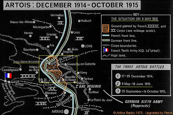
During the Second Battle of Artois five Army Corps of the 10th Army of Général d'Urbal launched an offensive at Notre Dame de Lorette and Vimy Ridge . Crown Prince Rupprecht Von Bayern's 6th Army defended this front sector.
The French Commander-in-Chief, Général Joffre , requested support for his Artois offensive from British units under General Sir John French , Commander of the British Expeditionary Force.
The Battle of Aubers Ridge , 9 May - 1915
The German defence
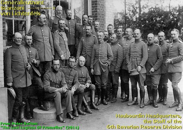
Since 26 December 1914 Generalleutnant Gustav Scanzoni von Lichtenfels commanded the 6th Bavarian Reserve Division , which comprised the 12. Bayerische Reserve Infanterie Brigade (12. B.R.I.B.), (Bayerische Reserve Infanterie Regiment 16 and B.R.I.R. 17), and next the 14. Bayerische Reserve Infanterie Brigade (B.R.I.R. 20 and B.R.I.R. 21).
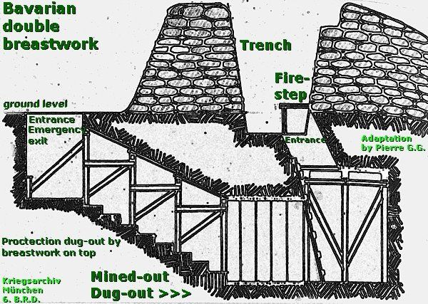
After the Battle of Neuve Chapelle t he units of the 6th Bavarian Reserve Division were constantly busy to improve their positions with mined -out dug-outs in the lower parts of the landscape and reinforcing the houses of the villages on the hills .
The barbed wire entanglements were doubled , sometimes tripled . The Bavarians extended the first defence line of ground level breastworks with sentry-posts .
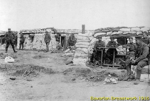
The first defence line formed also the accommodation for the main garrison , which was to move forward during an attack to hold the front line at all costs . The network of breastworks was extended with traverses and a “ parados ” (a bank of earth behind the trench to provide rear protection ).
Each battalion owned at least two machine- guns , which were positioned in emplacements at ground level, ready to sweep No Man's Land from flanking positions . About 700–1,000 m. behind the first line of breastworks the Bavarians built a line of concrete machine-gun posts , known as “ Stützpunkte “ .
Each Stutzpunkt was some 1,000 m. away from the other . In case an attack broke through the first line, the Stutzpünkte also served as rallying points for the infantry .
Some 200 m. behind the first line the Bavarians constructed a second line of breastworks , the “ Wohngraben “. The Wohngraben had underground dug-outs to accommodate some 20–30 men. It was connected to the first line by communication trenches . Close to the front the communication trenches were solidly built with concrete shelters. These communication trenches were also used as flanking trenches in the event of a breakthrough .
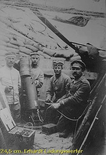
Some 2.5 – 4 km. behind the first line the Bavarians positioned on Aubers Ridge 12 four -gun field batteries and several heavy batteries , including ten heavy mortars , " Ladungswerfer ". A second line of gun positions lay about 2.5 km. behind the forward battery positions . ( See also my Illies Photo Impression ).
The British Battle Order and Objective
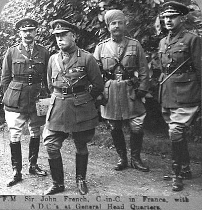
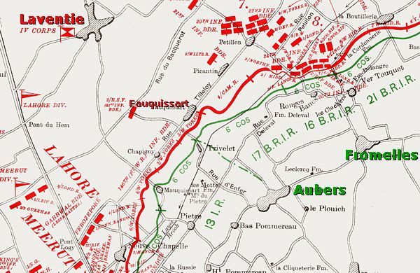
Général Joffre and General Sir John French decided that the British forces would attack the Germans from the villages of Richebourg , Laventie and Fleurbaix .
General French would deploy the following units: From I Corps; the 1st Division and 47th (1/2nd London) Division . From IV Corps; the 7th Division and 8th Division . From the Indian Corps; the 3rd (Lahore) Division and 7th ( Meerut ) Division .
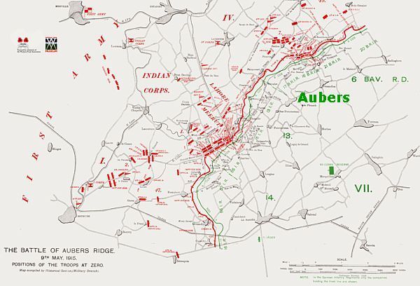
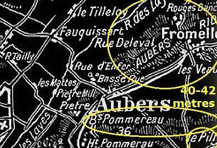
Their objective in the flat and poorly drained terrain were the heights of Aubers Ridge (40-42 m.), marked by the villages of Aubers , Fromelles and Le Maisnil .
The British attacked this same area two months earlier during the Battle of Neuve Chapelle. During this 9 May 1915 battle the units of the Indian Corps played again an important role near Neuve Chapelle.
1st Wing Royal Flying Corps
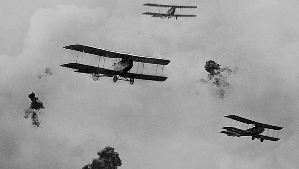
Four days before the attack, three squadrons of 1st Wing Royal Flying Corps were attached to the First Army of General French to fly defensive patrols and to deter enemy reconnaissance . During the attack the squadrons were to conduct artillery observation and reconnaissance sorties. The squadrons were meant also to bomb enemy rear areas , railway junctions and bridges .
Royal Engineers Tunnelling Companies
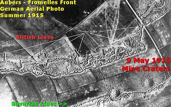
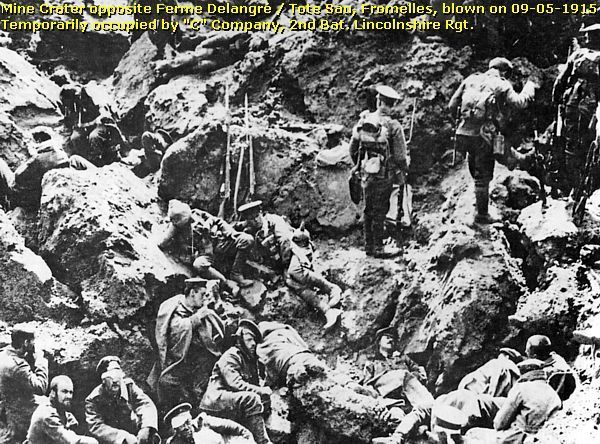
The battle involved the deployment of Royal Engineers Tunnelling Companies, who tunnelled under No Man's Land to position two mines under the German defences to be blown at zero hour , precisely 40 minutes after 5 o'clock in the morning .
Before the battle started , General French did not possess sufficient intelligence about the recently reinforced German positions . Some historians state that French neglected the bits of available intelligence.
Preliminary Artillery Bombardment
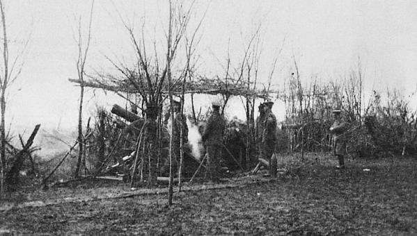
The British preliminary bombardment started at 5.00 a.m. The duration of only 40 minutes and the weight of the bombardment were completely insufficient to destroy the German wire and breastwork defences . Because of the ammunition shortage after Neuve Chapelle, which caused the “ Shell Crisis ”, the British artillery equipment and ammunition were still in poor condition : they failed to destroy the first line machine- guns . German artillery and free movement of reserves were not hindered by the artillery .
Infantry Attack
After this short bombardment the British launched on 9 May 1915 their pincer infantry attack on Neuve Chapelle, Aubers , Fromelles and le Maisnil .
Although surprise was intended by such a short bombardment , none was achieved during the infantry attack. A complicated trench lay-out and traffic jams at jump -off points behind the British front line impeded easy movement of reinforcements and the transport of wounded men. British rifle ammunition was in poor condition , a result of faulty manufacture .
During the advance and the combats it had become impossible for the soldiers to see where the other British troops were on the battlefield . Accurate close-support artillery fire was impossible . The German machine-gun fire and the field artillery caused much confusion among the British troops . Enfilading machine-gun fire mowed down the British at knee height over the wide No Man’s Land along the Layes brook ; there were many victims , dead or badly wounded .
Casualties
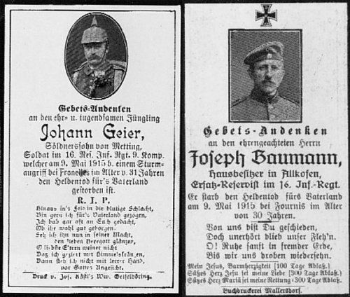
At the end of the day this battle was a complete disaster for the British army ! There was no ground won at all and no tactical advantage gained ! Historians estimate that the British counted 11,619 casualties (dead, wounded , M.I.A., P.O.W.) . The Bavarian opponents counted only 902 casualties !
The Aftermath
The Battle of Aubers Ridge did not have any positive effect on the French Second Battle of Artois. On 18 June 1915 the Second Battle of Artois came to an end. The French conquered Notre Dame de Lorette , Ablain St. Nazaire , and Neuville St. Vaast . Souchez and Vimy , including the lower grounds around , would stay in German possession until 9 April 1917.
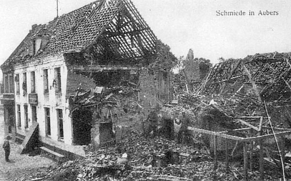
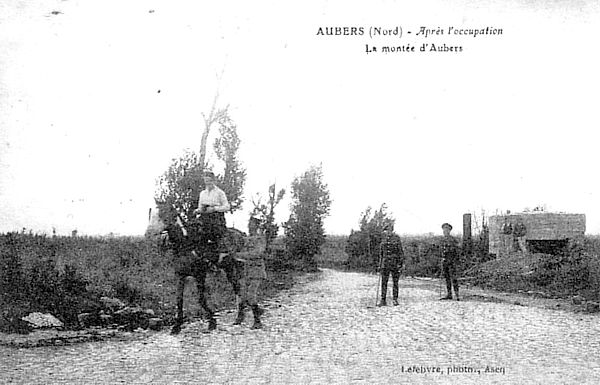
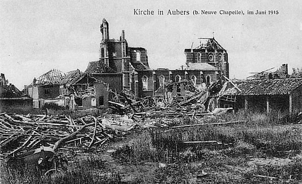
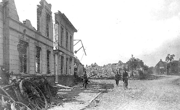
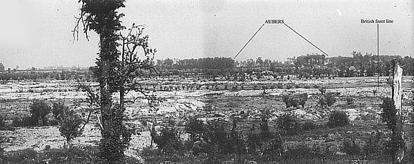
About the German period photos of the ruins of Aubers
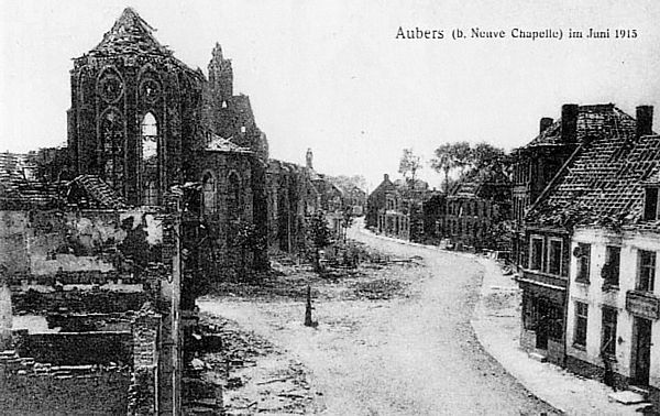
These period images show only rather limited damage to the village in the summer of 1915 and of 1916. But by 1918 the damage had become worse .
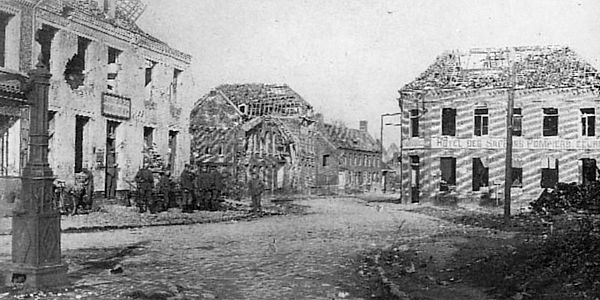
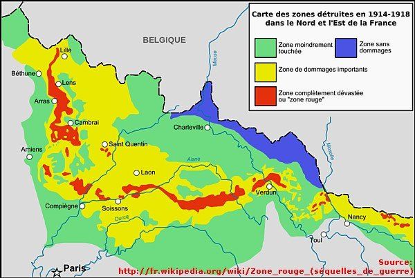
The Bavarian soldiers evacuated the population of Aubers in October 1914. But when the inhabitants returned to Aubers in 1919, they found their village completely destroyed . An April 1919 official report of a French government committee mentions that “ Aubers and Fromelles belong to the “Zone Rouge”. This Red Zone, created by the National Assembly, marked the most affected area of the Western Front: i.e., an area completely destroyed during the war.
Before the residents of Aubers could start rebuilding their village , they had to blow up many of the German bunkers themselves , using the gunpowder of the abundant live artillery ammunition , left on the battlefield . The debris was used for filling the trenches and the reconstruction of the roads . Living for years in temporary barracks, the population of Aubers would take ten years to rebuild their village .
( Source on the fate of Aubers village : Cercle Historique d'Aubers : " Aubers - Visions du Passé")
Other Battles for Aubers Ridge
| After the Battle of Neuve Chapelle and the Battle of Aubers Ridge , Aubers would be also a part of the battlefield during the Battle of Bois- Grenier and Piètre (25 September 1915), a northern attack and component of the Battle of Loos . The next year , in the summer of 1916, these German defence lines and the villages of Aubers and neighbouring Fromelles would be again the centre point of another large British offensive . Later, in the next photo impression , we will focus on the battlefield of Fromelles and the Battle of Fromelles (19-20 July 1916). For the fifth time Aubers would be a part of the battlefield in 1918 during the Battle of the Lys (7-29 April 1918) until its liberation in October 1918. |
From the Rue Basse we make a short detour via the D 141 north-ward, where we turn left into the Rue de Leval.
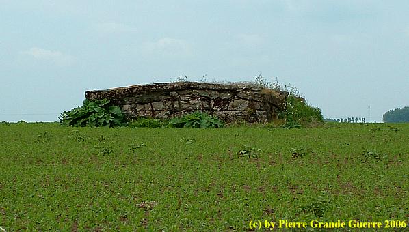
On the left side of the street , in the yard of a “ horticulteur ” at number 81, we find this shelter bunker.
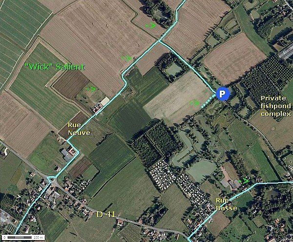
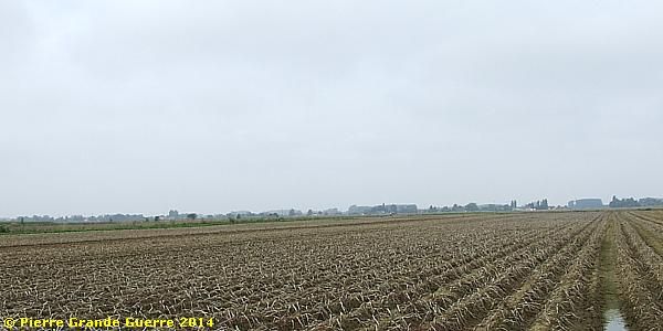
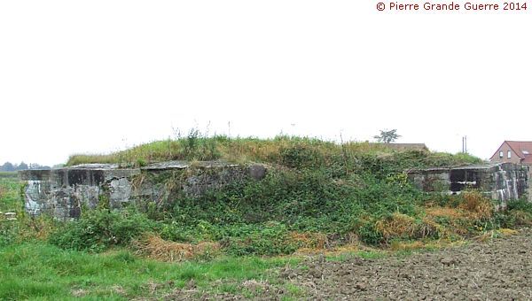
We continue until the street ends in a T- junction. We turn left to the unpaved Rue Neuve and after some 400 m. we follow an unpaved dead-end road south-eastward.
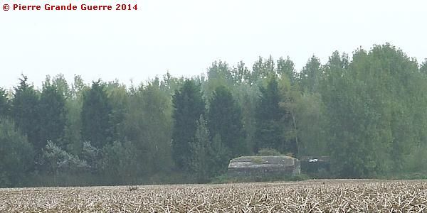
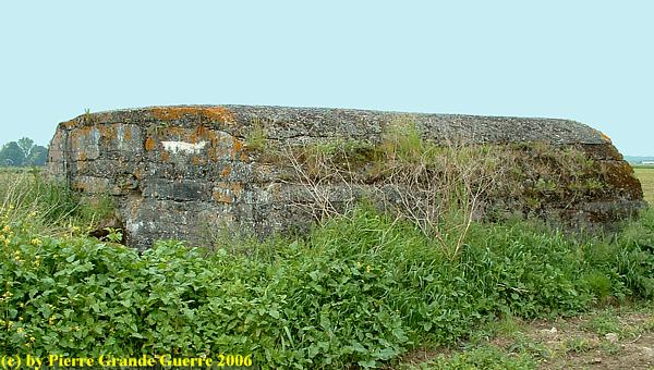
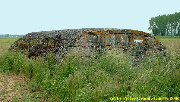
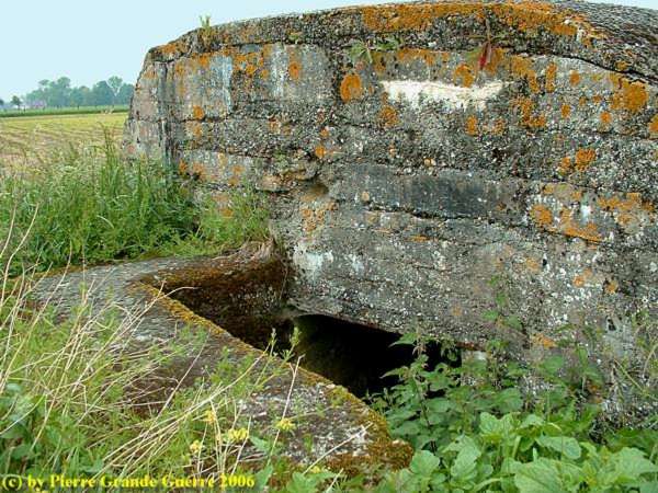
We stop on the parking of a private fish pond complex. On foot we proceed to a large “ Kaserne ”-bunker in the field.
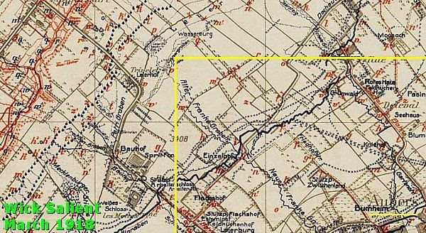
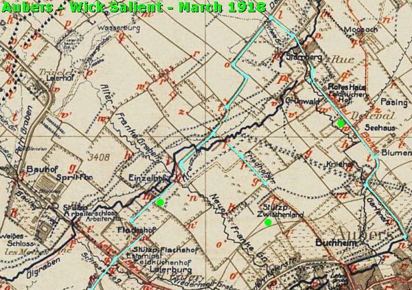
We are now in the former “ Wick ” Salient.
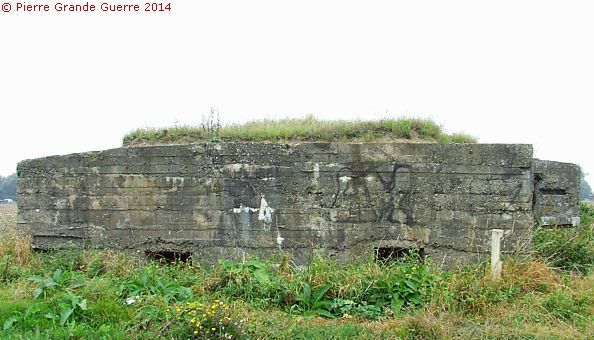
" Stützpunkt Zwischenland "
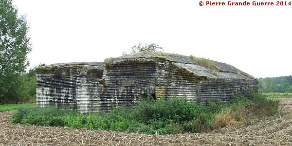
The site of this bunker offers a panorama westward to the former front line.
From the fish pond parking we return to the T- junction of the unpaved road of the Rue Neuve to continue our route southward.
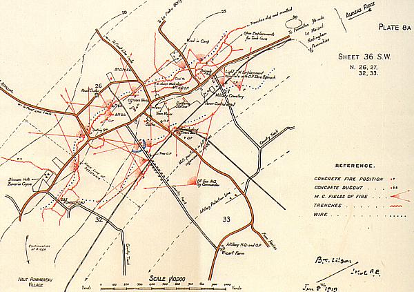
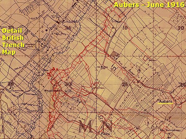
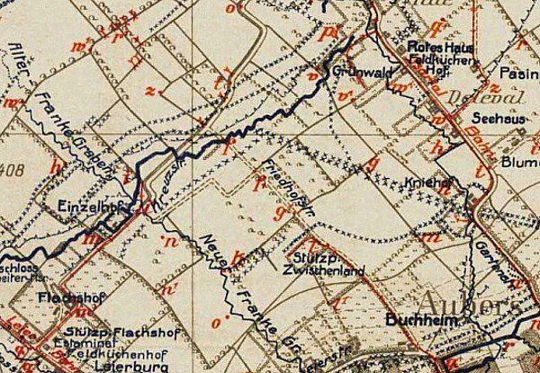
Aubers 1918
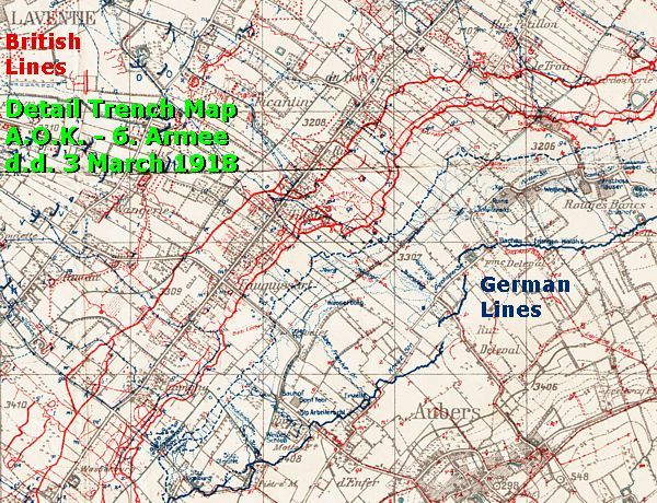
Of course nowadays we see only the relics of the front line in the situation of 1918, after the Germans left , and after the post-war operations of Chinese labourers clearing and cleaning the battlefield . This detail of a 1918 Trench Map of the “ Armee OberKommando ” of the 6th Army is one of the last situation maps of the Aubers front sector, and it covers the same area, which we are visiting now .
For photographing these 2 next bunkers, belonging to the stronghold of " Stützpunkt Einzelhof ", I asked the permission of Monsieur Joseph and his family. Of course I am very grateful to the family for allowing me to enter their land.
Many traces of trenches have been found in the courtyard of Monsieur Joseph's farm.
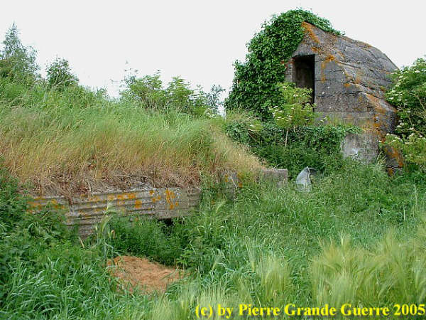
This large shelter bunker is only 50 m. away from Mr. Joseph's farmhouse.
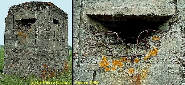
This concrete observation tower is some 30 m. behind the farmhouse. The rear side ...
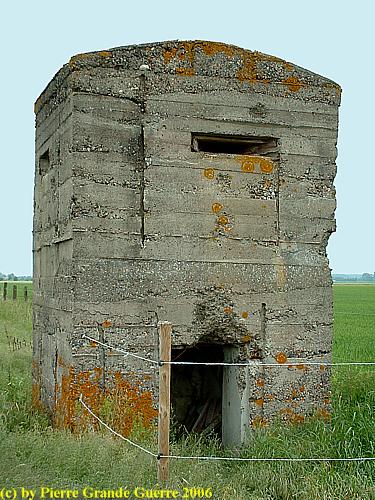
... and the front side of the tower. Notice the shell impact on the peep hole!
After passing the farm of Mr. Joseph, the road is paved again. We continue southward to our last bunker.
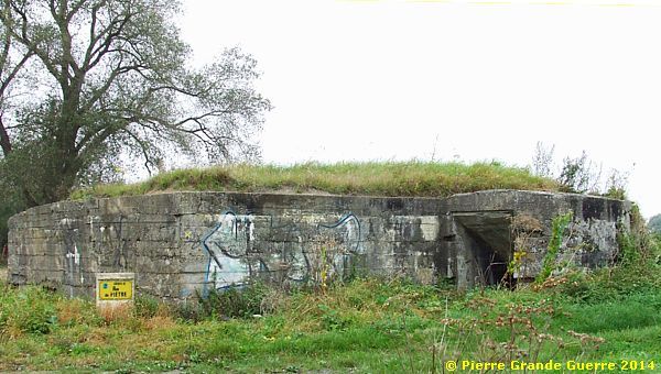
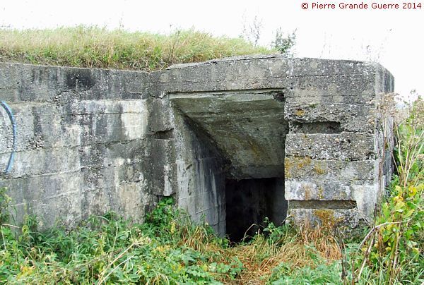
This large shelter bunkers stands along a small bridge over the Layes brook in the Rue de Piètre on the northern outskirts of Neuve Chapelle.
We will continue our exploration of the Aubers Ridge battlefield in the next photo impression about the neighbouring village of Fromelles , focusing on the Battle of Fromelles of 19 July 1916.
Continue to the next chapter : " Fromelles and the Battle of Fromelles - July 1916 ".


