Nord-Pas-de-Calais - CAMBRAI Battlefields
SPECIAL Photo Impression - Year of visit: 2011
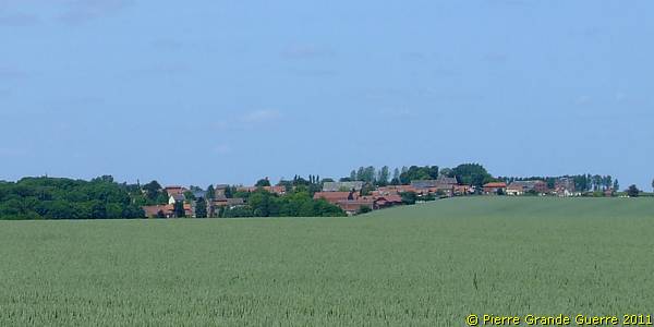
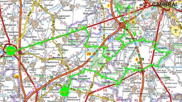
We will visit Bapaume - Beugny - Beaumetz-les-Cambrai - Louverval - Boursies - Hermies - Havrincourt - Trescault - Ribécourt - Flesquières - Bourlon Wood - Marcoing - Masnières - Les-Rues-des-Vignes - La Vacquerie - Villers-Plouich - Gouzeaucourt - Metz-en-Couture - Neuville-Bourjonval - Equancourt.
Though we will never reach the town of Cambrai we make a roundtrip over the 1917 battlefields east of Bapaume and west of Cambrai. We start at Bapaume and we will meander over the former battlefields of 1917 and 1918 to visit 21 locations. On our trip we will visit amongst others Havrincourt, Flesquières and Bourlon Wood. At the Canal de St. Quentin near Masnières we will reach our utter eastern point of our trip to return westward, visiting amongst others Villers-Plouich, Metz-en-Couture, to finish our tour west of Equancourt.
Introduction
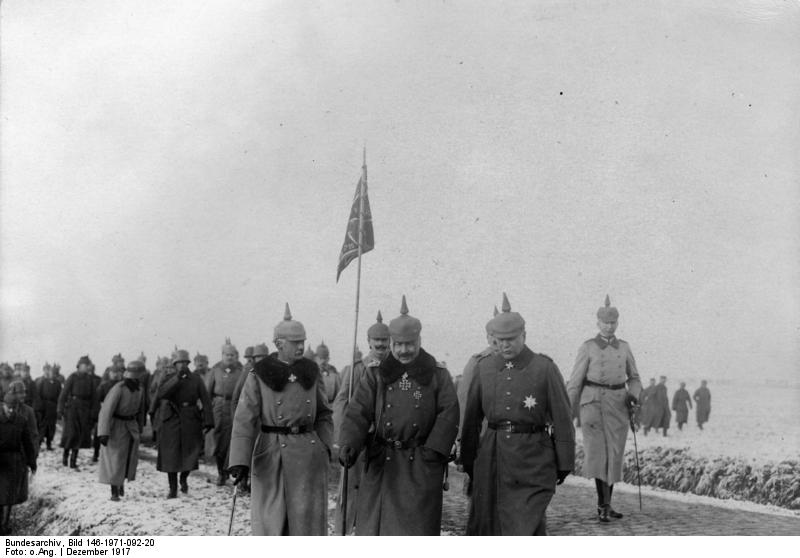
Since the German occupation of 1914 these battlefields in the area south-west of Cambrai knew three great battles. After the German strategic withdrawal on the Hindenburg Line, the Allies started the First Battle of Cambrai (20 November - 3 December 1917), followed by the German Michael Offensive (21 March – 5 April 1918) and later the Second Battle of Cambrai (29 September – 8 October 1918) , as a component of the last Allied Hundred Days Offensive, which started at le Hamel near Villers-Bretonneux at 8 August 1918.
For this reason we will find on our route through this area relics, cemeteries and memorials, all relating to these war periods. Unfortunately for us there is nowadays not much left of the German presence and of the formidable German Hindenburg Line.
Bapaume
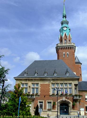
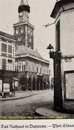
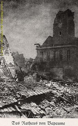
We start our trip at Bapaume with the Town Hall, which was severely damaged and booby-trapped during the German strategic withdrawal on the Hindenburg Line.
In front of the building stands an interesting statue of the French General Faidherbe.
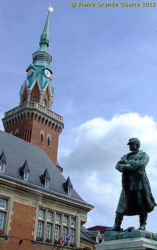
Louis Léon César Faidherbe
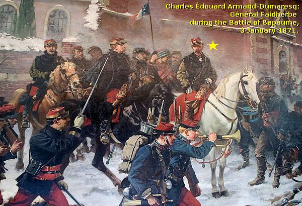
Louis Faidherbe
(1840–1879) was a French General of the Franco-Prussian War (1870-1871), who resisted for one day the German attacks of Edwin Freiherr von Manteuffel during the Battle of Bapaume (3 January 1871).
The Prussian 1st Army had reached Bapaume at the end of December, while at the same time the French Army of the North under Faidherbe moved out to break the German siege of Péronne. Both sides encountered each other near Bapaume. Although Faidherbe's rookie troops held their own against the outnumbered but experienced Prussians, they didn't follow up their advantage and retreated. As a consequence, Péronne surrendered on 10 January 1871.
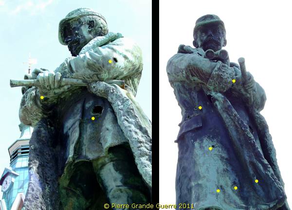
The statue of General Faidherbe has been inaugurated on 27 September 1891. Originally Louis Noel sculpted the statue. During the First World War, on 29 September 1916, the Germans requisitioned the statue for it's bronze. The pedestal, still pitted by shrapnel remained empty for 13 years. It was not until 1926 that the town decided to ask the sculptor Dechin to recreate the statue from the original plans. The new monument was inaugurated on 18 August 1929 by Paul Painlevé, then Minister of War.
Notice on my photo's below that the statue now possesses quite some bullet holes, probably stigmata of the Second World War period.
From the Franco-Prussian War, one of the many causes of the Great War, we return to the facade of the after the war rebuilt Town Hall, which tells us an interesting story about one of the consequences of the retreat of the Germans of 4 February 1917.

The Monument de Briquet et Taillandier commemorates two elected representatives of the National Assembly of France for Pas-de-Calais. On 25 March 1917 they were trapped in the town hall and they were killed by a large explosion.
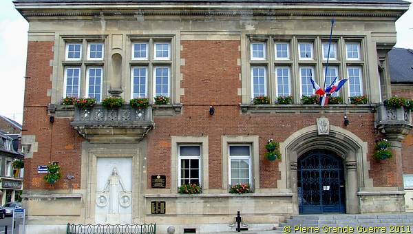
Monument de Briquet et Taillandier
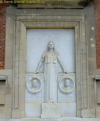
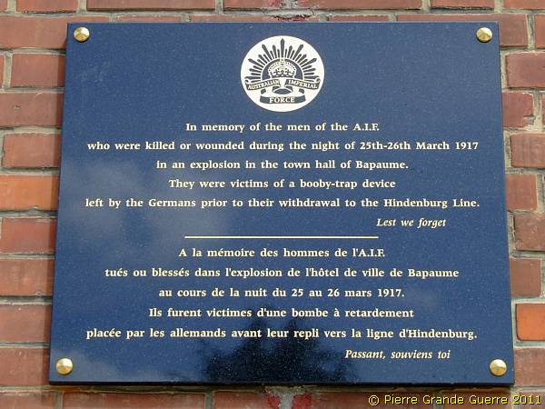
The Monument de Briquet et Taillandier commemorates two elected representatives of Pas-de-Calais: Albert Taillandier (left) and Raoul Briquet (right) . They were both elected representatives of the National Assembly of France for Pas-de-Calais, but of different political views. Albert Taillandier was a Conservative, and Raoul Briquet was a Socialist. On an inspection mission to the front on behalf of the National Assembly, they wanted to spend the night in the building. On 25 March 1917 they were trapped in the town hall and killed by the explosion. Besides them during this explosion 19 Australian soldiers were also killed in the building! (See later on this page).
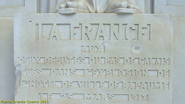
In the intermezzo below I tell more about the backgrounds of these booby-trap explosions.
Operation Alberich - The German Withdrawal on the Hindenburg Line
From 4 February 1917 General Erich Ludendorff ordered the Germans to organise secretly a 4 weeks during operation, called Operation Alberich.
Alberich was an intentional, strategic withdrawal on the Hindenburg Line or Siegfried Stellung, which shortened the German front line with about 40 km.
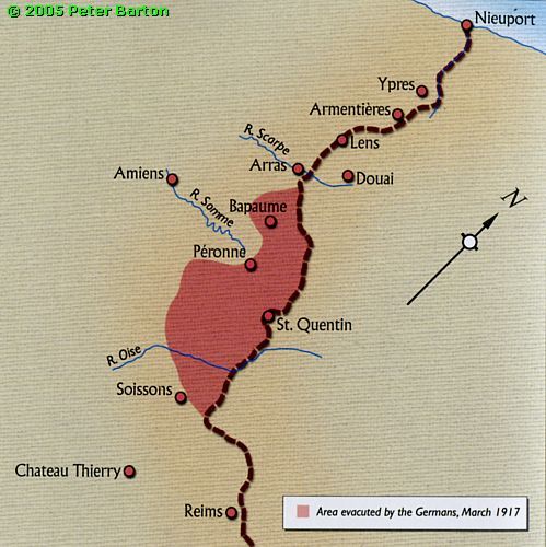
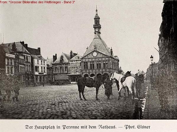
It was 18 days later, on 22 February 1917, that for the first time a patrol of Royal West Kents reported unmanned trenches in front of Miraumont, Somme, 3 days later followed by observations on the spot by daring Australian soldiers near the Butte de Warlencourt, Somme. Operation Alberich meant also that the Germans left their grounds being a completely destroyed wasteland. Before the Germans left the terrain, they destroyed everything of value, as the "Grosser Bilderatlas des Weltkrieges" still proudly mentions in detail in it's edition of 1919:
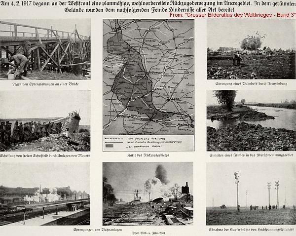
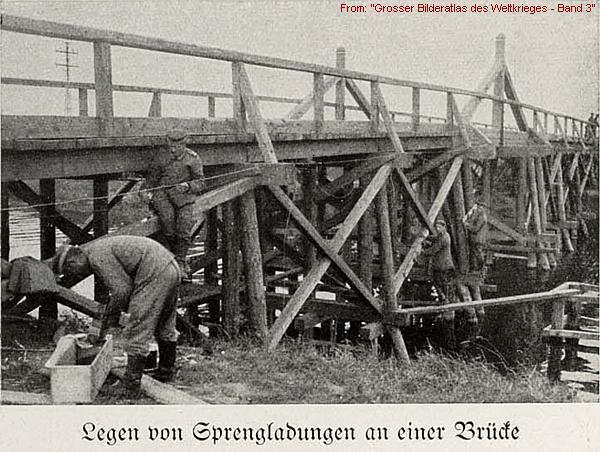
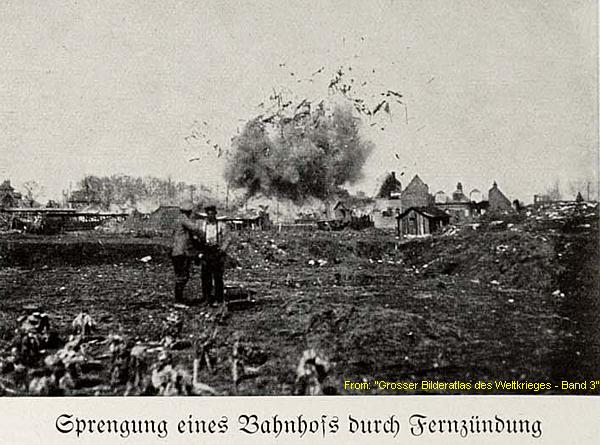
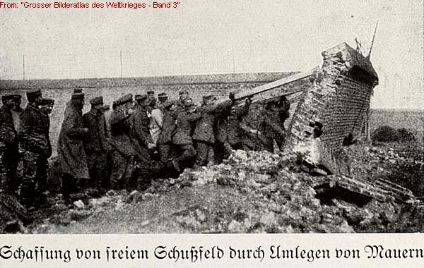
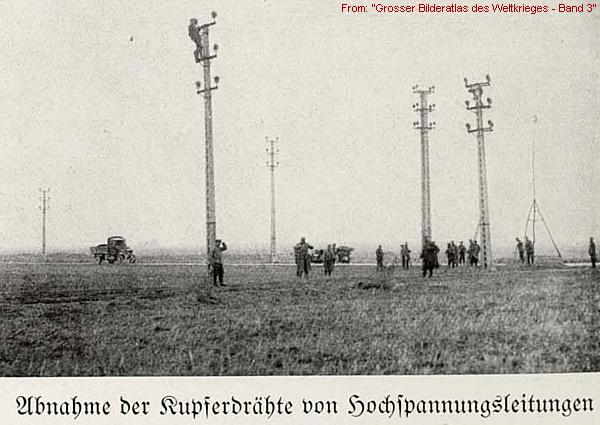
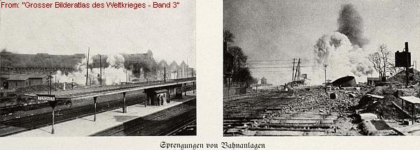
But as this warning summary of the British General Head Quarters shows, the Germans often booby-trapped ruins and buildings, with the following methods:
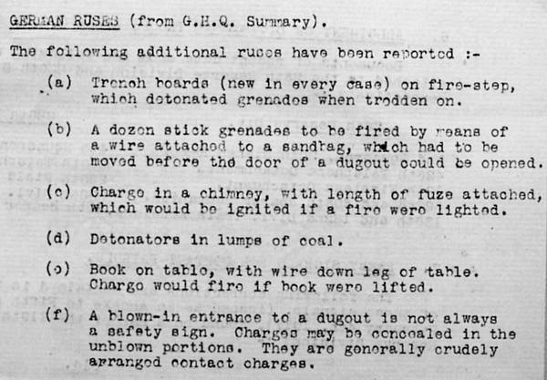
Back to Bapaume, where the Town Hall has been booby-trapped by one of these methods or worse to cause the explosion of 25 March 1917.
Right of the same wall of the Briquet et Taillandier memorial hang two plaques commemorating the 19 Australian soldiers, who were killed in the building during this same explosion.
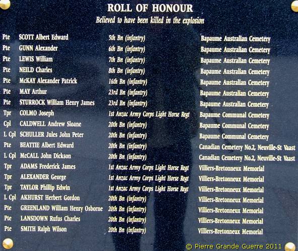
We leave Bapaume and we continue for some 5 km. along the Bapaume-Cambrai road, the D 930, to Beugny .
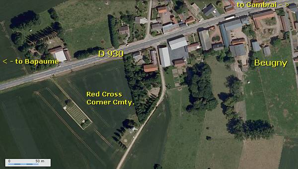
We visit the Red Cross Corner Cemetery of Beugny.
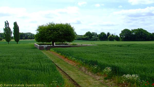
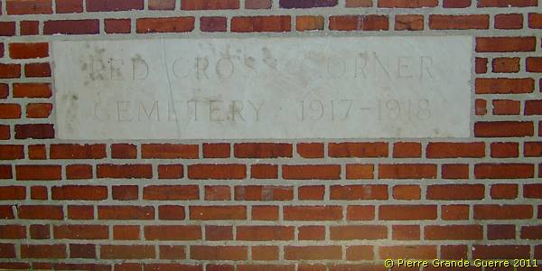
|
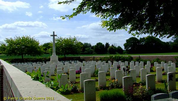
Red Cross Corner Cemetery contains 219 Commonwealth burials and commemorations of the First World War. 12 of the burials are unidentified and one casualty, whose grave was destroyed by shell fire in 1918, is commemorated by a special memorial. The cemetery was designed by W. H. Cowlishaw. Source of all descriptions of the British cemeteries on this web page : Commonwealth War Graves Commission. |
The cemetery lies along an important supply road of the First Battle of Cambrai to the Hindenburg Line.
The Hindenburg Line
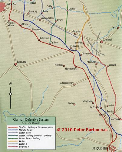
During the winter of 1916–17 the Germans secretly constructed a vast system of defences between Arras and St. Quentin, a “new” frontline, which reduced the length of the front by some 40 km.: the Hindenburg Line or Siegfried Stellung.
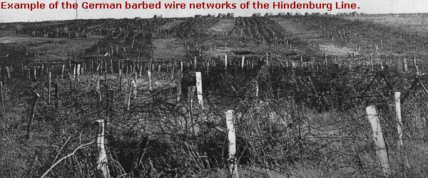
These 3 or sometimes 4 lines of fortifications, partly constructed by Russian P.O.W.’s, consisted of vast belts of barbed wire, ...
... concealed observation posts, rows of deep trenches, ...
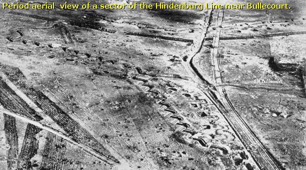
... dug-outs, machine-gun bunkers, concrete shelters, ...
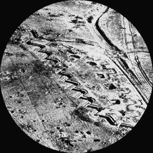
... tunnels for moving troops and underground communication, and command posts.
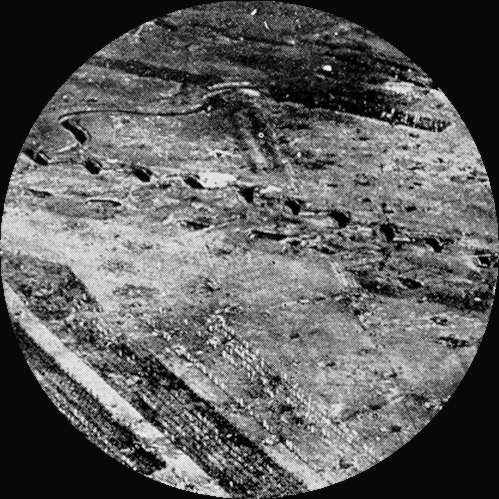
Along the line the ruins of the former villages were altered into fortified strongholds.
At a distance of 1-1,5 km. in front of these fortifications was a thinly-held outpost line, “das Vorpostenfeld”, mutually supporting small posts with light machine-guns. Behind this chain of outposts lay the first line of resistance.
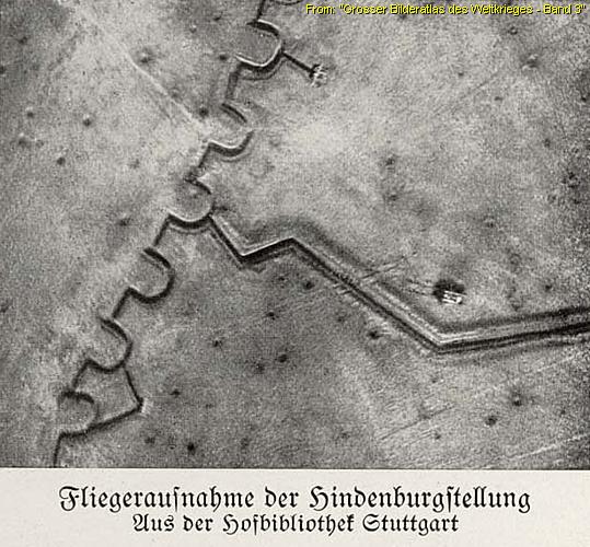
Between the first line and the second line the Germans created a battle zone of about 2-3 km. deep, to deploy mobile, fast counter-attacks against invaders of the first line.
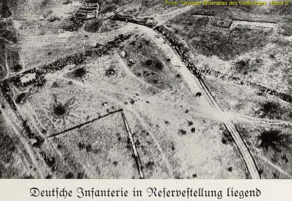
The Hindenburg Line enabled the Germans to keep 13 divisions in reserve and to release these divisions for defensive operations, counter-attacks and offensives. The German High Command believed in 1917 that it's new, formidable line was impregnable.
For our explorations in front of Cambrai we concentrate on a rather small sector of the Hindenburg Line; the Siegfried Stellung, the Monchy Riegel, and Siegfried II, the former "deutschen Stellungen im Cambraibogen".
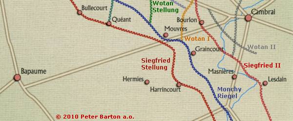
In this sector in front of Cambrai, there are hardly any relics left of the German presence. For interesting German concrete of the Hindenburg Line I would advise you to visit in the near future my Photo Impressions about Aubers Ridge or Illiès-la Bouchaine.
From Beugny we continue westward along the D 930 to the Beaumetz-les-Cambrai Military Cemetery No.1
.
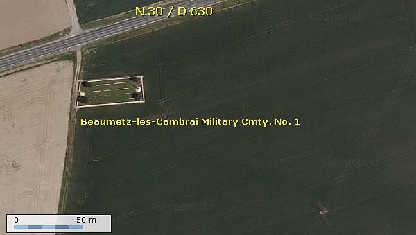
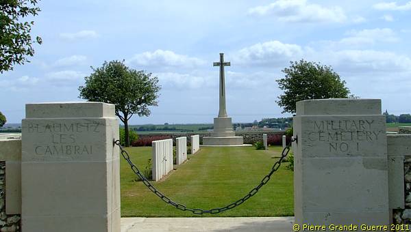
Beaumetz-les-Cambrai Military Cemetery No.1 was made by the Germans after the fighting of March 1918, and known to them as No.9 Military Cemetery; after the Armistice the graves of 307 German soldiers were removed to other cemeteries, and 33 of the British graves were regrouped. There are now over 250, 1914-18 war casualties commemorated in this site. Of these, three-quarters are unidentified; they belonged largely to the 51st Division, but partly also to the 25th, 6th, and 19th. It is composed mainly of collective graves. The Cemetery covers an area of 819 square metres and is enclosed by a low flint wall.
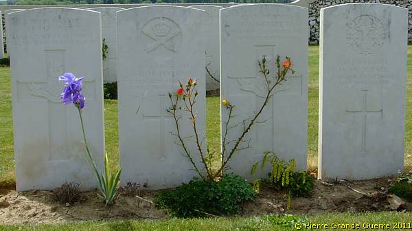
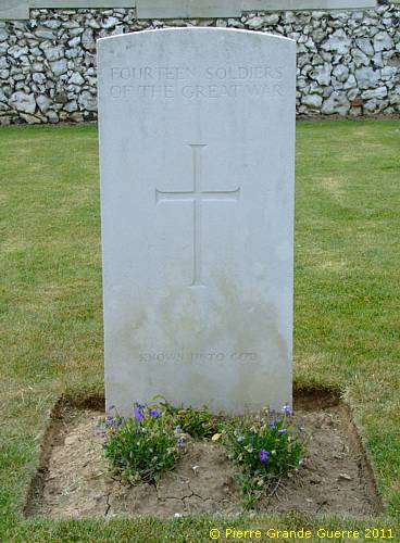
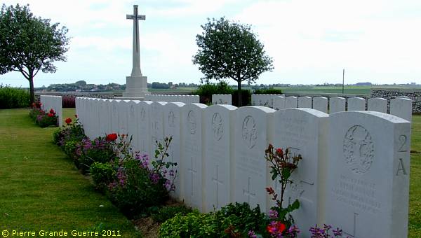
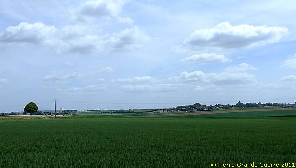
View from the cemetery eastward to Doignies.
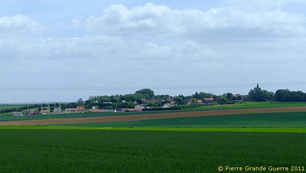
Panorama view north-eastward. Left the Bapaume-Cambrai Road. Left, behind the water tower, the Louverval Memorial, on the horizon Bourlon Wood. Right the village of Doignies.
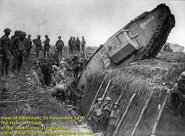
The First Battle of Cambrai (20 November - 6 December 1917)
The Opponents
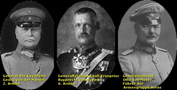
The German 2nd Army under command of General der Kavallerie, Georg von der Marwitz (1856-1929, installed itself with 8 divisions on the Hindenburg Line.
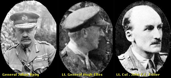
The British Third Army , under command of General Julian Byng, deployed for the offensive on the right 6 infantry divisions of III Corps (under Lt. Gen. Pulteney), and on the left IV Corps (under Lt. Gen. Woollcombe), supported by 9 battalions of the rather new Tank Corps with 437 tanks (under Lt. Gen. Hugh Elles). Byng kept in reserve 1 infantry division in IV Corps and 3 divisions of the Cavalry Corps (under Lt. Gen. Kavanagh).
Preparations
During the preparations for the battle, the artillery used relatively new tactics like sound ranging and “silent registration” of guns in order to achieve instant suppression of fire and surprise. Artillery fire would support the tanks during the attack with high explosive ammunition without cratering too much the ground. There would be no introducing artillery bombardment at the start of the offensive. The attack would start with a creeping artillery barrage, followed by a combined tank-infantry attack, to secure a breakthrough of the Hindenburg Line.
Lt. Col. John F. C. Fuller, a staff officer with the Royal Tank Corps, and Lt.
Gen. Hugh Elles, were looking for a suitable location to use on a large scale
the new Mark IV tanks for raiding parties. They were developing new tactics for
tanks to support the infantry. Tanks would be deployed to clear the extensive
barbed wire defences and to cross the trenches. General Byng decided to
integrate the tanks in the infantry attack.
Though many historians emphasize that the First Battle of Cambrai was the first major tank battle in history, I may perhaps modestly remind you that the bulk of the job still had to be done by infantry soldiers.
20 November 1917 - The Start of the Battle
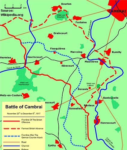
On 20 November at 06:00 hrs. the battle started with a carefully prepared artillery barrage by 1.003 guns on the German defences, followed by smoke and a creeping barrage at 300 m. ahead of the infantry soldiers to cover the first advance.
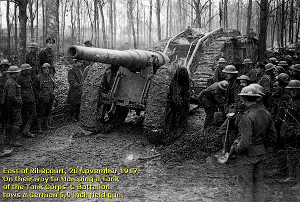
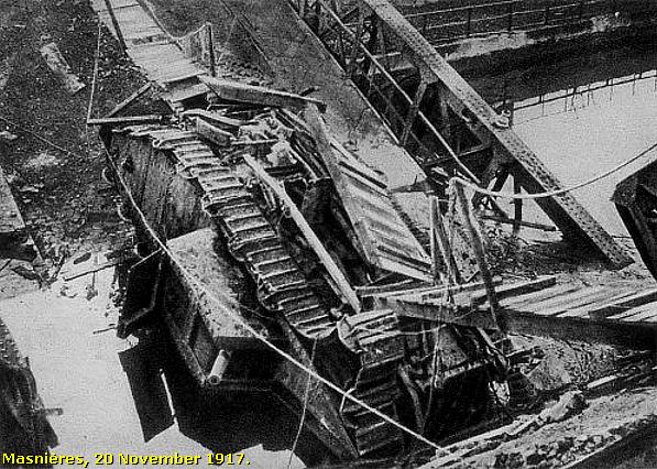
At first the attack looked rather successful; the Hindenburg Line had been penetrated with advances of up to 8 km. deep. In the south the 12th Eastern Division advanced as far as Lateau Wood near Bonavis before being ordered to dig in. The 20th Light Division forced it’s way through La Vacquerie and then advanced to capture the bridge across the St. Quentin Canal at Masnières. The bridge collapsed under the weight of crossing tanks, halting the advance there. In the centre the 6th Division captured Ribécourt and Marcoing but when the cavalry passed through late, they were forced to fall back from Noyelles.
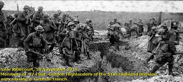
On IV Corps' front, the 51st (Highland) Division stalled at Flesquières, its first objective and this left the attacking divisions on each flank exposed to enfilade fire, where they lost that day 28 tanks on one German action.
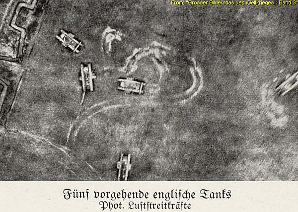
To the west of Flesquières, the 62nd West Riding Division swept all the way through Havrincourt and Graincourt to within the reach of the woods on Bourlon Ridge (127 m.).
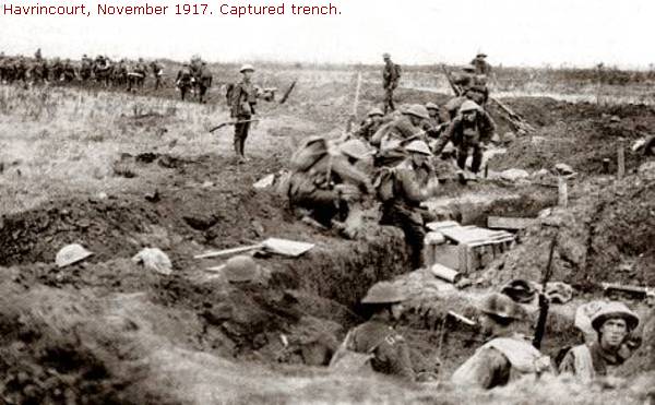
On the British left flank, the 36th Ulster Division reached the Bapaume-Cambrai road.
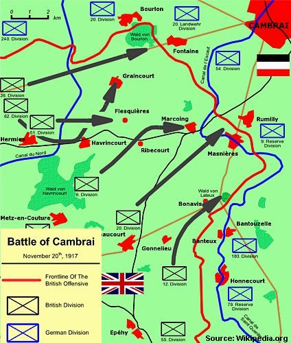
The British lost the first day around 4.000 casualties and took 4.200 prisoners. 180 Tanks were out of action, although only 65 had been destroyed. Of the other casualties 71 tanks had suffered mechanical failure and 43 had ditched. But the British had failed to reach their main target, Bourlon Wood.
German Reinforcements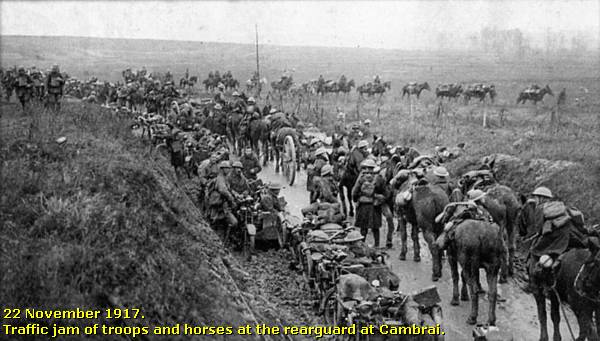
During the night the German command was quick to send up reinforcements. Generalfeldmarschall, Crownprince Rupprecht von Bayern, of the 6th Army recognised immediately the danger of this threatening situation and brought up reserves from the Flanders and Aisne sectors, which would all arrive around the 29th.

Von der Marwitz reorganised his Army and he divided the salient in front of Cambrai in 3 sectors; Arras (north), Caudry (centre) and Busigny (south). In the north, the Armeegruppe Arras, consisting of 4 divisions, under command of Generalleutnant Otto von Moser (1860-1931) concentrated the attack at the sector of Bourlon Wood. In the centre and south the two Armeegruppe, Caudry and Busigny, each consisting of two divisions, attacked the central sector in front of Cambrai, Flesquières and Havrincourt.

Ten days later during the battle these 3 German army groups together would expand by these auxiliaries to the size of 20 divisions.
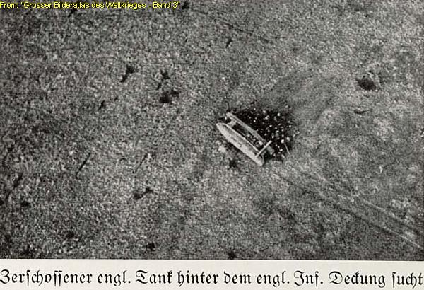
The next day the Germans recaptured Flesquières. The fighting around Bourlon and at Anneux was still fierce.
German counter-attacks squeezed the British out of Moeuvres on the 21st and on the 22nd out of Fontaine. Even after taking nearby Anneux the 62nd Division was not able to enter Bourlon Wood. The British were left exposed in a salient.
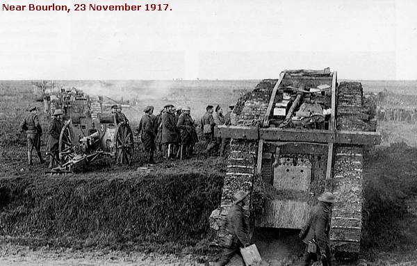
On the 23rd the exhausted 62nd Division was replaced by the 40th Division.

In the morning the 40th Division attacked the height of Bourlon Wood, supported by almost 100 tanks and 430 guns, but the division made little progress. The Germans had put two divisions of Armeegruppe Arras on the height with another two in reserve. The British 40th Division reached the crest but were held there and it would suffer over 4.000 casualties in 3 days.

On the 27th the British made a final effort to conquer Bourlon Wood, supported by 30 tanks, without result. The British now held a salient, roughly 11 km. by 9.5 km., with its front along the crest of the Bourlon height. On the 28th the offensive was stopped and the British troops were ordered to dig in. The Germans were quick to concentrate their artillery on the new British positions. On the 28th over 16.000 rounds were fired into the wood.
The German Counter-Offensive, 30 November - 6 December 1917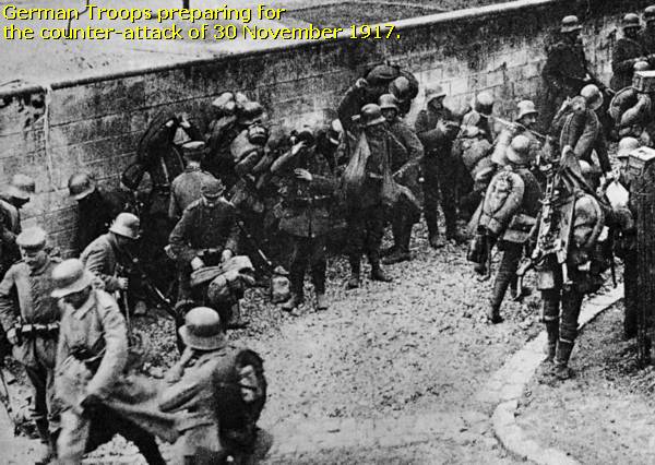
But the Germans were still not satisfied with bringing the British to a halt and they kept bringing in more troops.
On 30 November von der Marwitz started a counter-offensive. The Germans intended to retake the Bourlon salient and also to attack Havrincourt to reach at least the old positions of the Hindenburg Line.
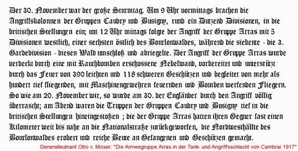
At 9.00 hrs. a dozen Divisions of Army Groups Busigny and Caudry attacked the British lines. Armeegruppe Busigny attacked from Banteux to Gouzeaucourt and Epéhy. Armeegruppe Caudry attacked from Bantouzelle to Marcoing. At 12.00 hrs. the Armeegruppe Arras attacked with 7 divisions the Bourlon Wood area.
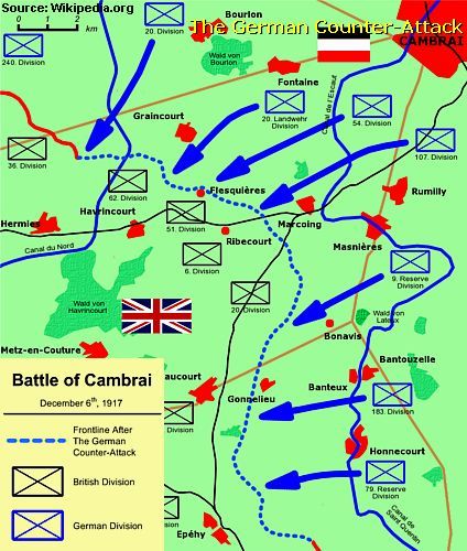
The unexpected overwhelming power of smoke, artillery fire and
the fast advance of the infantrymen, totally surprised the British forces.
In the south the Germans advanced up to 13 km. and they came within a few kilometres
of the vital village of Metz-en-Couture. In the north, at Bourlon, the British
had assigned 8 divisions and the Germans still suffered heavy casualties.
On 2 December the momentum of the German advance was lost, but it’s pressure still led to the recapture of La Vacquerie and to the British withdrawal to the west bank of the St. Quentin Canal.
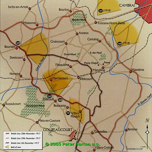
On 3 December, Haig ordered a retreat from the salient and by 7 December the British gains were abandoned except for a portion of the Hindenburg line around Havrincourt, Ribécourt and Flesquières.
Casualties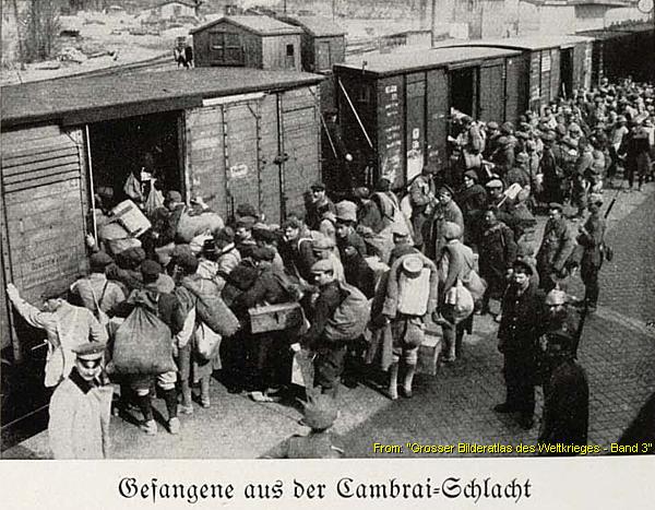
The British counted 44.207 casualties and 9.000 soldiers taken
Prisoner of War.
The Germans counted 34.000 casualties and 11.000 German soldiers taken Prisoner
of War.
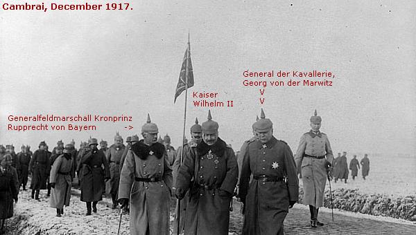
The Allies did indeed win quite some territory since the days of the Battle of the Somme of summer 1916 and during the following battles to follow until Cambrai, December 1917.
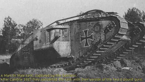
The German Michael Offensive
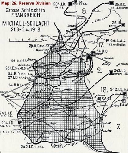
On 21 March 1918 however the German Oberste Heeres Leitung deployed the massive " Michael-Schlacht ", or Michael Offensive , re-conquering all lost terrain of Cambrai, Artois, and Somme until Arras and Albert. The offensive stopped at 5 April 1918. All gained grounds of the Allies would be lost until at least August 1918.
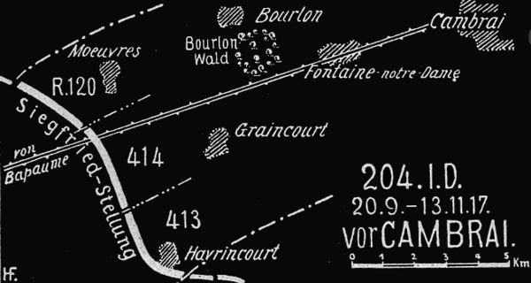
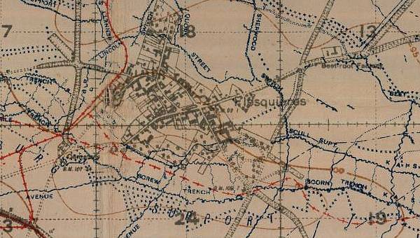
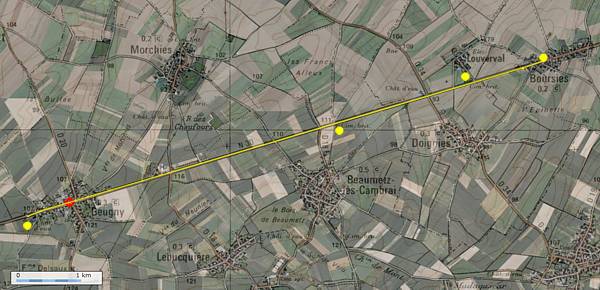
On the map below our route is roughly projected on the situation sketch of November-December 1917. We return to the year of 2011 to the Bapaume-Cambrai Road at Louverval.
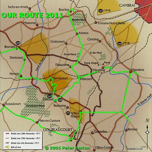
After this intermezzo we continue from Beaumetz-les-Cambrai along the D 930 to Louverval.
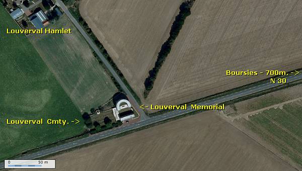
First we visit the Cambrai Memorial of Louverval .
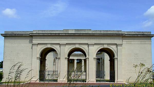
On 2 April 1917 the 56th Australian Infantry Battalion occupied the Château at Louverval. The hamlet of Louverval stayed in Allied hands until 21 March 1918, the start of the German Michael Offensive. Louverval was recaptured in September 1918.
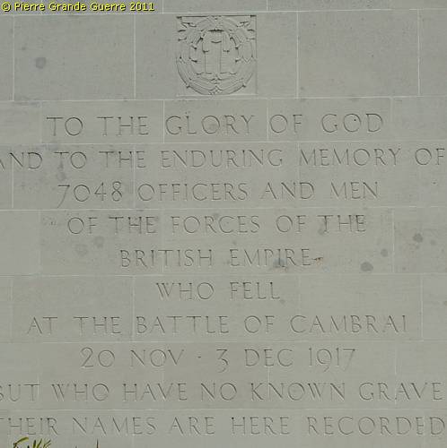
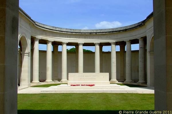
The CAMBRAI MEMORIAL of Louverval commemorates more than 7.000 servicemen of the United Kingdom and South Africa who died in the Battle of Cambrai in November and December 1917 and whose graves are not known. The Cambrai Memorial was designed by Harold Chalton Bradshaw with sculptures by Charles S. Jagger. It was unveiled by Lt. General Sir Louis Vaughan on 4 August 1930.
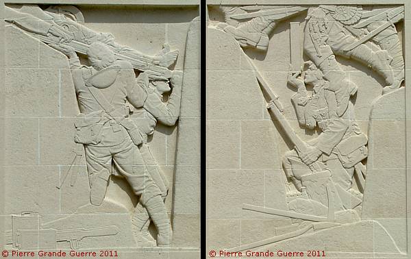
The bas-reliefs of Charles S. Jagger.
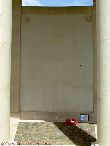
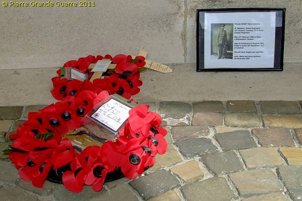
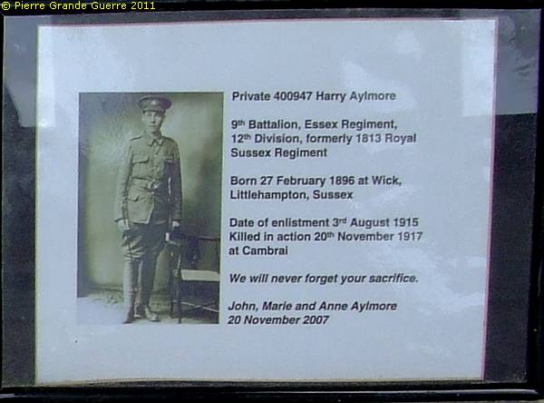
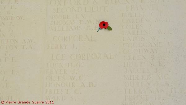
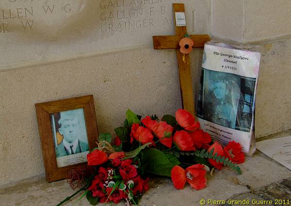
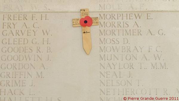
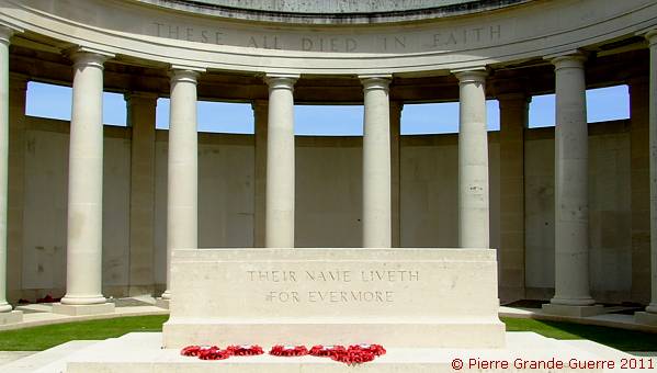
We descend the stairs at the left of the Memorial to visit the Louverval Military Cemetery.
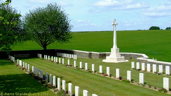
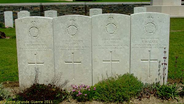
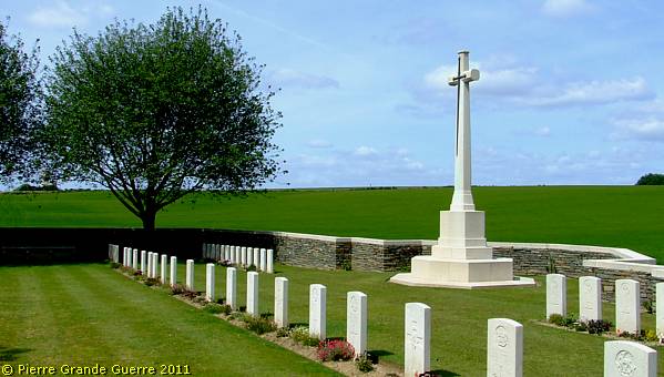
The LOUVERVAL MILITARY CEMETERY contains 124 First World War burials. Parts of Rows B and C of the cemetery were made between April and December 1917 and in 1927, graves were brought in from Louverval Chateau Cemetery, which had been begun by German troops in March 1918 and used by Commonwealth forces in September and October 1918.
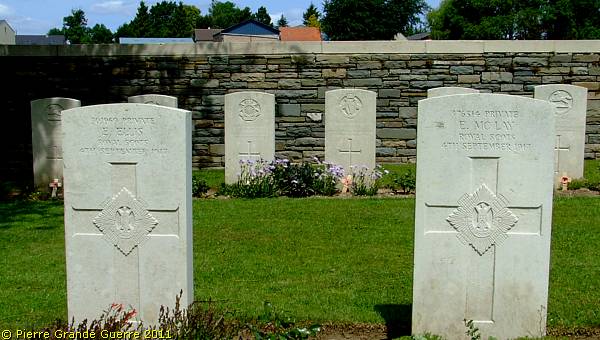
Four soldiers, fallen 20 November 1917, of the 1st Battalion London Regiment Royal Fusiliers.
We continue to Boursies .
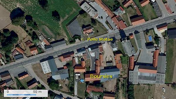
At the centre of the village, on the northern side of the road, stands a remarkable Poilu-statue.
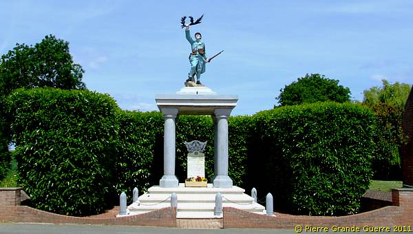
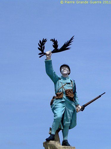
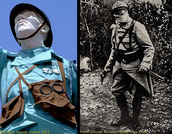
It is this primitive, Model 1915, gas mask and it's goggles of this Poilu, which intrigued me, and which made me associate it with this period picture of a "Nettoyeur de tranchées", a trench clearer.
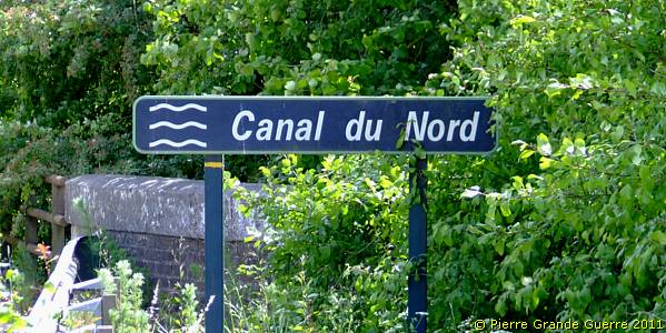
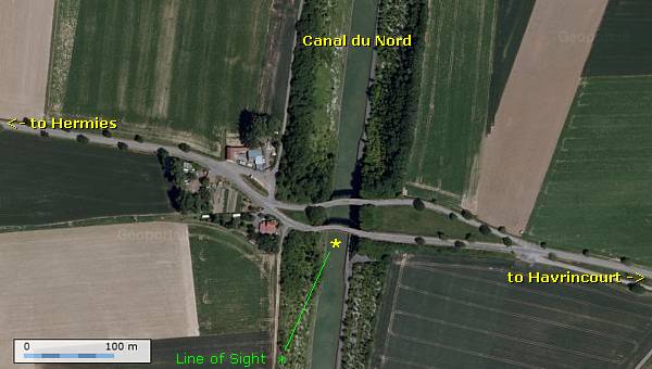
From Boursies, we deviate from the Bapaume-Cambrai road, and we continue southward to Hermies, and from there eastward, to the Canal du Nord.
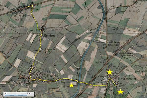
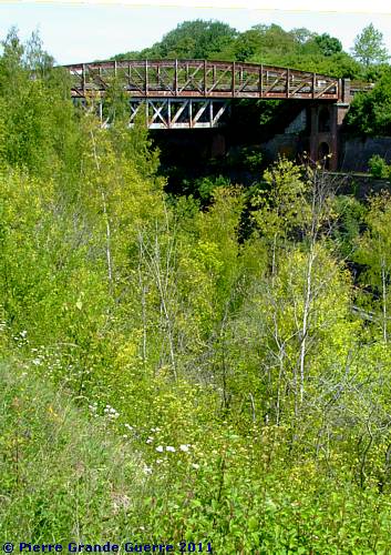
Not only in the winter of 1917, but also later, in the autumn of 1918, the deep Canal du Nord formed a formidable obstacle for the advancing troops.
The 1918 Battles near Cambrai (25-09 until 10-10-1918)
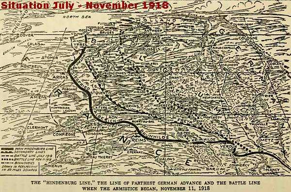
| Part of the “Hundred Days Offensive” On 8 August 1918 the Allies started near Villers-Bretonneux their last “Hundred Days Offensive”. These “Hundred Days” formed a period of a series of successful battles to re-conquer the Somme region and to break through the Hindenburg Line. From August 1918 these
battles were fought in this region between Bapaume and Cambrai; the
Second Battle of Bapaume
(21
August - 3 September 1918), The
Battle of Havrincourt
(12 September
1918), the
Battle of
Epéhy
(18 September 1918), the Battle of the
Canal du Nord
(27 September – 1 October 1918), the
Battle of the St. Quentin Canal
(29
September – 10 October 1918), and the
Second Battle of Cambrai
(8 - 10
October 1918), concentrating on Cambrai itself. The most decisive battle in
these series was the Battle of the Canal du Nord.
|
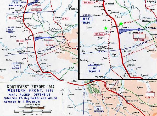
The Battle of the Canal du Nord (27 September – 1 October 1918)
One day after the start of the Meuse-Argonne Offensive , on 27 September 1918, Canadian and New-Zealand forces started the Battle of the Canal du Nord.
The construction of the 95 km. long Canal du Nord began in 1913 and was intended to link the Oise River to the Dunkerque-Escaut Canal. With the outbreak of the Great War the construction was halted and the construction works were left in varying stages of completion. The Canal with it's steep slopes is approximately 30 m. deep and 60 m. wide.
The German Defense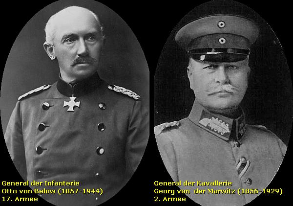
The Canal du Nord defensive system was the last major prepared defensive position of General von Below’s 17th Army and General von der Marwitz’s 2nd Army. The Canal formed nevertheless a significant obstacle as the Germans had taken measures to incorporate the unfinished canal into their defensive system. Beyond the damage done to make crossing the canal as difficult as possible, the Canal du Nord Defense Line ran directly behind the east bank of the canal. Along the banks the Germans swamped or flooded large areas, which made crossing the Canal more difficult.
During the night of 2 September the Oberste Heeres Leitung ordered the 17th Army to retreat behind the Canal du Nord and the following night it ordered the 2nd Army to withdraw to the Hindenburg Line. Especially the Prussian 1. Garde Reserve Division and the 3. Marine-Division would defend the lines.
The Attackers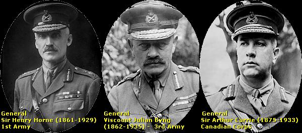
General Henry Horne’s 1st Army and General Julian Byng’s 3rd Army were to co-operate; the 1st Army had to secure the northern flank of the 3rd Army, and it had to take care of diversions. The 3rd Army had to secure the Escaut (Scheldt) Canal. Of the 1st Army the Canadian Corps under command of General Sir Arthur Currie would lead the attack, crossing the Canal, mainly some 8 km. to the north, on a front of only 2.500 m. between Sains-lès-Marquion and Mœuvres. Once over the Canal the Canadian Corps had to capture the Marquion Line, the villages of Marquion and Bourlon Wood.
Preparations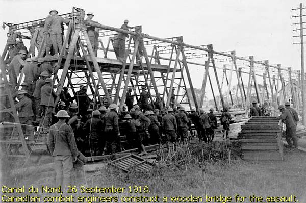
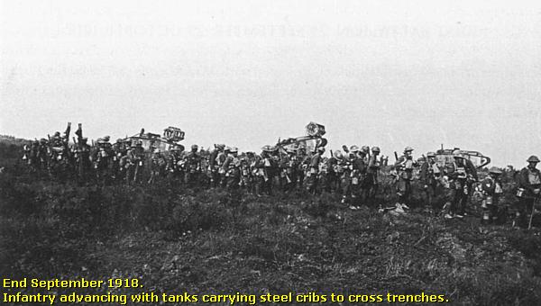
During the 4 weeks before the battle, Currie and Byng prepared thoroughly for the attack. Two divisions were sent south to cross the canal at a weaker point, while Canadian and New Zealand Engineers worked to construct often wooden bridges for the assault. To distract the Germans from the main attack XXII Corps, VII Corps, and the remainder of XXII Corps were instructed to carry out minor attacks for diversion on other positions along the Canal du Nord and along the Scarpe river.
The Attack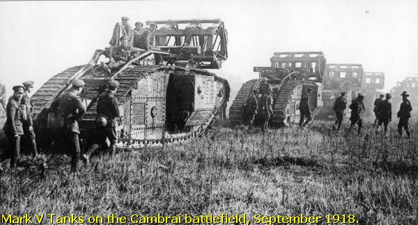
On 27 September at 5.20 hrs. all four divisions attacked taking the German defenders of the Prussian 1. Garde Reserve Division and the 3. Marine-Division by surprise.
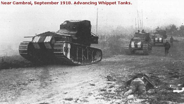
By noon all defenders had retreated or had been captured.
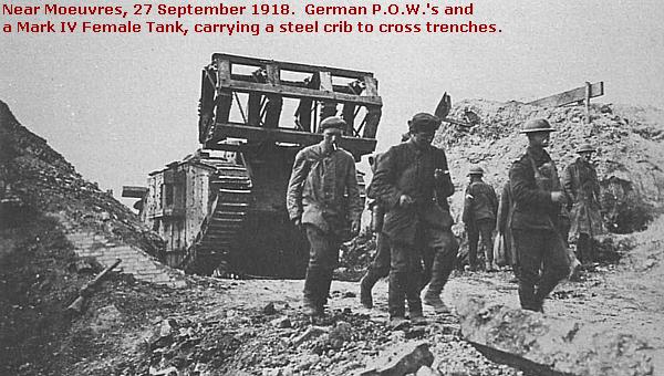
The combats would continue until 10 October 1918, finishing with the capture of Cambrai.
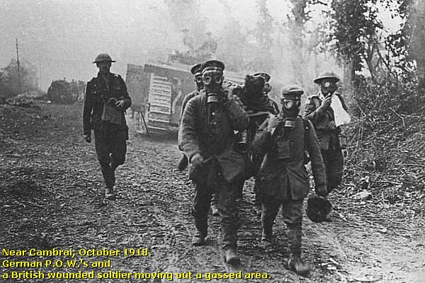
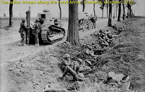
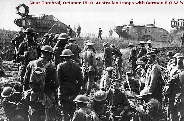
Back to 27 September 1918. The capture of the Canal du Nord gave way to the final campaign to Cambrai.
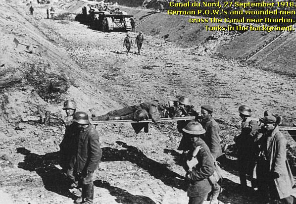
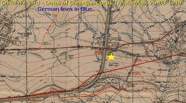
On 27 September 1918 the New Zealand Tunneling Company under command of Captain J. D. Holmes started to construct this bridge, the New Zealand Bridge, over the dry Canal du Nord under German shellfire.
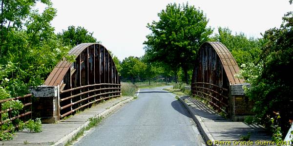
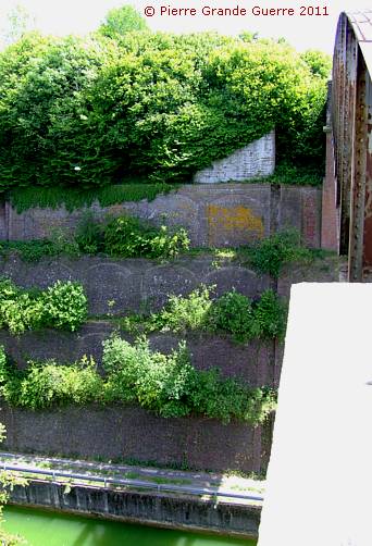
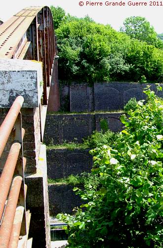
It took the New Zealand Tunneling Company 8 days to complete the bridge and to cross the Canal.
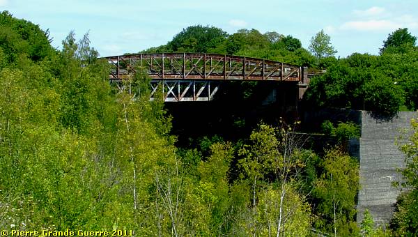
We cross the Canal and continue eastward to Havrincourt .

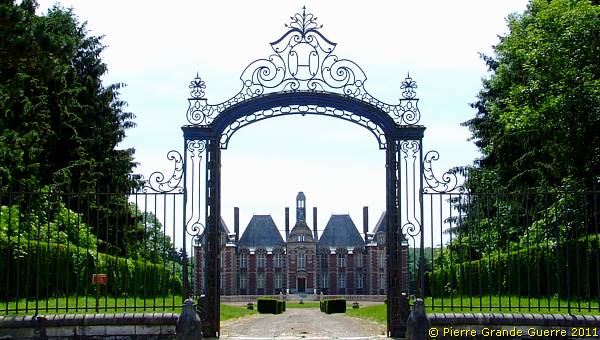
At Havrincourt we pass the gate of the impressive Château de Havrincourt .
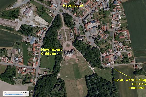
The fortified village of Havrincourt
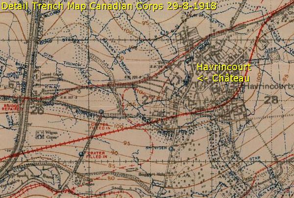
Behind the Canal du Nord, the fortified village of
Havrincourt
formed the first line of the German defence. The Germans used the Château de
Havrincourt as an important command post. In 1916 even Kaiser Wilhelm II paid
the castle a visit.
In February 1917 the Germans dynamited the castle to prevent it becoming a
shelter for the Allies. The ruins still served as a stronghold.
The restored Château de Havrincourt .
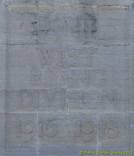
We drive eastward around the northern part of the park to the Memorial of the 62nd West Riding Division .
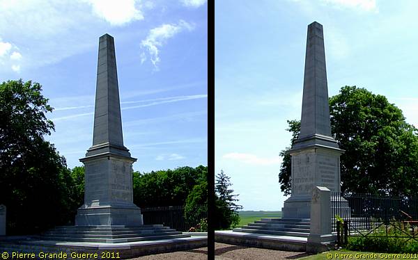
On 20 November 1917 the 62nd West Riding Division passed through Havrincourt with 50 tanks. The same day it reached even Anneux near Bourlon Wood with only 19 tanks left!

During the Battle of Havrincourt (12 September 1918) the 62nd West Riding Division recaptured,together with the New Zealand Division and the 2nd Division, the village. This battle lasted only one day, because in this late-war period the German soldiers were demoralised and lacked all fighting spirit.
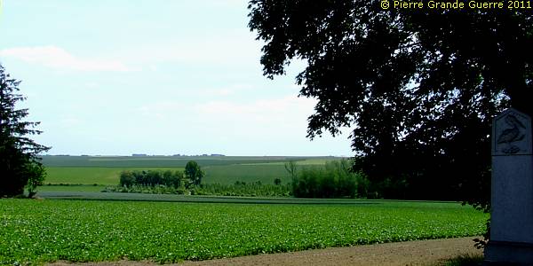
View from the memorial south-eastward.
We drive back around the castle and we continue southward to Trescault .
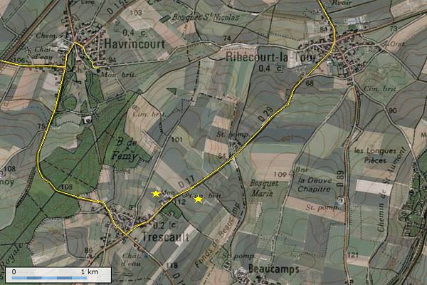
From there we follow the D 17, the "Ribécourt Road", north-eastward.
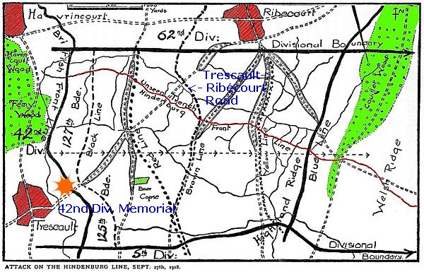
On the northern side of the "Ribécourt Road" stands the 42nd East Lancashire Territorial Division Memorial . See the Division's map above for details of the 1918 operation.
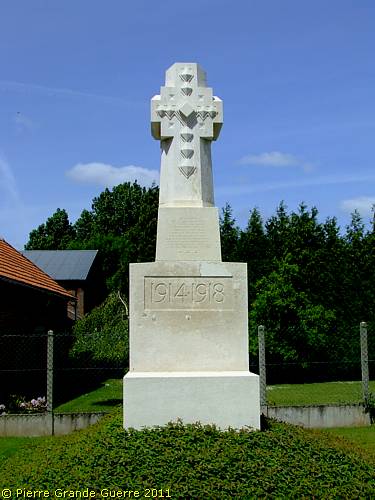
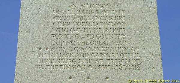
From the Memorial a panorama view south-eastward.
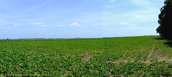
We continue for 1 km. along the Trescault - Ribécourt Road. We park our car to enjoy a panorama view at the smaller, north-west part of Havrincourt Wood.

Almost from the same location as the period 1917 Army Panorama below: a fine view over the former battlefield.

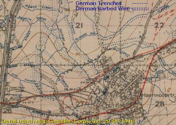
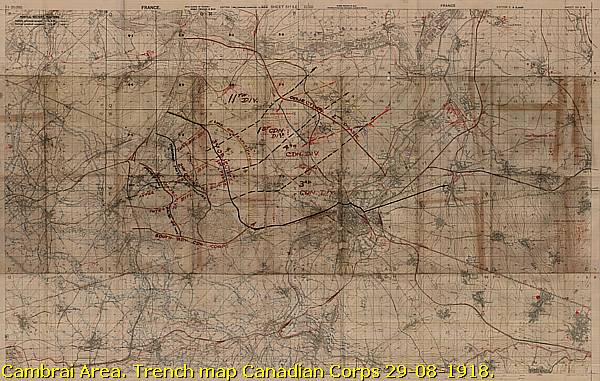
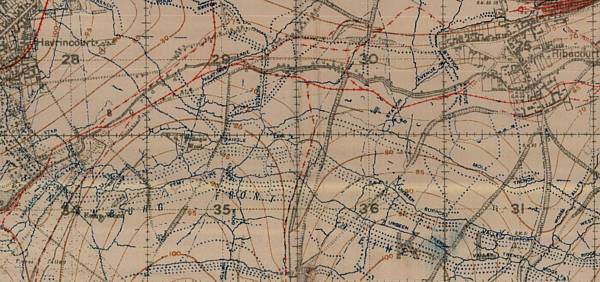
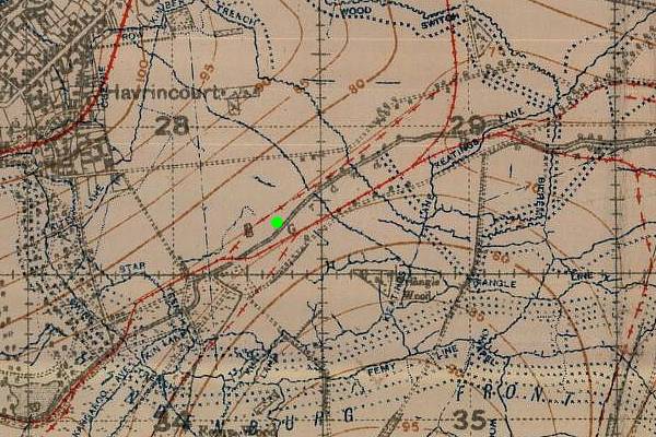
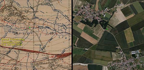
Two details of a Canadian Corps Trench Map of August 1918 to show you an impression of the German lines in this area.
Zoomed-in: Our view point is marked with a green dot.
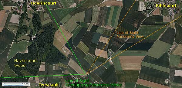
The five clockwise overlapping panorama views are directed at the south-west edge of the north-west part of Havrincourt Wood and Havrincourt village. The other panorama view focuses north-eastward to the village of Ribécourt-la-Tour.

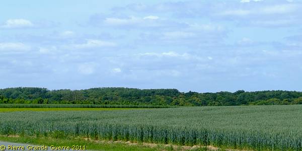
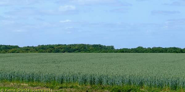
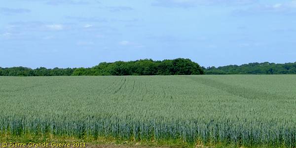
Havrincourt Wood, and right Havrincourt village.
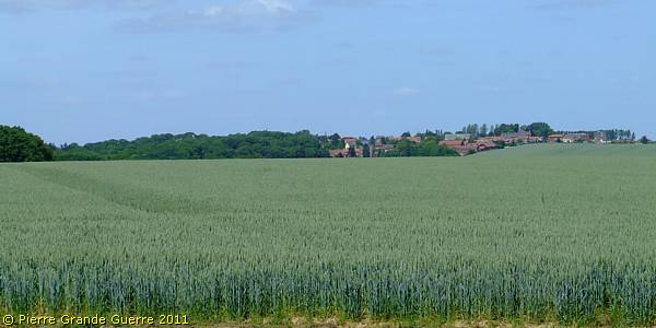
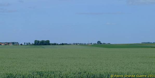
Ribécourt-la-Tour

Ribécourt-la-Tour was taken on 20 November 1917 by the 6th Division and the 51st Highland Division. At the end of the battle it remained practically on the British front line. It was lost in March 1918 and recaptured by the 3rd and 42nd East Lancashire Divisions on 28 September 1918.
Ribécourt-la-Tour , left on the horizon Flesquières.
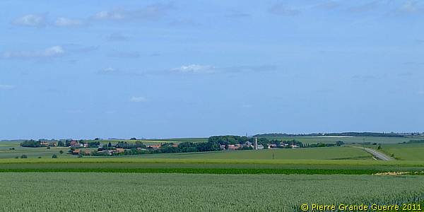
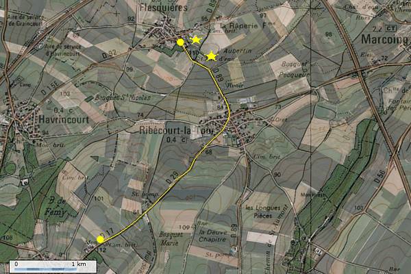
From Ribécourt-la-Tour we continue northward along the D 89 to Flesquières .
To give you somehow a period impression of the location, we are about to visit, I projected a detail of a 1918 Trench Map next to a 2011 Satellite View.
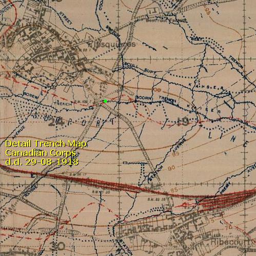
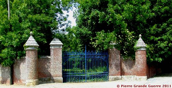
We will stop and park our car at the Blue Gate of the Château de Flesquières to visit the Tank Memorial at "the heart of the battlefield".
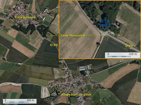
I emphasize here the Blue Gate, because it is an important landmark for locating the Tank Memorial, which is from the road hardly visible and easily missed.
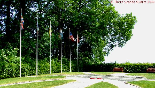
Along the sandy road into the wood, opposite the Blue Gate stands the Tank Memorial or the ...

Flesquières 1917
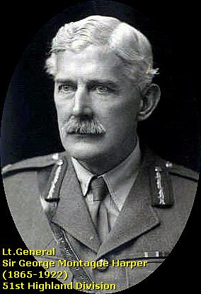
In 1917 Flesquières was one of the strongest points in the German lines, flanked by other strong points. The British tanks of the 51st Highland Division would face the German 54th Division. The 54. Division was one of the few divisions, which had specialised in training in anti-tank tactics and which had already some combat experience against French Renault tanks during the Nivelle Offensive of April-May 1917.

On 20 November 1917 the 51st Highland Division were forced to halt at Flesquières, it’s first objective. This left the situation for the other attacking divisions on each flank exposed to enfilading fire. Batteries of Feld Artillerie Regiment 108 destroyed at least 28 tanks.
The commander of the 51st Division, Lt. General George Harper, made a tactical mistake; he had "substituted his own tank drill" for the standard one, laid down by the Tank Corps; his tank drill caused an excessive distance between the tanks and the infantry, which contributed to the failure.
An unconfirmed legend tells that Unteroffizier Theodor Krüger, being the sole surviving member of 8. Batterie / FeldArtillerie Regiment 108 knocked out 5 tanks, before he was killed.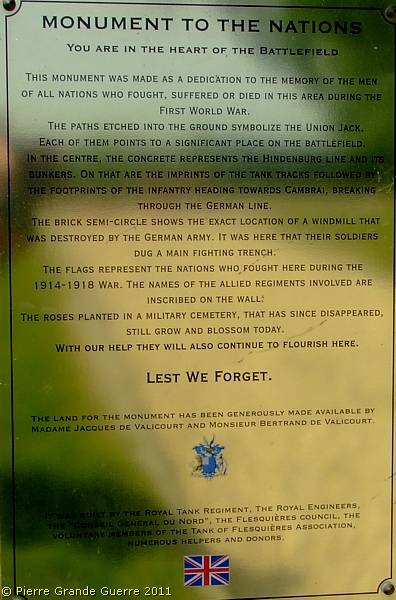
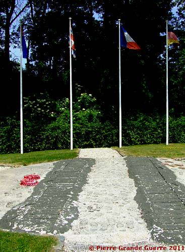
The memorial has the shape of a tank track.

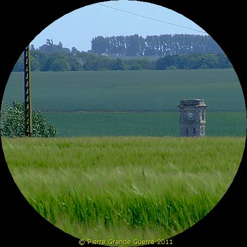
On the other side of the road, D 89, opposite the Blue Gate, I photographed these 6 clockwise overlapping panorama views south-westward of the " Heart of the Flesquières Battlefield ".
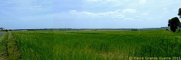
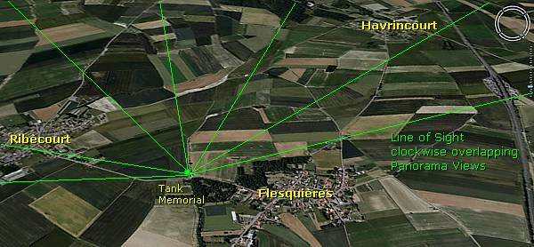
From left to right. Into the direction of Ribécourt (right).
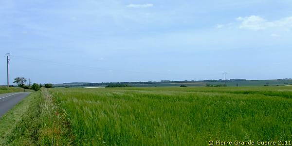
"La Tour", the typical Tower of Ribécourt-la-Tour.
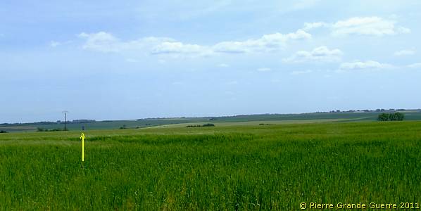
This the landscape in which 28 tanks were knocked out.
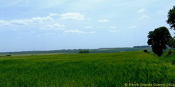
Havrincourt Wood on the horizon.
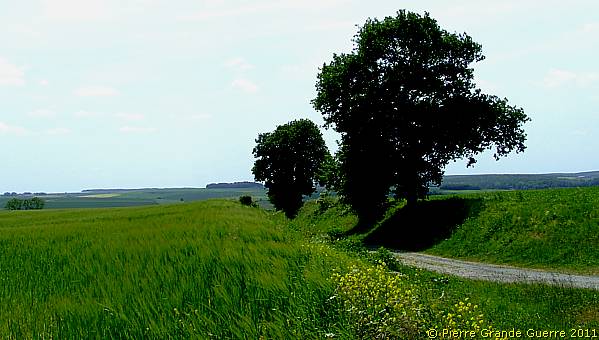
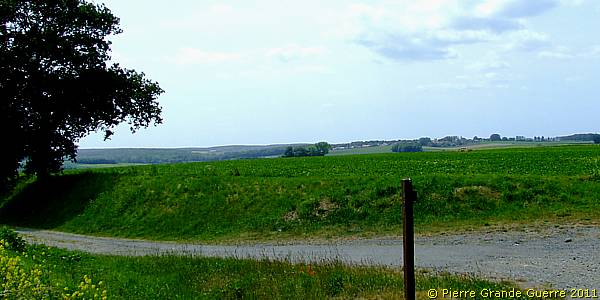
Behind these 3 trees below right Unteroffizier Theodor Krüger would have knocked out 5 tanks, before he was killed.
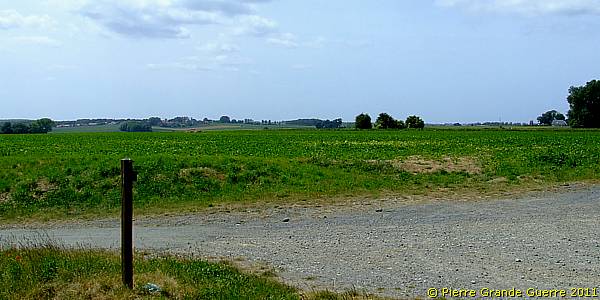
From here we enter the village of Flesquières for some 750 m. to visit, on appointment , the barn of the "Espace Louis Carnian".
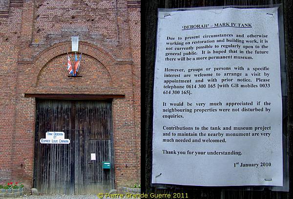
|
After making an appointment for a visit, we are welcomed at the “Espace Louis Carnian” by the President of the “ Association de Tank de Flesquières ”, Monsieur Philippe Gorczinsky. The volunteers of the “Association de Tank de Flesquières” are responsible for the creation and the maintenance of the Flesquières Tank Memorial. The Association is also responsible for lifting in 1998 the D. 51 Deborah Tank from the grounds around Flesquières and for preserving it. The “Espace Louis Carnian” forms only the provisionally quarters of the Deborah Tank, as the Association is planning to convert the barn into a proper museum for it’s fine collection and the Deborah Tank. As the Association is depending on donations, it is constantly fundraising to achieve this goal. My photos can never compete with the real experience of “meeting” the tank itself. So, whenever, you will visit the “Espace Louis Carnian” yourself, don’t forget to donate your gift to improve the housing conditions of the Deborah Tank and to support the Association's restoration works! Monsieur Philippe Gorczinsky et l'équipe de l'Association de Tank de Flesquières, Merci pour votre hospitalité! |
Before we just walk on to the tank, ...
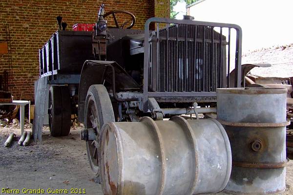
... we start our short tour with some views of ...
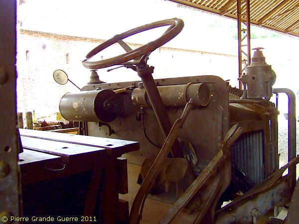
... an interesting 1918 U.S. Army truck.
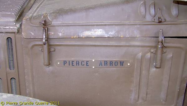
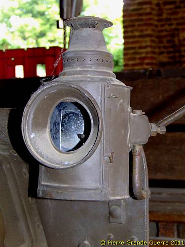
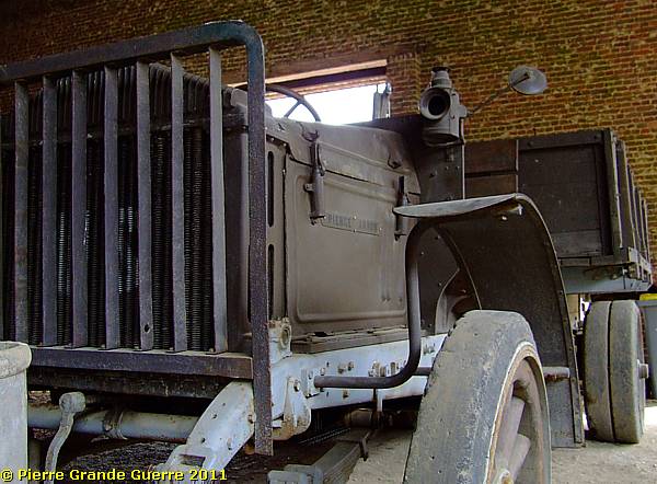
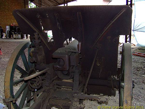
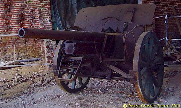
The "Espace Louis Carnian" also displays a well preserved German 1916-1917 model, 77 mm. artillery gun.
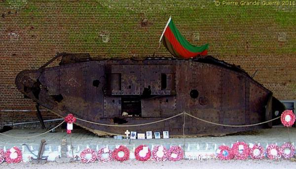
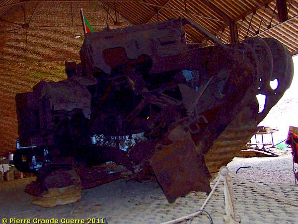
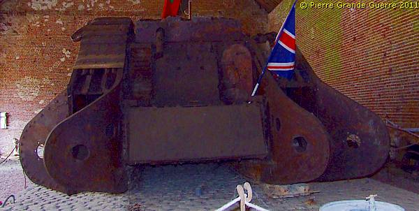
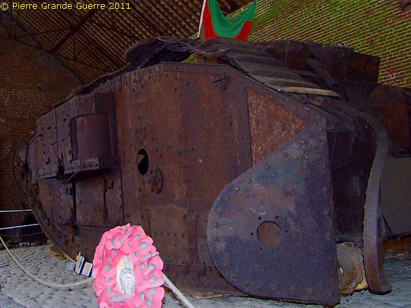
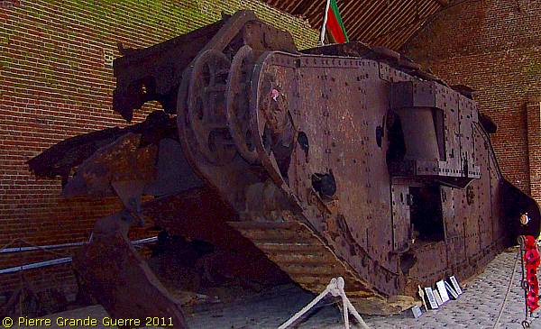
The Crown of the collection is of course the wreck of the D. 51 Deborah Tank .
The End of the Deborah Tank
|
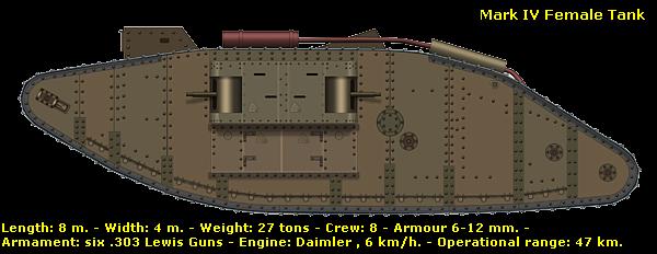
On 20 November 1917 at 10.15 hrs. the D. 51 Deborah tank,
a Mark IV Female Tank, passed through Flesquières. The crew of tank
commander, 2nd Lieutenant Frank G. Heap, came under fire of a German field
gun battery at Flesquières Château Farm, which scored immediately some hits
on the tank, killing instantly four crew members out of eight. Heap collected
the remainder of the crew and he successfully brought his men back into
safety. On the 21st Scottish infantry soldiers found the bodies and buried
the four men beside their tank. Nowadays the crew members are buried on the
Flesquières Hill Cemetery.
|
The "open wound" of the Deborah Tank.
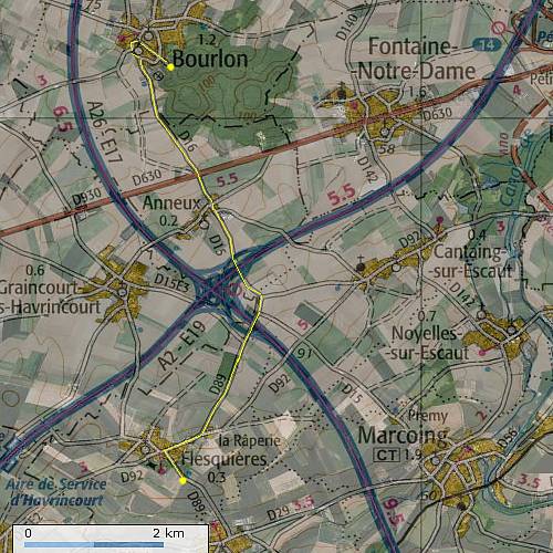
From Flesquières we continue northward via Anneux to Bourlon Wood.
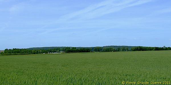
Bourlon Wood , photographed from Anneux northward.
From the village of Bourlon we ascend to Bourlon Wood.
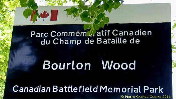
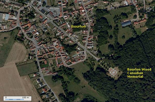
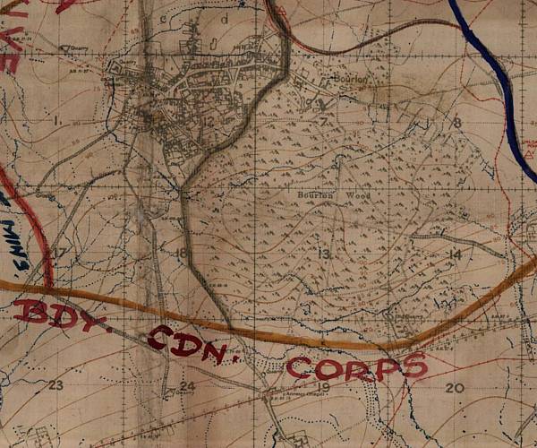
Bourlon Wood
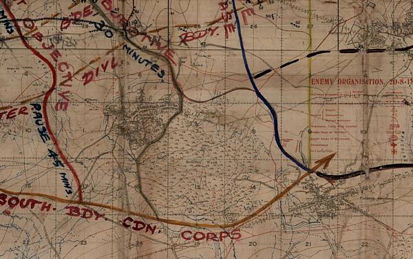
Bourlon Wood at a height of 127 m. and the village at it's foot formed the main target during the desperate fighting of the First Battle of Cambrai. At the end of the Battle, as we have seen, the British troops were withdrawn from Bourlon Wood.
On 27 September 1918, during the Battle of the Canal du Nord, the
Canadian
Corps
re-captured definitely Bourlon Wood and the village.
This day the normally flowered Memorial Park of the Bourlon Wood Memorial is alas under gardening reconstructions
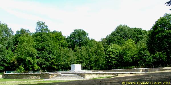
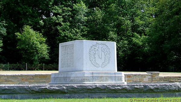
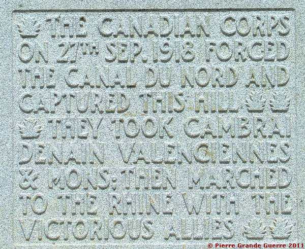
The Canadian Bourlon Wood Memorial commemorates the attack across the Canal Du Nord on ground donated by the Comte de Franqueville, at the end of the war being the Mayor of Bourlon.
The Canadian Battlefield Monument Commission selected the Canadian National Vimy Memorial at Vimy Ridge as the national memorial site and seven other locations, where an identical granite block has been placed. Each of the seven granite blocks have inscribed a brief description of the battle in both English and French to commemorate significant battles the Canadian Expeditionary Force had engaged in. In Belgium you will find these granite blocks at Hill 62, St. Juliaan, and Passchendaele, in France at Le Quesnel, Dury, Courcelette, and here at Bourlon Wood.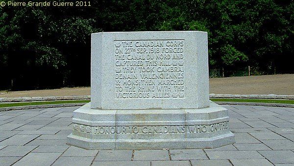
View from the Memorial Park westward.
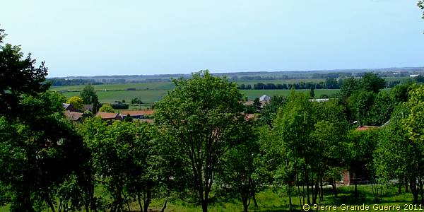
From Bourlon Wood we continue southward, first to the western outskirts of Marcoing, next to cross at the centre of the village the St. Quentin Canal to continue to the Marcoing British Cemetery.
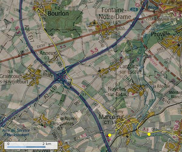
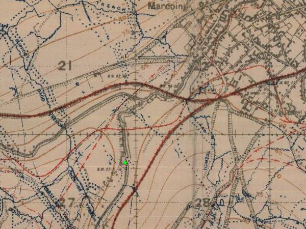
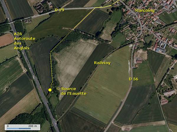
Via a dead-end country road along the D 29, outside the village of Marcoing, along the Eauette brook, we find a rare relic of the German presence; an inscription above the source of the Eauette brook: " Infanterie Regiment 31 - 1917 ".
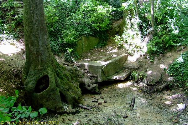
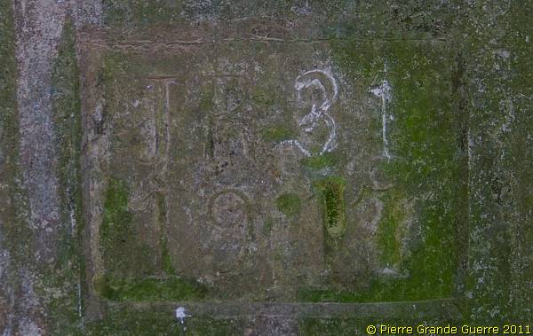
In the village of Marcoing we cross the bridge over the next obstacle, the Canal du St. Quentin, on our route to Masnières.
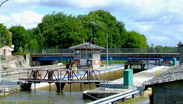
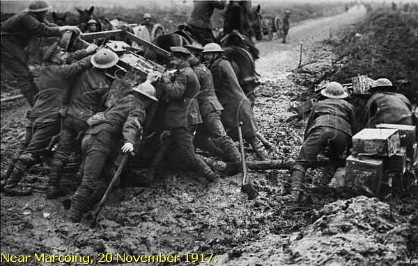
|
On 20 November 1917 the 29th Division captured Marcoing and Masnières. Marcoing was evacuated again on 3 December. On 28 September 1918 the 62nd West Riding Division recaptured Marcoing, and on the following day Masnières. |
On the southern side of the D 15 and some 200 m. from the bank of the St. Quentin Canal we pause to visit the Marcoing British Cemetery.
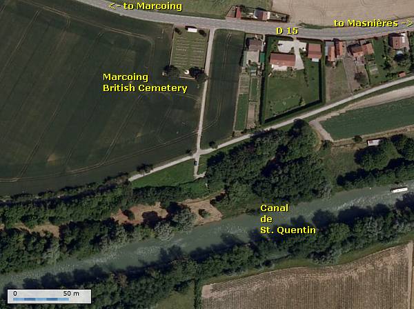
Marcoing British Cemetery
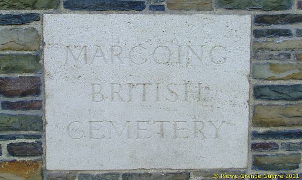
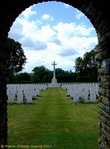
Marcoing British Cemetery was made after the Armistice, by the concentration of graves (almost all of November 1917 or September-October 1918) from RUMILLY GERMAN CEMETERY and from the local battlefields. There are now nearly 400, 1914-18 war casualties commemorated in this site. Of these, over half are unidentified and special memorials are erected to 19 soldiers from the United Kingdom, four from Canada and one from New Zealand, known or believed to be buried among them. The Cemetery covers an area of 1.404 square metres and is enclosed by a low stone rubble wall.
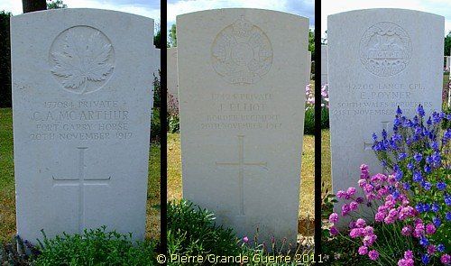
In 1917 the Newfoundlanders played an important role during the fights near Masnières.
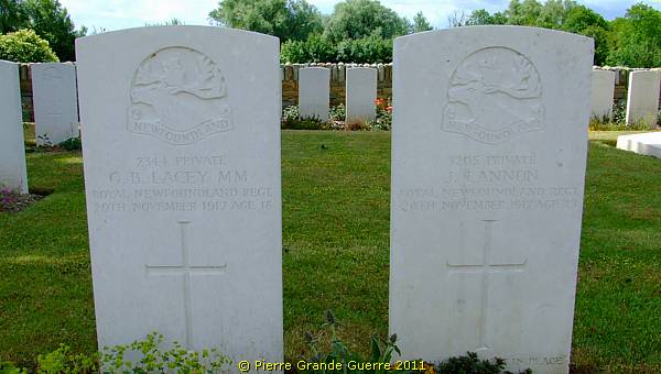
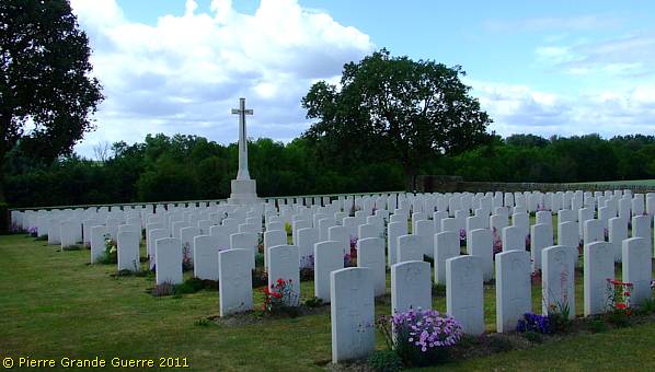
We follow the St. Quentin Canal to Masnières, cross again the Canal and follow it to the northern outskirts of les-Rues-des Vignes.
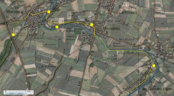
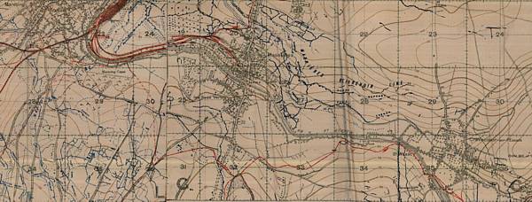
The 20th Light Division forced a way through La Vacquerie and then advanced to capture Masnières . The bridge at Masnières collapsed under the weight of a crossing tank, halting any advance from here. On 30 November and 1 December the 29th Division held Masnières against repeated attacks. During the night of the 1st to the 2nd Masnières was evacuated.
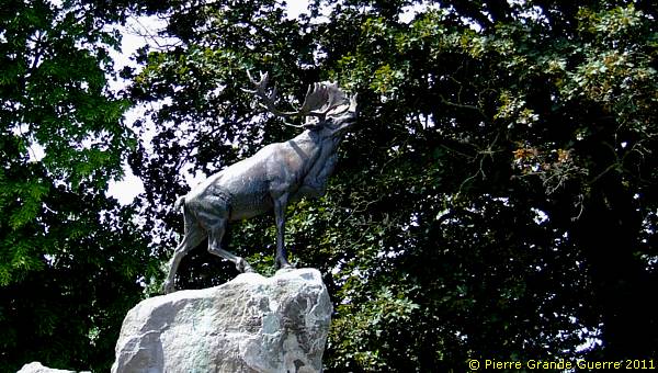
At the village of Masnières stands this proud Caribou Memorial, commemorating the achievements of the Royal Newfoundland Regiment during the First Battle of Cambrai.
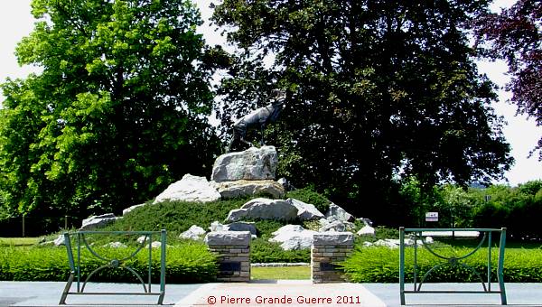
There are three other similar Caribou Memorials in France: at Beaumont-Hamel , Gueudecourt, and Monchy-le-Preux.
At the northern outskirts of Les-Rues-des-Vignes, opposite Crèvecoeur-sur-l'Escaut on the other side of the Canal, we see the bridge, which was in 1917 "a bridge too far" .
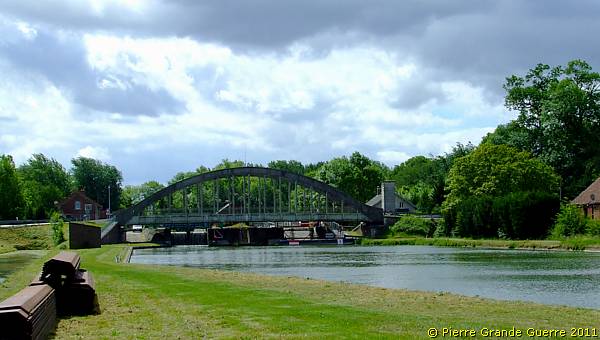
We also reached here our most eastern location of our trip.
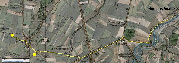
We return westward via Bonavis to La Vacquerie .
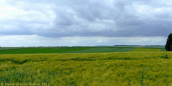
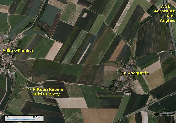
"Fifteen Ravine"
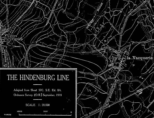
On 3 December the Germans recaptured la Vacquerie, during the British withdrawal.
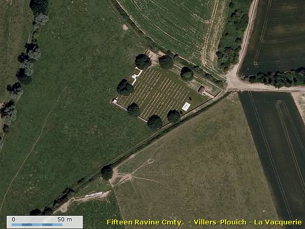
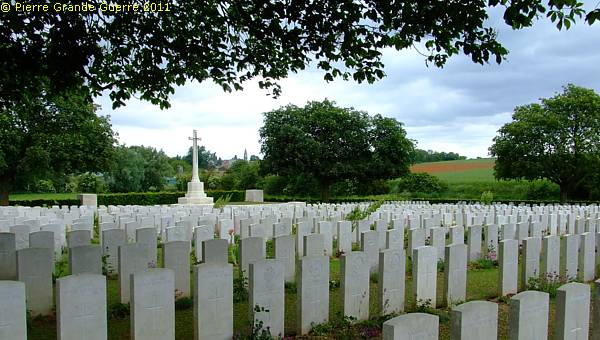
The British Army named this shallow ravine "Fifteen Ravine". Once the ravine was bordered by fifteen trees, which ran at right angles to the railway about 800 metres south of the village of Villers-Plouich, but the cemetery is in fact located at "Farm Ravine," on the east side of the railway line, nearer to the village.We visit the Fifteen Ravine British Cemetery.

|
Fifteen Ravine Cemetery contains 1.264 Commonwealth burials and commemorations of the First World War. 740 of the burials are unidentified, but there are special memorials to 44 casualties, known or believed to be buried among them. Other special memorials commemorate 10 men of the Argyll and Sutherland Highlanders, buried in Argyle Road Cemetery, Beaucamp, whose graves were destroyed by shell fire. The cemetery was designed by Sir Herbert Baker. |
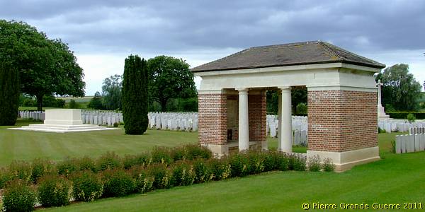
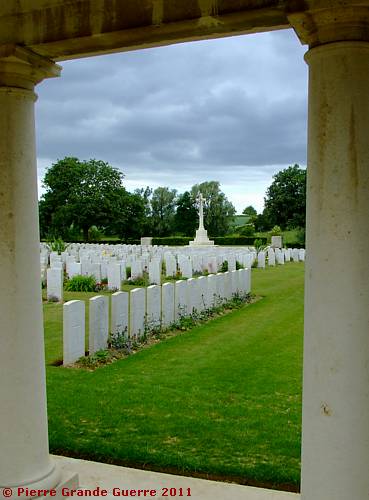
Remark the poppies in the field on the right.
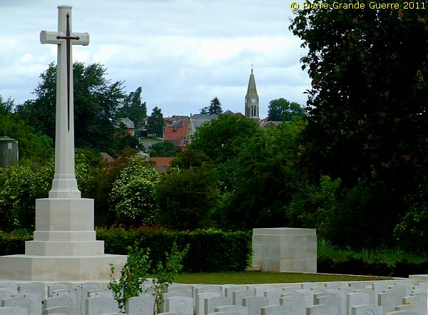
View from the cemetery northward at the church tower of Villers-Plouich.
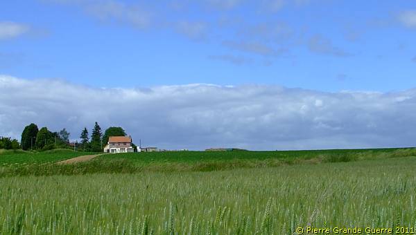
We pass the village of Villers-Plouich to its western outskirts along the nameless, sunken road to Beaucamp.
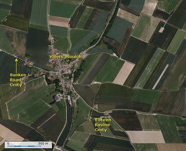
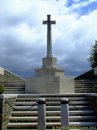
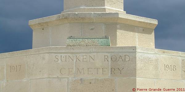
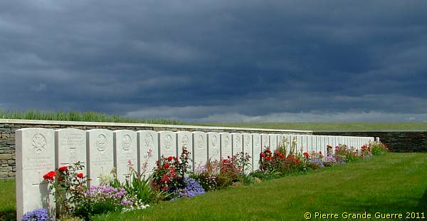
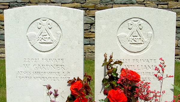
Here we visit the Sunken Road Cemetery .
|
SUNKEN ROAD CEMETERY contains over 50 Great War casualties of the periods of Winter 1917 and Autumn 1918. Of these, a small number are unidentified. The cemetery lies below the level of the fields around it, and it covers an area of 257 square metres and is enclosed on three sides by a low rubble wall. |
From Villers Plouich we go on southward to Gouzeaucourt.
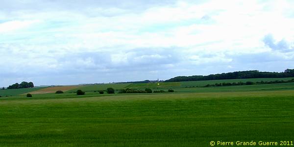
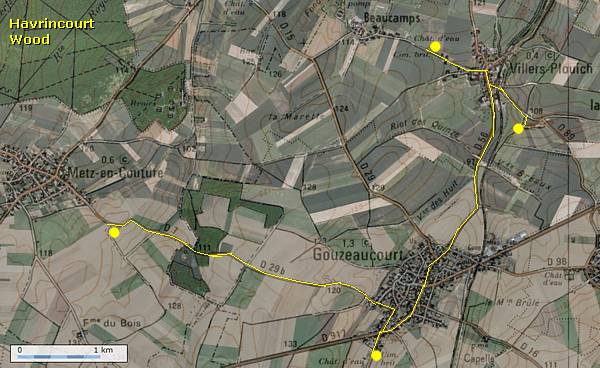
During the night of 12-13 April 1917 the 8th Division occupied Gouzeaucourt . It was lost on 30 November 1917 in the German counterattack at the end of the First Battle of Cambrai, and the same day the 1st Irish Guards recaptured it. On 22 March 1918 Gouzeaucourt was lost again. On 18 September 1918 the 38th Welsh Division attacked the village again. During the Second Battle of Cambrai, on 8 October 1918, the 21st Division finally recaptured Gouzeaucourt.

|
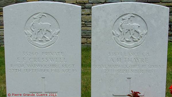
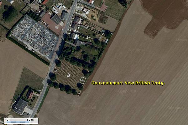
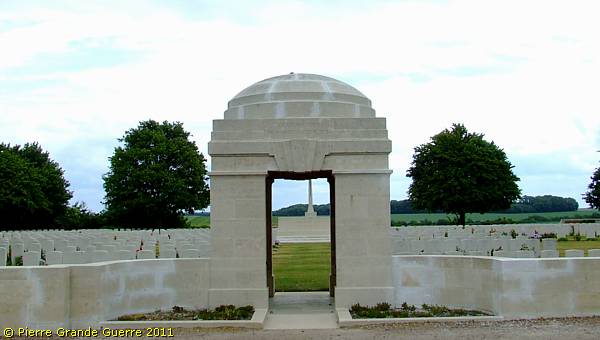
GOUZEAUCOURT NEW BRITISH CEMETERY was begun in November 1917, taken over by the Germans in 1918, and used again by Commonwealth forces in September and October 1918, but the original burials (now in Plot III) are only 55 in number. It was enlarged after the Armistice, when graves were brought in from other cemeteries and from the battlefield of Cambrai. The cemetery now contains 1.295 burials and commemorations of the First World War. 381 of the burials are unidentified but there are special memorials to 34 casualties known or believed to be buried among them. The cemetery was designed by Sir Herbert Baker. |
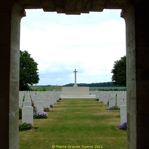
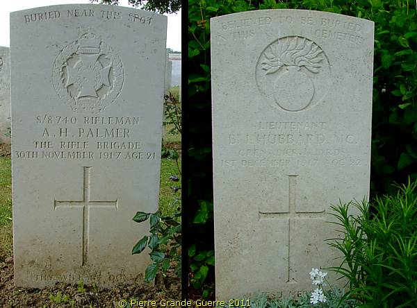
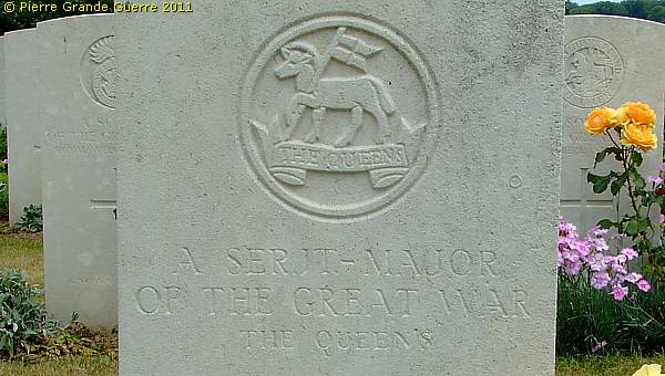
On this cemetery we find many graves of high officers.
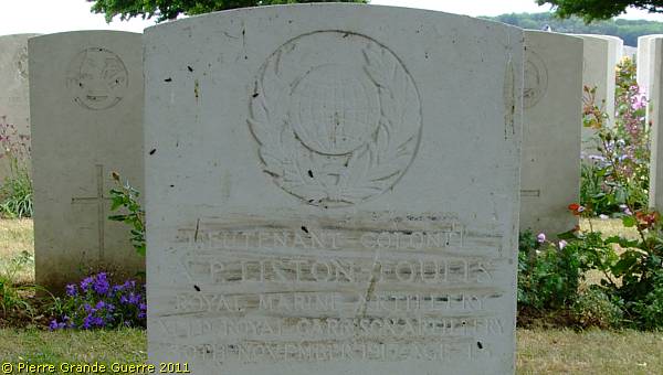
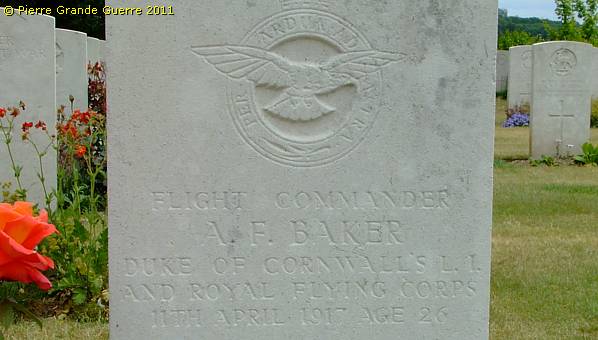
Some soldiers are "BURIED NEAR THIS SPOT", or they are "BELIEVED TO BE BURIED IN THIS CEMETERY".
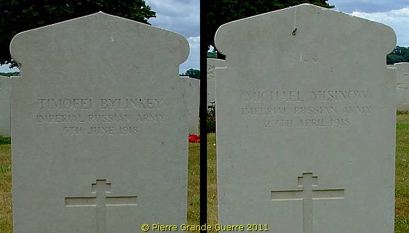
Two graves of soldiers of the Imperial Russian Army, who died somewhere near here after the October Revolution
of 1917, during the fights of April 1918 and later.
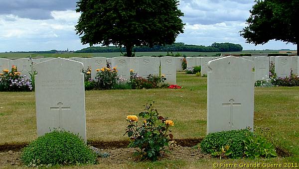
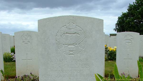
On this cemetery we find many graves of members of the Royal Tank Corps of both periods, of 1917 and of 1918.
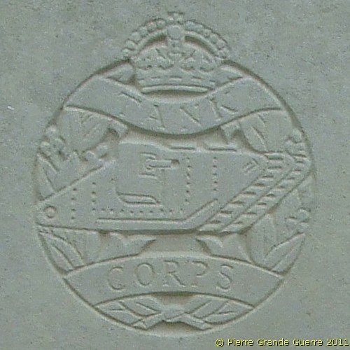
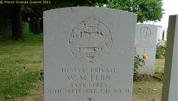
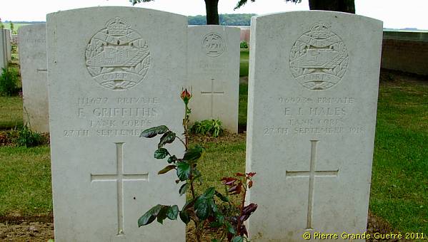
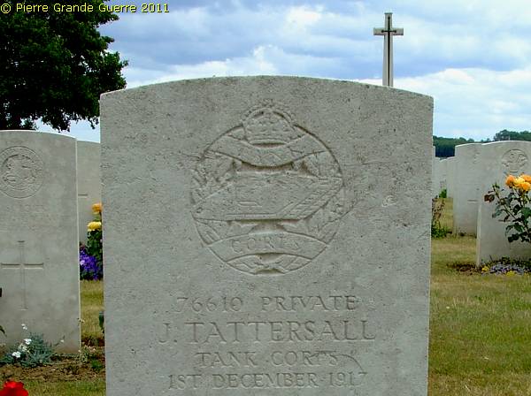
As often happens, the Cross of Sacrifice offers a magnificent view over the landscape.
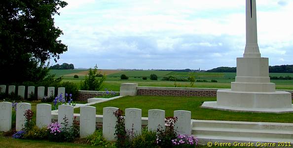
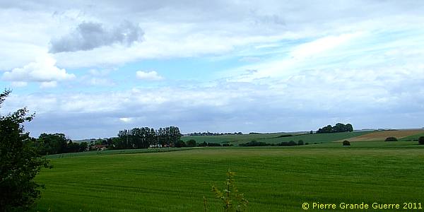
This panorama view from the Cross of Sacrifice looks eastward in 4 clockwise overlapping photo's.

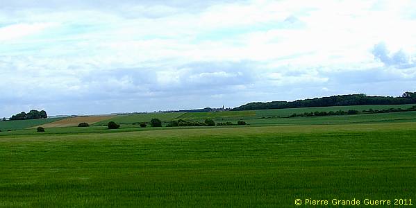
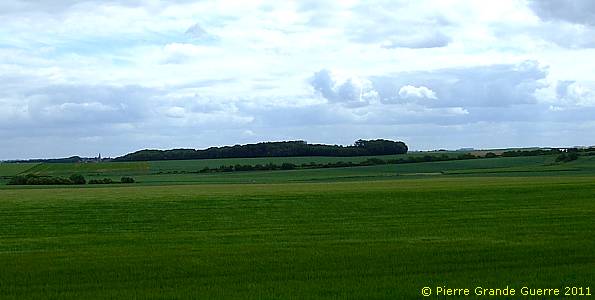
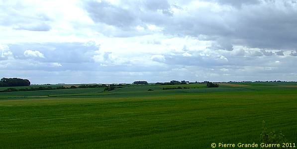
From the cemetery a panorama view southward.
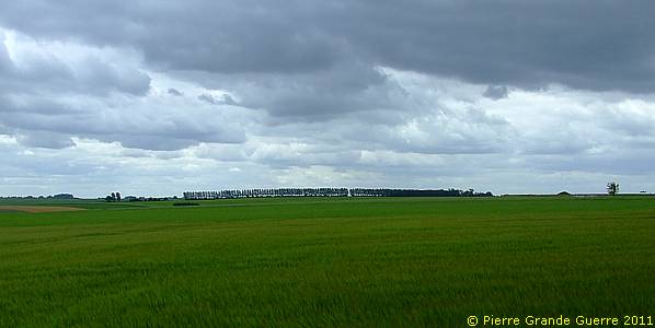
From Gouzeaucourt we continue north-westward via the D 29b and the D7 to Metz-en-Couture .
|
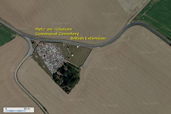
On 5 April 1917 the 10th and 11th King's Royal Rifle Corps occupied the village of Metz-en-Couture . Due to the German attacks of 23 March 1918, it was evacuated. On 6 September 1918 the 1st Otago Regiment recaptured the village. Metz-en-Couture was noted for its extensive system of underground cellars. |
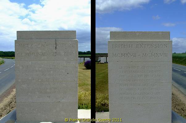
METZ-EN-COUTURE COMMUNAL CEMETERY BRITISH EXTENSION was begun in April 1917, and used until March, 1918, and two graves were added in the following September. These original burials, made by Field Ambulances and fighting units, are in Plots I and II; Plots III and IV were added after the Armistice by the concentration of graves from the immediate neighbourhood, including:- METZ-EN-COUTURE BRITISH CEMETERY No.2, which was on the West side of the village. There are now nearly 500, 1914-18 war casualties commemorated in this site. Of these, almost 50 are unidentified. The cemetery covers an area of 2,212 square metres and is enclosed on three sides by a rubble wall.
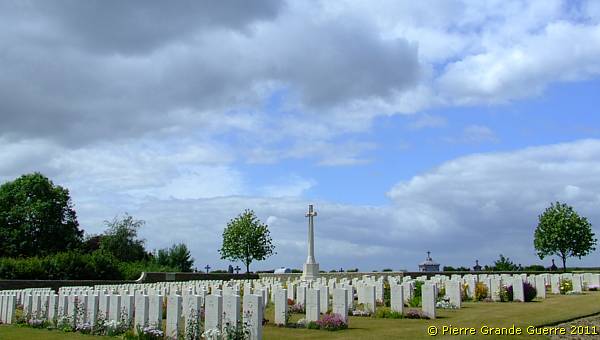
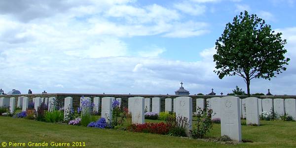
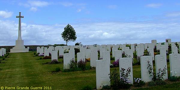
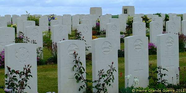
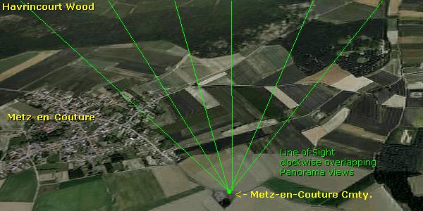
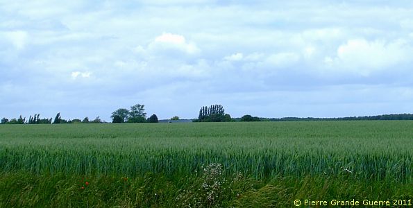
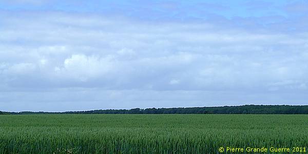
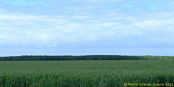
With my back to the entrance of the cemetery I made this panorama view northward of the southern edge of the extreme southern and largest part of Havrincourt Wood in 6 clockwise overlapping steps.

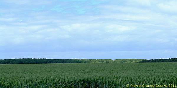
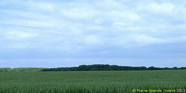
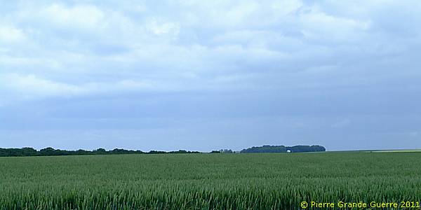
Via Neuville-Bourjonval and Ytres we continue to our last site of interest, west of the village of Equancourt.
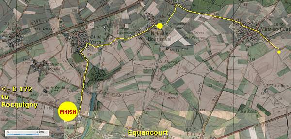
In Neuville-Bourjonval we pass this painted Poilu statue.
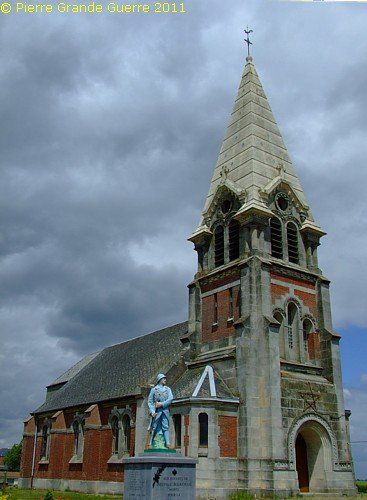
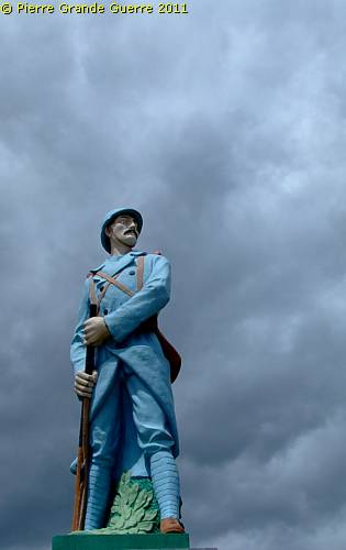
West of Equancourt, along the D 172, we visit the Rocquigny- Equancourt Road Cemetery .
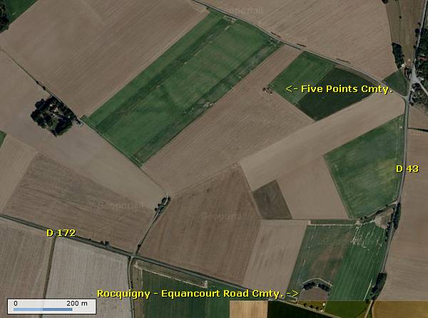
Rocquigny
and
Equancourt
are approximately 8 km. apart and the Rocquigny-Equancourt Road Cemetery lies about halfway between the two villages, on the north side of the road, just west of the crossing road from Etricourt to Ytres.
Etricourt and the nearby hamlet of Léchelle were occupied by British troops at the beginning of April 1917 during the German withdrawal to the Hindenburg Line. On 23 March 1918 it was lost, when the Germans advanced, but at the beginning of September 1918 it was regained.
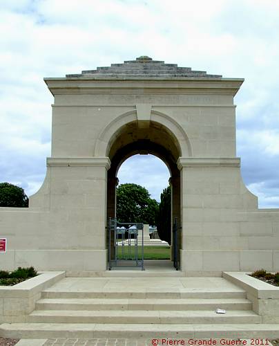
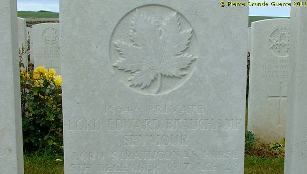
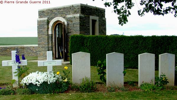
ROCQUIGNY-EQUANCOURT ROAD BRITISH CEMETERY was begun in 1917 and used until March 1918, mainly by the 21st and 48th Casualty Clearing Stations posted at Ytres, and to a small extent by the Germans, who knew it as "Etricourt Old English Cemetery". Burials were resumed by Commonwealth troops in September 1918 and the 3rd Canadian and 18th Casualty Clearing Stations buried in it in October and November 1918. The cemetery contains 1.838 Commonwealth burials and commemorations of the First World War. 21 of the burials are unidentified and 9 Commonwealth graves made by the Germans, which cannot now be found, are represented by special memorials. The cemetery also contains 198 German war burials and the graves of 10 French civilians . The cemetery was designed by Sir Reginald Blomfield.
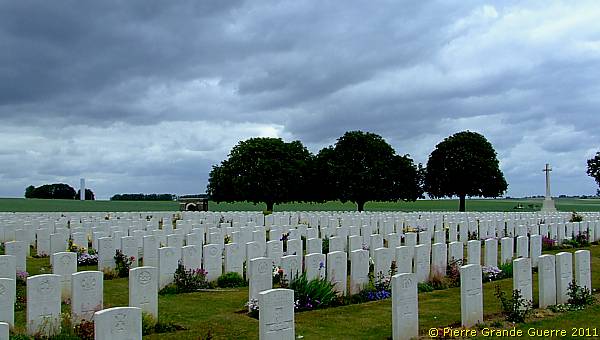
Again; we see here many graves of Royal Tank Corps members.
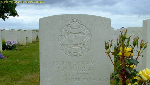
But the majority of the graves are reserved for infantry soldiers.
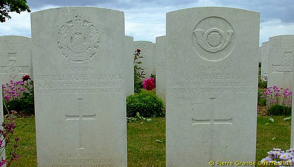
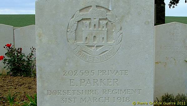
The grave of the Canadian Lord Beauchamp Seymour.
Two French civilians share a plot with some German soldiers.
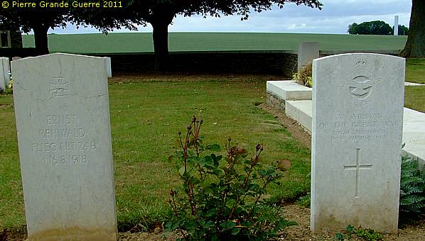
A German aviator and a British aviator, both killed in August 1918, lie next to each other.
A plot of German graves.
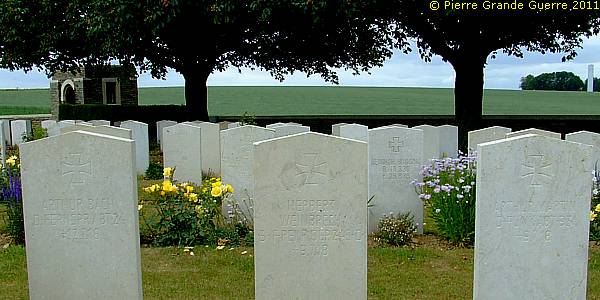
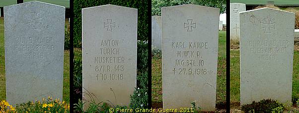
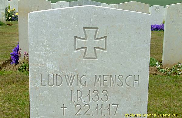
Rather remarkable: On German graves on German cemeteries you will seldom see headstones. On the crosses or slabs you will only see mentioned name, rank of the buried soldier and the date of his death. You will seldom see the army unit mentioned. On this British cemetery however the army units of the buried German soldiers are also engraved on the headstones.
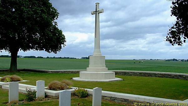
We end our virtual tour of the Cambrai battlefields with a last panorama view northward into the direction of ....
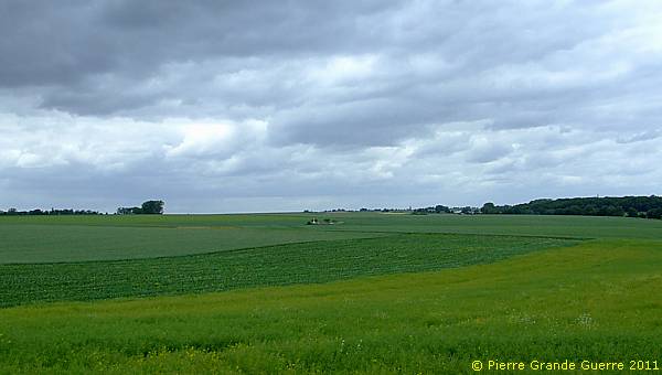
... Five Points Cemetery in the rain.
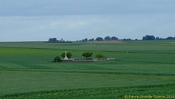
Five Points Cemetery. Early in September 1918 the 53rd Field Ambulance and the 18th Casualty Clearing Station, which were posted near the site created the cemetery. The origin of the name is not known with certainty. It was used until the following month. There are now over 100 Great War casualties commemorated in this site. Of these a small number are unidentified. The cemetery covers an area of 482 square metres and is enclosed by a rubble wall.
Continue to the next Special Photo Impression: " SOMME 1918 - Australian Corps - Villers-Bretonneux - 1st Tank vs. Tank Battle - Australian Memorial - Le Hamel "
